
Elevation 3,090 m | Area 87,101 km² | |
 | ||
Mountains Devils Paw, Devils Thumb, Hoodoo Mountain, Mount Ratz, The Volcano | ||
The Boundary Ranges, also known in the singular and as the Alaska Boundary Range, are the largest and most northerly subrange of the Coast Mountains. They begin at the Nass River, near the southern end of the Alaska Panhandle in the Canadian province of British Columbia and run to the Kelsall River, near the Chilkoot Pass, beyond which are the Alsek Ranges of the Saint Elias Mountains, and northwards into the Yukon Territory flanking the west side of the Yukon River drainage as far as Champagne Pass, north of which being the Yukon Ranges. To their east are the Skeena Mountains and Stikine Plateau of the Interior Mountains complex that lies northwest of the Interior Plateau; the immediately adjoining subregion of the Stikine Plateau is the Tahltan Highland. To their northeast is the Tagish Highland, which is a subregion of the Yukon Plateau. Both highlands are considered in some descriptions as included in the Coast Mountains. The Alexander Archipelago lies offshore and is entirely within Alaska.
Contents
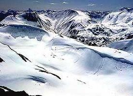
The Boundary Ranges include several large icefields, including the Juneau Icefield, between the Alaskan city of the same name and Atlin Lake in B.C.; and the Stikine Icecap, which lies between the lower Stikine River and the Whiting River. Some of the highest mountains in the Boundary Ranges are: Mount Ratz, 3090 m (10138 ft), Chutine Peak, 2910 m (9547 ft), and Devils Thumb, 2766 m (9077 ft), all in the Stikine Icecap region; and Devils Paw, 2593 m (8507 ft), in the Juneau Icefield. (Other peaks in the Stikine Icecap are higher than 2600 m (8500 ft), but they have relatively low topographic prominence.)
Despite the height of Mount Ratz and its neighbours, most of the Boundary Ranges are considerably lower than the Pacific Ranges of the southern Coast Mountains. The larger icefields of the Boundary Ranges are at a much lower elevation than their southern counterparts in the Pacific Ranges because of the difference in latitude.
Physiographically, they are a section of the larger Pacific Border province, which in turn is part of the larger Pacific Mountain System physiographic division.
The granitic intrusions that form the Boundary Ranges are remnants of a Late Cretaceous volcanic arc system called the Coast Range Arc.
Subranges
Rivers
Rivers draining or transiting the Boundary Ranges include the: