
Elevation 2,616 m | Prominence 1,733 m | |
 | ||
Listing Canada most prominent peak 75thCanada most isolated peaks 45thUS most prominent peaks 86thUS most isolated peaks 68th Similar Mount Igikpak, Mount Isto, Korovin Volcano, Mount Kimball, Mount Chiginagak | ||
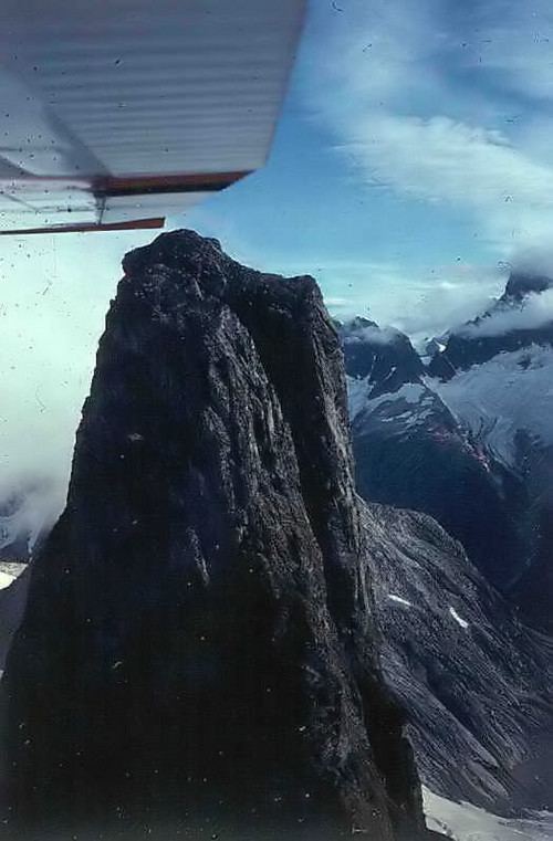
Devils Paw (or Devil's Paw, or Boundary Peak 93) is the high point of the Juneau Icefield, on the Alaska-British Columbia border. It is part of the Boundary Ranges of the Coast Mountains. It is also notable for its steep rise above the low local terrain. Its height is sometimes given as 8,507 feet (2,593 m)[2].
Map of Devils Paw, Stikine Region, BC, Canada
Devils Paw is located on the northeast side of the Juneau Icefield, and its north slopes feed Tulsequah Lake and the Tulsequah Glacier. Its south slope forms the head of the picturesquely-named "Hades Highway", which is the eastern extremity of the Icefield.
To illustrate the steepness of the peak: the north face drops 7,000 feet (2133 m) in approximately three miles (4.8 km), and the southeast side drops 8,000 feet (2438 m) in about seven miles (11.3 km).