
Width 90 mi (140 km) Elevation 5,959 m | Length 300 mi (480 km) Borders on Wrangell Mountains Area 112,509 km² | |
 | ||
Mountains | ||
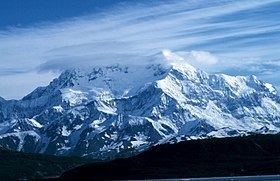
The Saint Elias Mountains are a subgroup of the Pacific Coast Ranges, located in southeastern Alaska in the United States, southwestern Yukon and the very far northwestern part of British Columbia in Canada. The range spans Wrangell-St. Elias National Park and Preserve in the USA and Kluane National Park and Reserve in Canada and includes all of Glacier Bay National Park in Alaska. In Alaska, the range includes parts of the city/borough of Yakutat and the Hoonah-Angoon and Valdez-Cordova census areas.
Contents
Map of Saint Elias Mountains, Yukon, Unorganized, Yukon, Canada
This mountain range was named after Mount Saint Elias which had been named in 1741 by the Danish explorer Vitus Bering.
Geology
The St. Elias Mountains is the highest coastal mountain range on Earth. It formed due to the subduction of the Yakutat plate underneath the North American plate. The Yakutat microplate is a wedge shaped oceanic plateau with 20–30 km thickness. Similar to the adjacent Pacific plate (7 km crustal thickness) the Yakutat plate is currently moving northwestward with a rate of ~50 mm/year with respect to stable North America. The Yakutat plate is transported northwards along the active Fairweather Fault, which probably started more than 35 million years ago. Due to its thickness the Yakutat plate is buoyant resulting in surface uplift of the overriding North American plate, which formed the Talkeetna Mountains and the Alaska Range in southcentral Alaska located above the subducted part of the Yakutat plate. The St. Elias Mountains formed at the plate boundary between the Yakutat and North American plate. The up to 12 km thick sediments that have been deposited on top of the Yakutat plate are imbricated and deformed as they became scraped off and compose today the southern (coastal) flanks of the St. Elias Mountains. In contrast the high elevated regions of the drainage divide (Bagley Ice Field, Seward Glacier) and north of it comprise rocks that are part of the North American plate. The highest peaks of the St. Elias Mountains are located in the high ice field region of the Kluane National Park (Mt. Logan, Mt. Vancouver) and north of the Malaspina Glacier (Mt. St. Elias, Mt. Cook), in the region known as the St. Elias syntaxis. At the syntaxis region the tectonic style changes from strike-slip motion along the Fairweather Fault to collision west of Malaspina. This tectonic transition concentrates stress in the crust at the syntaxis that together with efficient glacial erosion results in positive feedback processes that through time forms extreme high mountain peaks and local relief, and rapid exhumation of rocks from up to 10 km depths to the surface.
Ranges
The mountains are divided by the Duke Depression, with the shorter, more rounded Kluane Ranges to the east, and the higher Icefield Ranges to the west. Sub-ranges of the Saint Elias include the Alsek Ranges, the Fairweather Range, and the Centennial Range.
Highest mountains
The highest mountains of the range include: