
Founded November 16, 1820 Area 1,790 km² Unemployment rate 3.7% (Apr 2015) | Website www.showmeboone.com Population 170,773 (2013) | |
 | ||
Destinations Columbia, Rock Bridge Memorial State Park Colleges and Universities University of Missouri, University of Missouri System, Stephens College, Columbia College, Missouri School of Journalism Points of interest Francis Quadrangle Historic D, Museum of Art and Archaeology, Albert Oakland Park, Stephens Lake Park, Cosmo Park | ||
Boone County is a county in the U.S. state of Missouri. As of the 2010 census, the population was 162,642; a 2015 estimate put the population at 174,974, making it the state's seventh-most populous county. Its county seat is Columbia, Missouri's fourth-largest city. The county was organized November 16, 1820 and named for Daniel Boone.
Contents
- Map of Boone County MO USA
- History
- Geography
- National protected area
- Adjacent counties
- Major highways
- Demographics
- Public schools
- Private schools
- Post secondary
- Local
- State
- Federal
- Missouri Presidential Preference Primary 2008
- Cities
- Villages
- Unincorporated communities
- Public safety
- USAR Task Force
- References
Map of Boone County, MO, USA
Boone County comprises the Columbia, MO Metropolitan Statistical Area.
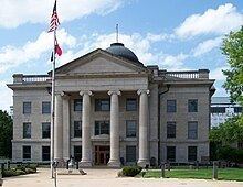
The University of Missouri is in Columbia.
History
Boone County was organized November 16, 1820, from a portion of the territorial Howard County. The area was then known as Boone's Lick Country, because of a salt lick which Daniel Boone's sons used for their stock.
Boone County was settled primarily from the Upper South states of Kentucky, Tennessee and Virginia. The settlers brought slaves and slave-holding with them, and quickly started cultivating crops similar to those in Middle Tennessee and Kentucky: hemp and tobacco. Boone was one of several counties settled by Southerners to the north and south of the Missouri River. Because of its culture and traditions, the area became known as Little Dixie, and Boone County was at its heart. In 1860 slaves made up 25 percent or more of the county's population, and Little Dixie was strongly pro-Confederate during the American Civil War.
Geography
According to the U.S. Census Bureau, the county has a total area of 496 square miles (1,280 km2), of which 685 square miles (1,770 km2) is land and 5.6 square miles (15 km2) (0.8%) is water. The Missouri River makes up the southern border of the county.
National protected area
Adjacent counties
Major highways
Demographics
As of the census of 2000, there were 135,454 people, 53,094 households, and 31,378 families residing in the county. The population density was 198 people per square mile (76/km²). There were 56,678 housing units at an average density of 83 per square mile (32/km²). The racial makeup of the county was 85.43% White, 8.54% Black or African American, 0.42% Native American, 2.96% Asian, 0.03% Pacific Islander, 0.69% from other races, and 1.93% from two or more races. Approximately 1.78% of the population were Hispanic or Latino of any race. 24.6% claimed German, 12.3% American, 11.2% English and 9.8% Irish ancestry.
There were 53,094 households out of which 30.30% had children under the age of 18 living with them, 45.50% were married couples living together, 10.40% had a female householder with no husband present, and 40.90% were non-families. 28.70% of all households were made up of individuals and 6.20% had someone living alone who was 65 years of age or older. The average household size was 2.38 and the average family size was 2.97.
In the county, the population was spread out with 22.80% under the age of 18, 19.90% from 18 to 24, 29.90% from 25 to 44, 18.80% from 45 to 64, and 8.60% who were 65 years of age or older. The median age was 30 years. For every 100 females there were 93.50 males. For every 100 females age 18 and over, there were 90.90 males.
The median income for a household in the county was $37,485, and the median income for a family was $51,210. Males had a median income of $33,304 versus $25,990 for females. The per capita income for the county was $19,844. About 7.60% of families and 14.50% of the population were below the poverty line, including 12.10% of those under age 18 and 5.90% of those age 65 or over.
There are 121,319 registered voters.
Public schools
Private schools
Post secondary
Local
Like nearly all counties nationwide with a major university, the Democratic Party predominantly controls politics at the local level in Boone County. Democrats currently hold all but two of the elected county-wide positions, which are an associate commissioner and presiding circuit judge.
State
Boone County is divided into five legislative districts in the Missouri House of Representatives, two of which are held by Democrats and three held by Republicans.
All of Boone County is a part of Missouri’s 19th District in the Missouri Senate and is currently represented by Kurt Schaefer (R-Columbia).
Federal
All of Boone County is included in Missouri’s 4th Congressional District and is currently represented by Vicky Hartzler (R-Harrisonville) in the U.S. House of Representatives.
Missouri Presidential Preference Primary (2008)
Cities
Villages
Unincorporated communities
Public safety
The Boone County Fire Protection District provides fire protection and emergency medical services for a large portion of Boone County, Missouri. The BCFPD is the largest volunteer fire department and third largest fire service organization in the state, protecting 492 square miles (1,270 km2) of residential, commercial, industrial and agricultural property and over 50,000 people. The Boone County Fire District maintains 14 fire stations, a training center, and a headquarters facility.
History
Prior to 1964, there was no organized fire protection in Boone County. This changed after an elderly handicapped woman died in a house fire just west of the city limits of Columbia. A small group of CB radio enthusiasts, known as the Central Missouri Radio Squad, banded together to develop a fire protection system for Boone County.
USAR Task Force
Boone County Fire is the sponsoring agency of Urban Search and Rescue Missouri Task Force 1 (MO-TF1) which is one of the 28 FEMA Urban Search and Rescue Task Forces across the United States. The team is made up of 210 members that are qualified in various aspects of urban search and rescue.