
Phone +1 573-449-7402 | ||
 | ||
Hours Closed now Monday6AM–6PMTuesday6AM–6PMWednesday6AM–6PMThursday6AM–6PMFriday6AM–6PMSaturday6AM–6PMSunday6AM–6PMSuggest an edit Similar Stephens Lake Park, Cooper's Landing Campgro, Three Creeks Conserva, Flat Branch Park, Pine Grove Village | ||
Rock bridge memorial state park
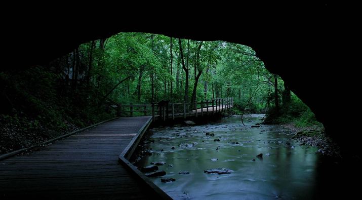
Rock Bridge Memorial State Park is a state park in the U.S. state of Missouri consisting of 2,272.83 acres (919.78 ha) located in Boone County approximately 5 miles (8.0 km) south of Columbia, Missouri. The park is noted for its excellent examples of karst landforms including the rock bridge, sinkholes, and an underground stream at the cave known as Devil's Icebox. The rock bridge was created by the collapse of a section of a cave which resulted in a small arch of rock being left to form a natural bridge over the creek.
Contents
- Rock bridge memorial state park
- Winter hiking at rock bridge memorial state park
- Activities and amenitiesEdit
- References
Winter hiking at rock bridge memorial state park
Activities and amenitiesEdit
The park offers several trails for hiking and cycling. The boardwalk on the Devil's Icebox Trail allows visitors to see the park's primary karst features and explore the cave opening at Connor's Cave. Horseback riding is offered in the 750-acre (300 ha) Gans Creek Wild Area.