
Congressional district 4th Founded 1845 Population 15,748 (2013) | Area 1,085 km² Unemployment rate 5.3% (Apr 2015) | |
 | ||
Rivers Petite Saline Creek, Splice Creek, Moniteau Creek | ||
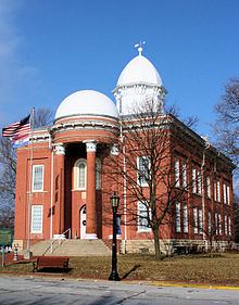
Moniteau County is a county located in the U.S. state of Missouri. As of the 2010 census, the population was 15,607. Its county seat is California. The county was organized February 14, 1845 and named for the Moniteau Creek. 'Moniteau' is a French spelling of Manitou, Algonquian for the Great Spirit.
Contents
- Map of Moniteau County MO USA
- Geography
- Adjacent counties
- Major highways
- Demographics
- Public schools
- Private schools
- Local
- State
- Federal
- Missouri Presidential Preference Primary 2008
- References
Map of Moniteau County, MO, USA
Moniteau County is part of the Jefferson City, MO Metropolitan Statistical Area.
Geography
According to the U.S. Census Bureau, the county has a total area of 419 square miles (1,090 km2), of which 415 square miles (1,070 km2) is land and 3.8 square miles (9.8 km2) (0.9%) is water.
Adjacent counties
Major highways
Demographics
As of the census of 2000, there were 14,827 people, 5,259 households, and 3,728 families residing in the county. The population density was 36 people per square mile (14/km²). There were 5,742 housing units at an average density of 14 per square mile (5/km²). The racial makeup of the county was 92.75% White, 3.78% Black or African American, 0.40% Native American, 0.31% Asian, 0.01% Pacific Islander, 1.48% from other races, and 1.27% from two or more races. Approximately 2.93% of the population were Hispanic or Latino of any race. 35.8% were of German, 20.5% American, 8.2% English and 7.0% Irish ancestry.
There were 5,259 households out of which 35.30% had children under the age of 18 living with them, 58.00% were married couples living together, 8.60% had a female householder with no husband present, and 29.10% were non-families. 25.60% of all households were made up of individuals and 13.00% had someone living alone who was 65 years of age or older. The average household size was 2.56 and the average family size was 3.07.
In the county, the population was spread out with 25.90% under the age of 18, 8.20% from 18 to 24, 31.10% from 25 to 44, 20.90% from 45 to 64, and 13.90% who were 65 years of age or older. The median age was 36 years. For every 100 females there were 113.30 males. For every 100 females age 18 and over, there were 116.80 males.
The median income for a household in the county was $37,168, and the median income for a family was $42,487. Males had a median income of $26,807 versus $20,853 for females. The per capita income for the county was $16,609. About 7.30% of families and 9.90% of the population were below the poverty line, including 13.10% of those under age 18 and 9.00% of those age 65 or over.
Public schools
Private schools
Local
The Republican Party predominantly controls politics at the local level in Moniteau County. Republicans hold all but three of the elected positions in the county.
State
All of Moniteau County is included in Missouri’s 117th District in the Missouri House of Representatives and is represented by Caleb Jones (R-California).
All of Moniteau County is a part of Missouri’s 6th District in the Missouri Senate and is currently represented by Mike Kehoe (R-Jefferson City).
Federal
All of Moniteau County is included in Missouri’s 4th Congressional District and is currently represented by Vicky Hartzler (R-Harrisonville) in the U.S. House of Representatives.