
Country United States Elevation 1,265 m Population 3,863 (2013) | Incorporated May 6, 1903 Area 4.949 km² Local time Thursday 11:55 AM | |
 | ||
Weather 14°C, Wind W at 8 km/h, 17% Humidity | ||
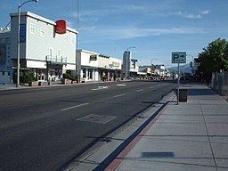
Sabrina campground inyo national forest in bishop california
Bishop (formerly Bishop Creek) is a city in Inyo County, California, United States. Though Bishop is the only city and the largest populated place in Inyo County, the county seat is located in Independence. Bishop is located near the northern end of the Owens Valley, at an elevation of 4,150 feet (1,260 m). The population was 3,879 at the 2010 census, up from 3,575 at the 2000 census. The town was named after Bishop Creek, flowing out of the Sierra Nevada: the creek was named after Samuel Addison Bishop, a settler in the Owens Valley.
Contents
- Sabrina campground inyo national forest in bishop california
- Map of Bishop CA 93514 USA
- Geography
- Notable locations
- Climate
- Demographics
- 2010
- 2000
- Politics and government
- Transportation
- History
- Notable residents
- AM radio
- FM radio
- Television
- Erick Schats Bakker
- References
Map of Bishop, CA 93514, USA
Geography
Bishop lies west of the Owens River at the northern end of the Owens Valley.
It is on U.S. Route 395, the main north-south artery through the Owens Valley, connecting the Inland Empire to Reno, Nevada. US 395 also connects Bishop to Los Angeles via State Route 14 through Palmdale. Bishop is the western terminus of U.S. Route 6. The Paiute-Shoshone Indians of the Bishop Community of the Bishop Colony control land just west of the town. The Los Angeles Department of Water and Power (DWP) controls much of the upstream and surrounding area.
Bishop is immediately to the east of the Sierra Nevada, and west of the White Mountains. Numerous peaks are within a short distance of Bishop, including Mount Humphreys (13,986 ft.), to the west, White Mountain Peak (14,242 ft.) in the northeast, and pyramidal Mount Tom (13,658 ft.) northwest of town. Basin Mountain (13,187 ft.) is viewed to the west from Bishop as it rises above the Buttermilks.
According to the United States Census Bureau, the city has a total area of 1.9 square miles (4.9 km2), over 97% of it land.
Bishop is known as the "Mule Capital of the World" and a week-long festival called Bishop Mule Days has been held since 1969 on the week of Memorial Day, celebrating the contributions of pack mules to the area. The festival attracts many tourists, primarily from the Southern California area.
Bishop is well known in the rock climbing community. Near the city are numerous climbing spots that attract visitors from around the world. There are over 2,000 bouldering problems in Bishop. The two main types of rock are volcanic tuff and granite.
Notable locations
Climate
Bishop, as well as the rest of the Owens Valley, has an arid climate (Köppen BWk) with an annual average of 5.18 inches (132 mm) of precipitation, and is part of USDA Plant Hardiness Zone 7. The wettest year was 1969 with 17.09 in (434 mm) of precipitation and the driest 1989 with 1.81 in (46.0 mm), although from July 2006 to June 2007 a mere 1.46 inches (37.1 mm) fell. Measurable precipitation occurs on an average of 27.6 days annually. The most precipitation in one month was 8.93 in (227 mm) in January 1969, which included 4.00 in (102 mm) on January 4, the most rainfall recorded in 24 hours in Bishop. Snowfall averages 6.8 inches (17 cm) per year. The snowiest season was from July 1968 to June 1969 with 57.1 inches (145 cm), which included the snowiest month, January 1969, at 23.2 inches (59 cm).
There is an average of 2.5 nights of sub 10 °F (−12 °C) lows, 134 nights where the low reaches the freezing mark, 100 days with 90 °F (32 °C)+ highs, and 25 days with 100 °F (38 °C)+ highs. Due to the aridity and hot high-altitude sun, there are only 32 days with maxima below 50 °F (10 °C) and only one per year with a maximum below 32 °F (0 °C), and the annual diurnal temperature variation is 36.9 °F (20.5 °C), reaching 42 °F (23 °C) in summer. The record high temperature of 110 °F (43 °C) occurred on July 10, 2002; the record low of −8 °F (−22 °C) was recorded on December 22, 1990 and December 27, 1988.
Demographics
The demographic information below applies to residents living within the city limits of Bishop; 3,879 in downtown Bishop.
The "greater Bishop area," which includes unincorporated nearby neighborhoods such as West Bishop, Meadow Creek-Dixon Lane, Wilkerson Ranch, Rocking K, Mustang Mesa and Round Valley includes an additional 11,000 residents.
2010
The 2010 United States Census reported that Bishop had a population of 3,879. The population density was 2,029.9 people per square mile (783.8/km²). The racial makeup of Bishop was 2,867 (73.9%) White, 22 (0.6%) African American, 91 (2.3%) Native American, 61 (1.6%) Asian, 1 (0.0%) Pacific Islander, 723 (18.6%) from other races, and 114 (2.9%) from two or more races. Hispanic or Latino of any race were 1,200 persons (30.9%).
The Census reported that 3,771 people (97.2% of the population) lived in households, 36 (0.9%) lived in non-institutionalized group quarters, and 72 (1.9%) were institutionalized.
There were 1,748 households, out of which 499 (28.5%) had children under the age of 18 living in them, 574 (32.8%) were opposite-sex married couples living together, 181 (10.4%) had a female householder with no husband present, 99 (5.7%) had a male householder with no wife present. There were 143 (8.2%) unmarried opposite-sex partnerships, and 10 (0.6%) same-sex married couples or partnerships. 767 households (43.9%) were made up of individuals and 288 (16.5%) had someone living alone who was 65 years of age or older. The average household size was 2.16. There were 854 families (48.9% of all households); the average family size was 3.07.
The population was spread out with 925 people (23.8%) under the age of 18, 298 people (7.7%) aged 18 to 24, 1,014 people (26.1%) aged 25 to 44, 1,031 people (26.6%) aged 45 to 64, and 611 people (15.8%) who were 65 years of age or older. The median age was 38.9 years. For every 100 females there were 99.8 males. For every 100 females age 18 and over, there were 97.7 males.
There were 1,926 housing units at an average density of 1,007.9 per square mile (389.2/km²), of which 676 (38.7%) were owner-occupied, and 1,072 (61.3%) were occupied by renters. The homeowner vacancy rate was 0.3%; the rental vacancy rate was 5.8%. 1,353 people (34.9% of the population) lived in owner-occupied housing units and 2,418 people (62.3%) lived in rental housing units.
2000
As of the census of 2000, there were 3,575 people, 1,684 households, and 831 families residing in the city. The population density was 2,042.5 people per square mile (788.8/km²). There were 1,867 housing units at an average density of 1,066.7 per square mile (411.9/km²). The racial makeup of the city was 84.6% White, 0.2% Black or African American, 2.0% Native American, 1.4% Asian, <0.1% Pacific Islander, 6.5% from other races, and 5.4% from two or more races. 17.4% of the population were Hispanic or Latino of any race.
There were 1,684 households out of which 26.2% had children under the age of 18 living with them, 33.5% were married couples living together, 11.8% had a female householder with no husband present, and 50.6% were non-families. 44.2% of all households were made up of individuals and 19.1% had someone living alone who was 65 years of age or older. The average household size was 2.08 and the average family size was 2.93.
In the city the population was spread out with 24.2% under the age of 18, 7.3% from 18 to 24, 26.5% from 25 to 44, 22.8% from 45 to 64, and 19.2% who were 65 years of age or older. The median age was 40 years. For every 100 females there were 91.8 males. For every 100 females age 18 and over, there were 90.0 males.
The median income for a household in the city was $27,338, and the median income for a family was $34,423. Males had a median income of $23,433 versus $24,545 for females. The per capita income for the city was $17,660. About 14.0% of families and 16.3% of the population were below the poverty line, including 23.0% of those under age 18 and 6.0% of those age 65 or over.
Politics and government
In the state legislature, Bishop is in the 26th Assembly District, represented by Republican Devon Mathis. It is also in the 8th State Senate district.
Federally, Bishop is in California's 8th congressional district, represented by Republican Paul Cook.
Bishop maintains its own police force (the only one in Inyo County), but also has a substation of the Inyo County Sheriff's Department on the outskirts of the city. The California Highway Patrol also has an office in town. Ambulance services are provided by Symons Ambulance.
Transportation
U.S. Route 395 is the main highway serving Bishop between southern California and Reno while U.S. 6 provides access to Tonopah and other communities in Nevada. The Eastern Sierra Airport provides general aviation services locally while scheduled passenger airline flights are available at Mammoth Yosemite Airport.
History
The Bishop Creek post office operated from 1870 to 1889 and from 1935 to 1938. The first Bishop post office opened in 1889.
In order to support the growth aspirations of the City of Los Angeles, water was diverted from the Owens River into the Los Angeles Aqueduct in 1913. The Owens Valley cultures and environments changed substantially. From the 1910s to 1930s the Los Angeles Department of Water and Power purchased much of the valley for water rights and control. The economy of Bishop suffered when farmers sold their land. Jack Foley, a Bishop resident and sound effects specialist, mitigated the economic loss by persuading several Los Angeles studio bosses that the town of Bishop would be ideal as a location to shoot westerns.
Notable residents
AM radio
FM radio
Television
Erick Schat's Bakkerÿ
Erick Schat's Bakkerÿ is a bakery and tourist attraction in Bishop. It is known for a unique bread, called Original Sheepherder's Bread (trademarked in 1938) and produces 450 other products. The bakery produces approximately 25,000 loaves of bread per day, and they have produced their Sheepherder's bread continuously since 1907. The bakery uses a basque recipe. The bakery has a staff of 77 under the oversight of Erick Schat, and bakes the bread in stone hearth ovens, with no preservatives, with everything handmade from scratch, including the yeast.