
Country Area 2,769.08 km2 Capital La Trinidad Population 403,944 | Language spoken benguet.gov.ph Governor LP | |
 | ||
Colleges and Universities Benguet State University Destinations Baguio, La Trinidad, Tuba - Benguet, Itogon, Atok Points of interest Mount Pulag, Burnham Park, Mines View Park, Session Road, Baguio Cathedral | ||
Region | ||
Map of Benguet
Benguet ([beŋˈɡet]; Ibaloi: Probinsya ne Benguet; Pangasinan: Luyag na Benguet; Ilocano: Probinsia ti Benguet; Filipino: Lalawigan ng Benguet), is a landlocked province of the Philippines located in the southern tip of the Cordillera Administrative Region in the island of Luzon. Its capital is La Trinidad.
Contents
- Map of Benguet
- forevermore humihila ng turista sa benguet baguio
- Aliwan fiesta 2013 adivay festival benguet hd
- History
- Spanish period
- American period
- World War II
- Modern history
- Geography
- Climate
- Administrative divisions
- Barangays
- Demographics
- Ethnicity
- Languages
- Religion
- Economy
- Education
- Tourism
- References
The highland province is known as the Salad Bowl of the Philippines due to its huge production of upland vegetables.
Situated within the interior of Benguet is the highly urbanized city of Baguio, which is administratively independent from the province.
forevermore humihila ng turista sa benguet baguio
Aliwan fiesta 2013 adivay festival benguet hd
History
The mountainous area now covered by Benguet has been settled for millennia by several peoples collectively known as the Igorots. Two of these groups, the Ibaloi and the Kankanaey, are dominant ethnolinguistic groups of the area. In the pre-conquest period, these tribes enjoyed flourishing trade with lowland groups immediately to their west and south, such as the Pangasinense.Governor Juan "Oraa" Cariño (1913-1918) one of the governors of Benguet, he is the first filipino to be a governor.
Spanish period
At the beginning of the Spanish Era, colonisers heard of the rich gold mines in the mountains and attempted to colonize the highlands, but failed. In 1572, Spanish conquistador Juan de Salcedo led a small expedition into the southern part of Benguet, but the natives forced it to retreat. The first major expedition into the mountains occurred in 1620, when Spanish explorers went into the La Trinidad Valley and briefly controlled some Igorot gold mines, but abandoned them after a few years.
In the 1800s, Spanish colonizers made more serious attempts such as expeditions under Col. Guillermo Galvey and succeeded in establishing a presence in the La Trinidad Valley, named after Galvey's wife.
This area later became a district of the new province of La Montañosa (or La Montaña) in 1846. Eight years later, in 1854, Benguet became a separate comandancia politico-militar. Parts of the present province were established as component territories of other comandancias such as Lepanto and Amburayan.
American period
When the Americans took control of the Philippines, they established local civil governments in many parts of the country. American civilian government was established in Benguet on November 23, 1900 through Act No. 48, with Canadian journalist H.P. Whitmarsh appointed as the province's first governor.
Upon the American colonial government enacting Act No. 1876 on August 18, 1908 which created Mountain Province from areas of the old La Montañosa, Benguet (along with Amburayan, Apayao, Bontoc, Ifugao, Kalinga, and Lepanto) became sub-provinces of this new province. A year later in 1909, the township of Baguio was abolished upon its conversion into a chartered city. In 1920, portions of the sub-provinces of Amburayan and Lepanto were incorporated into Benguet.
Mining companies started operating in the province in the 1930s. This brought jobs, and many lowlanders migrated to Benguet, especially in towns surrounding the gold mines, such as Itogon, Mankayan and Tuba.
World War II
During World War II, Igorot guerrillas and the combined Filipino and American forces fought Japanese soldiers during the final days of the war in 1945.
Modern history
On June 18, 1966, the huge Mountain Province was split into four provinces with the enactment of Republic Act No. 4695. The four provinces were Benguet, Mountain Province, Kalinga-Apayao and Ifugao.
On June 22, 1973, as part of the Integrated Organization Plan of President Ferdinand E. Marcos, Benguet was placed under the jurisdiction of the Ilocos Region. When the Cordillera Administrative Region was established by President Corazon Aquino thru Executive Order 220 on July 15, 1987, Benguet was made one of its provinces.
Geography
Benguet covers an area of 2,769.08 square kilometres (1,069.15 sq mi) occupying the southwestern tip of the Cordillera Administrative Region. If Baguio City is included for geographical purposes, the total area of Benguet is 2,826.59 square kilometres (1,091.35 sq mi).
The province is bordered on the northeast by Mountain Province and Ifugao, on the southeast by Nueva Vizcaya, on the south by Pangasinan, on the west by La Union, and on the northwest by Ilocos Sur.
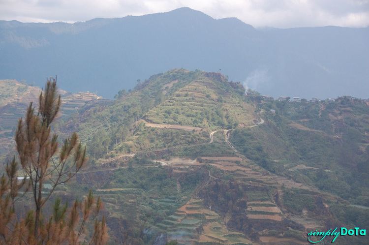
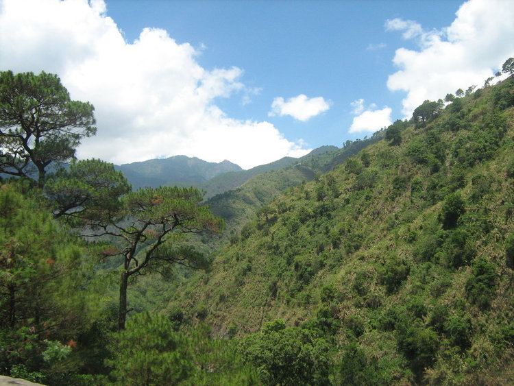
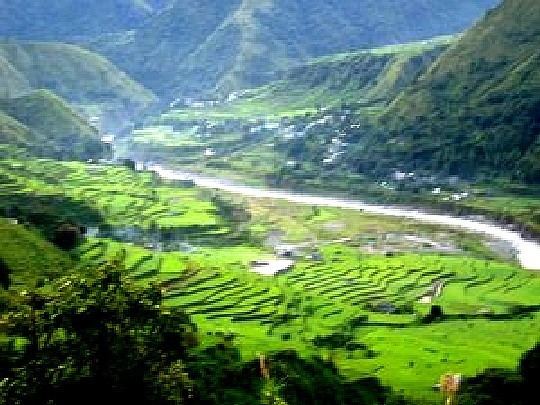
Situated within the Cordillera mountains, Benguet is dominantly mountainous. Mount Pulag, the highest in Luzon is located within Kabayan. The mountains form the headwaters of several rivers, the major ones which include the Agno, Amburayan, Bued, Bakun, Balili and the Asin. Some of these run through river valleys or gorges.
Several natural lakes, small in size, are found within the hinterlands. The largest are the "Four Lakes" in Kabayan; Lake Bulalacao, Lake Detepngepos, Lake Incolos and Lake Tabeyo.
Climate
Benguet generally has a cool climate, experiencing an annual average record high of 25.3 °C (77.5 °F) in April, and an annual average record low of 13.3 °C (55.9 °F) in January.
The province suffers from crop damage resulting from seasonal frost during the cold months of December to March, especially in high-altitude towns such as Atok, Buguias, Mankayan and Kibungan. In February 2007, Benguet suffered crop damage due to temperatures reaching as low as 7 °C (45 °F).
Administrative divisions
Benguet comprises 13 municipalities, all encompassed by a single legislative district.
The highly urbanized city of Baguio, although administratively independent from Benguet, is situated in the interior of the province, surrounded by the municipalities of La Trinidad, Itogon, Sablan and Tuba. The city used to be part of the province but became independent when the city's charter was enacted in 1909.
Barangays
The 13 municipalities of the province comprise a total of 140 barangays, with Pico in La Trinidad as the most populous in 2010, and Anchokey in Kabayan as the least.
Demographics
The population of Benguet in the 2015 census was 446,224 people, making it the most populous province in the region. It had a density of 160 inhabitants per square kilometre or 410 inhabitants per square mile. If the highly urbanized city of Baguio is included for geographical purposes, the population is 791,590, with a density of 280/km2 (725/sq mi).
In the May 2000 census, Benguet had a total population of 330,129. This figure is up by 16,296 from 313,833 persons recorded in the 1995 census, giving an annual growth rate of 1.09% during the 5-year period compared to the national average of 2.43%. The province registered 63,123 households, an increase of 4,588 households over the 1990 figure. This gave an average household size of 5.20 persons, slightly higher than the national average of 4.99.
Ethnicity
The native inhabitants of Benguet comprise three ethnolinguistic groups. Kankanaeys dominate the northwestern municipalities, Ibalois are concentrated on the southeast, and Kalanguyas are mostly found in the east. Migrants from lowland provinces have fused with the local populace to form a melting pot in some areas.
According to the 2000 Philippine census, Kankanaeys comprised 42.96% (141,434) of the entire provincial household population of 329,216 at the time, while 29.15% (95,968) were identified as Ibalois, and 3.69% (12,147) were Ikalahan/Kalanguya. Major resident lowland ethnic groups included Ilocanos at 13.36% (43,984) and Tagalogs at 2.36% (7,773).
Languages
Benguet residents generally speak their own languages in addition to Ilocano, Tagalog, and English, which are used for trade and commerce. The Ibaloi tribe speak Ibaloi, which is similar to Pangasinan, while the Kankanaey have their own eponymous language, which is related to the Bontoc language.
The SIL Ethnologue database classifies the languages under the South-Central Cordilleran branch. Nabaloy (named in the database as Ibaloi) is part of the Southern Cordilleran branch which also includes Pangasinense. The Kankanaey language is under the Central Cordilleran branch, which also includes Bontoc and Ifugao.
Religion
Roman Catholicism is the predominant religion with 73% adherence while Aglipayan (a local form of Catholicism) is an important minority. Many other Christian groups are also found and they are represented by Church of Christ of Latter Day Saints, Iglesia Ni Cristo, Presbyterian, Methodist, Baptist, Jehovah's Witnesses, Seventh-day Adventist as well as Muslims.
Economy
Agriculture, mining, and tourism are the major industries in Benguet. Its cool climate and high altitude has made it an ideal place for producing highland vegetables. Benguet is often called the Salad Bowl of the Philippines. The La Trinidad Vegetable Trading Post in the capital town of La Trinidad serves as the hub of vegetable trading in the province, attracting farmers, merchants and traders from the local community and the Philippines' different provinces. Major crops produced which include potatoes, Baguio beans, peas, strawberries, cabbage, broccoli, cauliflower, lettuce, sayote and carrots are shipped throughout the country.
Horticulture and floriculture are practiced in the province. The province supplies flowers to the different municipalities, including Baguio City, as well as to Metro Manila, including other parts of Luzon, Visayas and Mindanao. Roses are produced, particularly in Barangay Bahong in La Trinidad, earning the barangay the title Rose Capital of the Philippines. Apisang (scientific name: Pittosporum resiniferum), a plant endemic to the Philippines, is grown in the municipalities of Kapangan and Kibungan as a potential alternative source of fuel and energy, rivaling the jatropha biofuel plant.
Other agricultural-related activities are monggo processing, fruit preservation, peanut brittle manufacturing, broom making and basket weaving.
Mining is a major industry in Benguet, which is one of the country's leading gold producers. The Benguet Corporation, the first and oldest mining company in the Philippines, has extracted gold, copper and chromite in Itogon since 1903.
Other mineral deposits are silver, copper, pyrite, and limestone. Silver smithing is a large industry in Benguet, and many entrepreneurs sell silver works at lower prices in Baguio City compared to Manila. In 2006, revenues from mining reached 4 billion pesos from just two (Lepanto Consolidated Mining Corporation and Philex Mines) of many mining firms operating in the province. The province's mining vigor has never translated into better quality of life of the Benguet people, simply because a bulk of the mining firm's taxes are not paid directly to the province. The two mining corporations, like many others around the country, have principal offices in the City of Makati, a set-up that makes Makati the prime mining tax beneficiary.
The location of Baguio City within Benguet draws many tourists from the lowlands. Often, people who go to Baguio also explore the province, especially the strawberry fields in La Trinidad.
Education
Higher education in the province is centered in the capital town of La Trinidad, which houses the Main Campus of the only university in Benguet, the Benguet State University (BSU). The university has two satellite campuses in two municipalities; the Buguias Campus at Loo, Buguias, and the Bokod Campus at Ambangeg, Bokod.
Other educational institutions which include Advocates Academic College, BVS Colleges, Cordillera Career Development College, King's College of the Philippines, Philippine College of Ministry, Philippine Nazarene College, as well as the Cordillera Regional Science High School, the Benguet National High School (with several annexes) and the Benguet SPED Center are also situated within La Trinidad.
The independent chartered city of Baguio hosts several higher education institutions, which include most notably the University of the Philippines Baguio, Saint Louis University, University of the Cordilleras (formerly Baguio Colleges Foundation), University of Baguio, Pines City Colleges, Baguio Central University, and Baguio School of Business and Technology, attracting students from across the Philippines.
Tourism
The province is a major tourist destination in the country, with most of its tourist spots centered on culture and nature. Baguio City's location within the province provides a boost to the tourism industry of the province. Notable interesting places in the province include Mount Pulag along Kabayan, Kennon Road in Tuba, Ambuklao Dam in Bokod, Binga Dam in Itogon, strawberry and flower farms in La Trinidad, and the Palina and Naguey rice terraces in Atok.
Tuba and Tublay hot springs are usually flocked by local tourists from the neighboring provinces. Vegetable terraces can be seen along the Halsema Highway, especially during the growing season. Kabayan is known for its centuries-old mummies, while Buguias is visited for its hot springs and the Apo Anno.