
Time zone PHT (UTC+8) | Founded 1908 Area rank 58th out of 81 Municipalities 10 | |
 | ||
Points of interest Bomod‑ok Falls, Kiltepan View, Sumaging Cave, Lake Danum, Lumiang Cave Destinations | ||
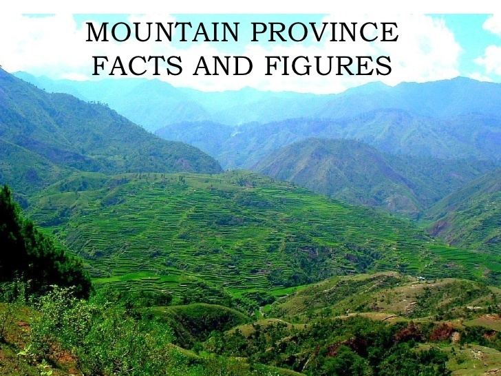
Sagada mountain province exploration 2015
Mountain Province (Filipino: Lalawigang Bulubundukin), is a landlocked province of the Philippines in the Cordillera Administrative Region in Luzon. Its capital is Bontoc.
Contents
- Sagada mountain province exploration 2015
- Map of Mountain Province Philippines
- Spelunking in sagada mountain province couple travel vlog philippines episode 6
- Spanish period
- American period
- Post war era
- Geography
- Administrative divisions
- Barangays
- Demographics
- Religion
- Tourism
- Government
- References
Map of Mountain Province, Philippines
Mountain Province was formerly referred to as Mountain in some foreign references. The name is usually shortened by locals to Mt. Province. The province was named so for being in the Cordillera Central mountain range found in the upper realms of Luzon island.
Mountain Province was also the name of the historical province that included most of the current Cordillera provinces. This old province was established by the Philippine Commission in 1908, and was later split in 1966 into Mountain Province, Benguet, Kalinga-Apayao and Ifugao.
The province is also known for its mummy caves, which contain naturally mummified bodies, and for its hanging coffins.
Spelunking in sagada mountain province couple travel vlog philippines episode 6
Spanish period
The area of the Cordillera mountains proved difficult to control by the Spaniards. From 1566 to 1665, they sent expeditions to conquer the land but the rugged terrain and hostile indigenous population at the time were major obstacles to complete subjugation.
Formerly called La Montañosa by the Spanish colonizers due to its mountainous terrain, the area was subdivided into 6 comandancias politico-militar.
American period
In August 19, 1908, during the American rule, the Philippine Commission enacted Act No. 1876, which organized the entire area of the Cordilleras into one large province, named Mountain Province.
The first governor was Samuel Cane, and the town of Bontoc was made the capital. It was originally composed of the sub-provinces of Amburayan, Apayao, Benguet, Lepanto-Bontoc, Ifugao and Kalinga.
Amburayan was later abolished in 1920 and its corresponding territories were transferred to the provinces of Ilocos Sur and La Union. Lepanto was also reduced in size and its towns were integrated into the sub-provinces of Bontoc and Benguet, and to the province of Ilocos Sur.
Post-war era
Effective on April 7, 1967, Republic Act No. 4695 abolished the old Mountain Province, converting its sub-provinces into 4 independent provinces: Benguet, Ifugao, Kalinga-Apayao and Mountain Province (corresponding to the former Bontoc sub-province). On June 15, 1987, the Cordillera Administrative Region was established upon the issuance of Executive Order 220 by then-President Corazon Aquino, and Mountain Province was made one of its provinces.
Geography
Mountain Province covers a total area of 2,157.38 square kilometres (832.97 sq mi) occupying the central section of the Cordillera Administrative Region in Luzon. The province is bordered on the north by Kalinga, south by Ifugao, southwest by Benguet, west by Ilocos Sur, and northwest by Abra.
Situated within the Cordillera Central, Mountain Province is 83% mountainous while 17% make up hills and levels. The province has many rivers, waterfalls, mountains, and caves. The central and western areas of the province are characterized by rugged mountains and steep cliffs, while the eastern portion has generally sloping terrain.
Administrative divisions
Mountain Province comprises ten municipalities, all encompassed by a lone legislative district.
Barangays
Mountain Province has 144 barangays comprising its 10 municipalities.
As of 2010, the most populous barangay in the province is Poblacion in the municipality of Paracelis, with a total of 5,687 inhabitants. Balintaugan in the municipality of Bauko has the least population with only 144.
Demographics
The population of Mountain Province in the 2015 census was 154,590 people, with a density of 72 inhabitants per square kilometre or 190 inhabitants per square mile.
Based on the 2000 census survey, Kankana-ey comprised 7001518000000000000♠51.8% (72,694) of the total provincial population of 140,339. Balangao/Baliwon came in second at 7001134600000000000♠13.46% (18,886), and Bontoc at 7001122800000000000♠12.28% (17,234). Other ethnicities were the Ilocano at 7000497000000000000♠4.97% (6,968), Applai at 7000210000000000000♠2.1% (2,947), Binontok at 7000179000000000000♠1.79% (2,510), and Kalinga at 7000176000000000000♠1.76% (2,468).
Religion
Anglicanism predominates in the province with approximately 60% adherence with the other religions such as Roman Catholicism, Seventh-Day Adventist Church, Iglesia Filipina Indepiendente, Iglesia ni Cristo and Free Believers.
Tourism
The province has several rice terraces in seven of its different towns: