
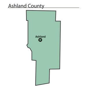
Area 1,106 km² Population 53,043 (2013) University Ashland University | Congressional district 7th Website www.ashlandcounty.org Founded 24 February 1846 County seat Ashland | |
 | ||
Points of interest Mohican State Park, MOHICAN COUNTRY MARKET, The Cleo Redd Fisher Mu, Wolf Creek Grist Mill, Ashland County Historical Destinations Loudonville, Mohican Township, Perrysville, Mohican‑Memorial State Forest, Pleasant Hill Lake | ||
Ashland County is a county in the U.S. state of Ohio. As of the 2010 census, the population was 53,139. Its county seat is Ashland. The county is named for "Ashland", the home of Senator Henry Clay near Lexington, Kentucky. It was formed in 1846 from parts of Huron, Lorain, Richland and Wayne Counties.
Contents
- Map of Ashland County OH USA
- Ashland county ohio u s a farms barns and scenery
- History
- Geography
- Adjacent counties
- 2000 census
- 2010 census
- Transportation
- City
- Census designated place
- References
Map of Ashland County, OH, USA
Ashland County comprises the Ashland, OH Metropolitan Statistical Area, which is also included in the Mansfield-Ashland-Bucyrus, OH Combined Statistical Area.
Ashland county ohio u s a farms barns and scenery
History
Ashland County was formed on February 24, 1846 from portions of Huron, Lorain, Richland, and Wayne counties. Like the county seat, it was named after Ashland, the Lexington, Kentucky-area home of Henry Clay, a Kentucky senator.
Geography
According to the U.S. Census Bureau, the county has a total area of 427 square miles (1,110 km2), of which 423 square miles (1,100 km2) is land and 3.8 square miles (9.8 km2) (0.9%) is water.
Adjacent counties
2000 census
As of the census of 2000, there were 52,523 people, 19,524 households, and 14,018 families residing in the county. The population density was 124 people per square mile (48/km²). There were 20,832 housing units at an average density of 49 per square mile (19/km²). The racial makeup of the county was 97.54% White, 0.81% Black or African American, 0.11% Native American, 0.55% Asian, 0.03% Pacific Islander, 0.21% from other races, and 0.76% from two or more races. 0.65% of the population were Hispanic or Latino of any race. 36.8% were of German, 17.3% American, 10.1% English and 8.8% Irish ancestry according to Census 2000. 96.1% spoke English, 1.2% German and 1.0% Spanish as their first language.
There were 19,524 households out of which 32.50% had children under the age of 18 living with them, 59.50% were married couples living together, 8.50% had a female householder with no husband present, and 28.20% were non-families. 24.00% of all households were made up of individuals and 10.30% had someone living alone who was 65 years of age or older. The average household size was 2.58 and the average family size was 3.06.
In the county, the population was spread out with 25.70% under the age of 18, 10.80% from 18 to 24, 26.50% from 25 to 44, 23.00% from 45 to 64, and 13.90% who were 65 years of age or older. The median age was 36 years. For every 100 females there were 96.60 males. For every 100 females age 18 and over, there were 92.40 males.
The median income for a household in the county was $39,179, and the median income for a family was $46,306. Males had a median income of $32,585 versus $22,334 for females. The per capita income for the county was $17,308. About 7.10% of families and 9.50% of the population were below the poverty line, including 13.10% of those under age 18 and 7.50% of those age 65 or over.
2010 census
As of the 2010 United States Census, there were 53,139 people, 20,196 households, and 14,017 families residing in the county. The population density was 125.6 inhabitants per square mile (48.5/km2). There were 22,141 housing units at an average density of 52.3 per square mile (20.2/km2). The racial makeup of the county was 97.3% white, 0.7% black or African American, 0.5% Asian, 0.2% American Indian, 0.1% Pacific islander, 0.2% from other races, and 1.0% from two or more races. Those of Hispanic or Latino origin made up 0.9% of the population. In terms of ancestry, 32.7% were German, 16.1% were American, 11.2% were Irish, 10.1% were English, and 5.2% were Italian.
Of the 20,196 households, 30.9% had children under the age of 18 living with them, 55.6% were married couples living together, 9.4% had a female householder with no husband present, 30.6% were non-families, and 25.3% of all households were made up of individuals. The average household size was 2.53 and the average family size was 3.02. The median age was 39.3 years.
The median income for a household in the county was $44,542 and the median income for a family was $54,177. Males had a median income of $39,663 versus $31,012 for females. The per capita income for the county was $20,558. About 10.2% of families and 15.6% of the population were below the poverty line, including 26.6% of those under age 18 and 7.9% of those age 65 or over.
Transportation
The Ashland County Airport is located three nautical miles (3.5 mi, 5.6 km) northeast of the central business district of the City of Ashland.