
Congressional district 16th Website www.wayneohio.org Population 115,071 (2013) | Largest city Wooster Area 1,443 km² Unemployment rate 3.5% (Apr 2015) | |
 | ||
Founded January 4, 1812 (date organized; formed 1808) Colleges and Universities College of Wooster, University of Akron Wayne C, Ohio State University Agricultur Points of interest Secrest Arboretum, KNIGHTS FIELD PARK, Grace Church, College of Wooster Art Museum, Village Green Park | ||
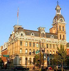
Wayne county ohio s one of a kind attractions
Wayne County is a county in the U.S. state of Ohio. As of the 2010 census, the population was 114,520. Its county seat is Wooster. The county is named for General "Mad" Anthony Wayne.
Contents
- Wayne county ohio s one of a kind attractions
- Map of Wayne County OH USA
- Explosion on u s route 30 wayne county ohio
- Geography
- Adjacent counties
- 2000 census
- 2010 census
- Government
- Cities
- Census designated places
- References
Map of Wayne County, OH, USA
Wayne County comprises the Wooster, OH Micropolitan Statistical Area.
Explosion on u s route 30 wayne county ohio
Geography
According to the U.S. Census Bureau, the county has a total area of 557 square miles (1,440 km2), of which 555 square miles (1,440 km2) is land and 1.9 square miles (4.9 km2) (0.3%) is water.
Adjacent counties
2000 census
As of the census of 2000, there were 111,564 people, 40,445 households, and 29,484 families residing in the county. The population density was 201 people per square mile (78/km²). There were 42,324 housing units at an average density of 76 per square mile (29/km²). The racial makeup of the county was 96.52% White, 1.57% Black or African American, 0.16% Native American, 0.66% Asian, 0.01% Pacific Islander, 0.24% from other races, and 0.84% from two or more races. 0.75% of the population were Hispanic or Latino of any race. 31.7% were of German, 13.9% American, 9.6% Irish, 9.0% English and 5.5% Swiss ancestry according to Census 2000. 91.5% spoke English, 3.2% German, 1.6% Dutch, 1.5% Pennsylvania Dutch and 1.2% Spanish as their first language.
There were 40,445 households out of which 35.00% had children under the age of 18 living with them, 60.80% were married couples living together, 8.70% had a female householder with no husband present, and 27.10% were non-families. 22.70% of all households were made up of individuals and 8.70% had someone living alone who was 65 years of age or older. The average household size was 2.68 and the average family size was 3.17.
In the county, the population was spread out with 27.40% under the age of 18, 9.80% from 18 to 24, 27.80% from 25 to 44, 22.70% from 45 to 64, and 12.20% who were 65 years of age or older. The median age was 35 years. For every 100 females there were 97.50 males. For every 100 females age 18 and over, there were 94.50 males.
The median income for a household in the county was $41,538, and the median income for a family was $48,294. Males had a median income of $33,976 versus $23,203 for females. The per capita income for the county was $18,330. About 5.40% of families and 8.00% of the population were below the poverty line, including 10.60% of those under age 18 and 6.90% of those age 65 or over.
2010 census
As of the 2010 United States Census, there were 114,520 people, 42,638 households, and 30,070 families residing in the county. The population density was 206.4 inhabitants per square mile (79.7/km2). There were 45,847 housing units at an average density of 82.6 per square mile (31.9/km2). The racial makeup of the county was 95.7% white, 1.5% black or African American, 0.8% Asian, 0.2% American Indian, 0.5% from other races, and 1.4% from two or more races. Those of Hispanic or Latino origin made up 1.6% of the population. In terms of ancestry, 34.1% were German, 13.3% were American, 12.9% were Irish, and 9.0% were English.
Of the 42,638 households, 32.5% had children under the age of 18 living with them, 57.1% were married couples living together, 9.2% had a female householder with no husband present, 29.5% were non-families, and 25.1% of all households were made up of individuals. The average household size was 2.61 and the average family size was 3.13. The median age was 38.3 years.
The median income for a household in the county was $48,375 and the median income for a family was $59,692. Males had a median income of $42,082 versus $29,623 for females. The per capita income for the county was $22,645. About 7.8% of families and 9.9% of the population were below the poverty line, including 14.9% of those under age 18 and 6.3% of those age 65 or over.
Government
The Wayne County Public Library serves the communities of Wayne County, Ohio from its administrative offices in Wooster, Ohio and branches in Creston, Dalton, Doylestown, Rittman, Shreve, and West Salem. It also offers bookmobile service and outreach program, and patron can use the extended services of CLEVNET, a group of libraries located in northeast Ohio.
In 2005, the library loaned more than 1.2 million items to its 54,000 cardholders. Total holding are over 340,000 volumes with over 900 periodical subscriptions.