
Founded January 4, 1825 Website www.co.holmes.oh.us Population 43,593 (2013) Unemployment rate 3.1% (Apr 2015) | Area 1,098 km² | |
 | ||
Rivers Mohican River, Doughty Creek, Salt Creek, Misers Run Destinations | ||
A tour of a newer amish home in holmes county ohio with wanda brunstetter
Holmes County is a county located in the U.S. state of Ohio. As of the 2010 census, the population was 42,366. Its county seat is Millersburg. The county was formed in 1824 from portions of Coshocton, Tuscarawas and Wayne counties and organized the following year. It was named after Andrew Holmes, an officer killed in the War of 1812. Holmes County is home to an Amish community, the largest in the world, that draws many visitors to the county.
Contents
- A tour of a newer amish home in holmes county ohio with wanda brunstetter
- Map of Holmes County OH USA
- History
- Geography
- Adjacent counties
- 2000 census
- 2010 census
- Communities
- Transportation
- Amish community
- References
Map of Holmes County, OH, USA
History
Holmes County was formed on January 20, 1824 from portions of Coshocton, Tuscarawas and Wayne counties. It was named after Andrew Holmes, an officer in the War of 1812. During the Civil War, small-scale riots broke out in ethnic German areas. Holmes County was an isolated localistic area dominated by Pennsylvania Dutch and some recent German immigrants. It was a Democratic stronghold and few men dared speak out in favor of conscription. Local politicians denounced Lincoln and Congress as despotic, seeing the draft law as a violation of their local autonomy. In June 1863, small scale disturbances broke out; they ended when the Army sent in armed units.
Geography
According to the U.S. Census Bureau, the county has a total area of 424 square miles (1,100 km2), of which 423 square miles (1,100 km2) is land and 1.4 square miles (3.6 km2) (0.3%) is water.
Adjacent counties
2000 census
As of the census of 2000, there were 38,943 people, 11,337 households, and 9,194 families residing in the county. The population density was 92 people per square mile (36/km²). There were 12,280 housing units at an average density of 29 per square mile (11/km²). The racial makeup of the county was 99.03% White, 0.33% Black or African American, 0.06% Native American, 0.06% Asian, 0.01% Pacific Islander, 0.13% from other races, and 0.40% from two or more races. Hispanic or Latino of any race were 0.75% of the population. 56.1% spoke English, 20.1% Pennsylvania German, 15.8% German and 7.1% "Dutch" as their first language.
There were 11,337 households out of which 44.30% had children under the age of 18 living with them, 71.50% were married couples living together, 6.50% had a female householder with no husband present, and 18.90% were non-families. 16.10% of all households were made up of individuals and 6.90% had someone living alone who was 65 years of age or older. The average household size was 3.35 and the average family size was 3.82. Religious breakdown for those who gave a religion (68.33 of the total population) was 89.79% Evangelical Protestant, 8.04% Mainline Protestant and 2.16% Catholic. There were 140 Amish congregations with 17,654 adherents. There were several other unrelated Amish congregations and Mennonite congregations. There was one Catholic congregation.
In the county, the population was spread out with 35.60% under the age of 18, 10.40% from 18 to 24, 25.70% from 25 to 44, 17.80% from 45 to 64, and 10.50% who were 65 years of age or older. The median age was 28 years. For every 100 females there were 99.60 males. For every 100 females age 18 and over, there were 95.50 males.
The median income for a household in the county was $36,944, and the median income for a family was $40,230. Males had a median income of $28,490 versus $20,602 for females. The per capita income for the county was $14,197. About 10.50% of families and 12.90% of the population were below the poverty line, including 17.40% of those under age 18 and 13.30% of those age 65 or over.
Holmes County has a relatively high number of residents who do not speak English at home. According to the 2000 census, almost 36% of the population speak either Pennsylvania German or German at home, and a further 7% speak "Dutch", i.e. Pennsylvania Dutch. 42.92% of the total population and 50.28% of the children in 5-17 age range uses German/Pennsylvania German or "Dutch" at home.
2010 census
As of the 2010 United States Census, there were 42,366 people, 12,554 households, and 10,035 families residing in the county. The population density was 100.3 inhabitants per square mile (38.7/km2). There were 13,666 housing units at an average density of 32.3 per square mile (12.5/km2). The racial makeup of the county was 98.7% white, 0.3% black or African American, 0.1% Asian, 0.1% American Indian, 0.2% from other races, and 0.5% from two or more races. Those of Hispanic or Latino origin made up 0.8% of the population. In terms of ancestry, 37.8% were German, 10.8% were American, 6.6% were Irish, and 6.3% were English.
Of the 12,554 households, 42.9% had children under the age of 18 living with them, 69.7% were married couples living together, 6.9% had a female householder with no husband present, 20.1% were non-families, and 17.2% of all households were made up of individuals. The average household size was 3.31 and the average family size was 3.80. The median age was 29.7 years.
The median income for a household in the county was $43,533 and the median income for a family was $49,133. Males had a median income of $36,644 versus $24,317 for females. The per capita income for the county was $17,009. About 10.5% of families and 13.3% of the population were below the poverty line, including 18.9% of those under age 18 and 6.9% of those age 65 or over.
Communities
CDP = Census-designated place
UIC = Unincorporated community
Transportation
Holmes County Airport (FAA LID: 10G) located two miles southwest of Millersburg.
Amish community
A large Amish community of about 36,000 exists in Northeast-Central Ohio, centered on Holmes County and extending into surrounding counties. The Holmes Old Order Amish affiliation with 140 church districts out of 221 in the Holmes County Amish settlement in 2009 is the main and dominant Amish affiliation. Holmes County houses the highest percentage of Amish of any U.S. county, currently 42 percent of the population, and experts speculate that within 15 years Holmes County may be the first majority Amish county. The Amish & Mennonite Heritage Center in Berlin explains traditional ways of the Amish and provides an illustrated history for visitors in its 10-foot-by-265-foot mural.
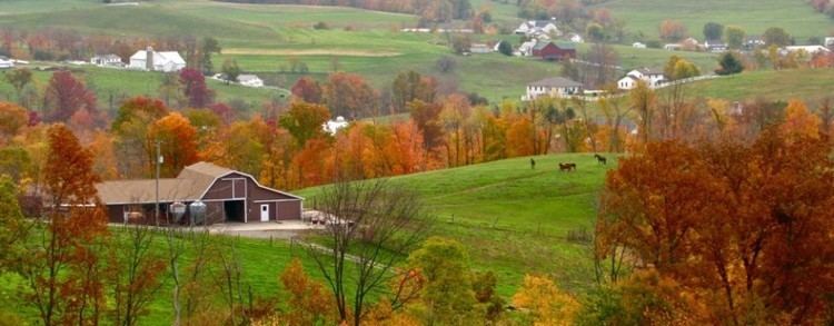
The overall Amish population of the area, centered on Holmes County, is the largest Amish community in the world. Called locally "Amish Country", it draws many visitors to the county, thus making tourism an important sector of the local economy.
The Holmes County Amish Settlements have the most diverse Old Order Amish affiliations. The Holmes Old Order Amish affiliation is the main and original affiliation, the Swartzentruber Amish, that also originated in 1917 in Holmes County, has three sub affiliations there. There are also Andy Weaver Amish (formed 1952) and New Order Amish (formed in the early 1960s) there.