
Country United States Incorporated (village) 1972 Elevation 271 m Population 31,709 (2013) | Founded 1857 Incorporated (city) 1974 Zip code 55304 Local time Thursday 2:04 AM | |
 | ||
Weather -7°C, Wind NW at 18 km/h, 75% Humidity | ||
Andover is a city in Anoka County, Minnesota, United States. The population was 30,598 at the 2010 census.
Contents
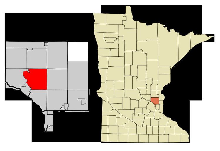
- Map of Andover MN 55304 USA
- Geography
- History
- 2010 census
- 2000 census
- City Celebration
- Education
- References
Map of Andover, MN 55304, USA
Geography
According to the United States Census Bureau, the city has a total area of 34.83 square miles (90.21 km2), of which, 33.88 square miles (87.75 km2) is land and 0.95 square miles (2.46 km2) is water. County Roads 9, 18, 78, and 116 are the main routes in the community. U.S. Highway 10 is in close proximity to the city.
Crooked Lake is the only fully recreational lake in Andover. It is on the south border of the city with the majority of the lake actually in neighboring Coon Rapids.
History
Once a stop on the Great Northern Railway, Andover was established as a city in 1974.
2010 census
As of the census of 2010, there were 30,598 people, 9,811 households, and 8,357 families residing in the city. The population density was 903.1 inhabitants per square mile (348.7/km2). There were 10,091 housing units at an average density of 297.8 per square mile (115.0/km2). The racial makeup of the city was 93.2% White, 1.7% African American, 0.3% Native American, 2.2% Asian, 0.6% from other races, and 1.9% from two or more races. Hispanic or Latino of any race were 2.0% of the population.
There were 9,811 households of which 47.6% had children under the age of 18 living with them, 74.2% were married couples living together, 7.1% had a female householder with no husband present, 3.9% had a male householder with no wife present, and 14.8% were non-families. 10.6% of all households were made up of individuals and 3.4% had someone living alone who was 65 years of age or older. The average household size was 3.11 and the average family size was 3.35.
The median age in the city was 37.3 years. 30.4% of residents were under the age of 18; 7.6% were between the ages of 18 and 24; 25.5% were from 25 to 44; 29.9% were from 45 to 64; and 6.7% were 65 years of age or older. The gender makeup of the city was 50.7% male and 49.3% female.
2000 census
As of the census of 2000, there were 26,588 people, 8,107 households, and 7,150 families residing in the city. The population density was 779.6 people per square mile (301.0/km²). There were 8,205 housing units at an average density of 240.6 per square mile (92.9/km²). The racial makeup of the city was 96.48% White, 0.54% African American, 0.35% Native American, 1.08% Asian, 0.02% Pacific Islander, 0.32% from other races, and 1.21% from two or more races. Hispanic or Latino of any race were 1.05% of the population.
There were 8,107 households out of which 55.1% had children under the age of 18 living with them, 80.0% were married couples living together, 5.5% had a female householder with no husband present, and 11.8% were non-families. 8.4% of all households were made up of individuals and 2.3% had someone living alone who was 65 years of age or older. The average household size was 3.28 and the average family size was 3.48.
In the city, the population was spread out with 35.5% under the age of 18, 6.0% from 18 to 24, 36.4% from 25 to 44, 19.2% from 45 to 64, and 2.9% who were 65 years of age or older. The median age was 32 years. For every 100 females there were 103.4 males. For every 100 females age 18 and over, there were 102.5 males.
The median income for a household in the city was $76,241, and the median income for a family was $78,785. Males had a median income of $50,248 versus $33,814 for females. The per capita income for the city was $26,317. About 1.2% of families and 2.0% of the population were below the poverty line, including 2.0% of those under age 18 and 4.0% of those age 65 or over.
City Celebration
The annual city celebration is the Andover Family Fun Fest, held near the beginning of July on and around the grounds of City Hall, Andover Elementary School, and Sunshine Park. Events include a 5K fun run, a street dance, a parade, and a fireworks show.
The 20th Annual Andover Family Fun Fest was held on July 10 and 11, 2015.
Education
Andover is part of Minnesota's Anoka-Hennepin School District 11. District 11 schools within Andover's boundaries include Andover Elementary School, Crooked Lake Elementary School, Rum River Elementary School, Oak View Middle School, Andover High School (Andover, Minnesota). In addition, a small strip of the northern part of the city is part of Anoka-Isanti Independent School District 15 (St. Francis, Minnesota Public Schools).