
Time zone IST (UTC+5:30) Area 1,983 km² | Elevation 623 m (2,044 ft) PIN 497001 Population 214,575 (2010) | |
 | ||
Weather 27°C, Wind N at 11 km/h, 20% Humidity Neighborhoods Bouripara, Kalam Para, Meyar Colony, Babupara | ||
Ambikapur chhattisgarh time lapse hyperlapse motion by aman bhagat mr awesome
Ambikapur is a city and Surguja district headquarters. The district is one of the oldest districts of the Indian state of Chhattisgarh, in east-central India. Ambikapur is also the divisional headquarters of Surguja Division which consists of the five districts of Surguja, Korea, Balrampur, Surajpur and Jashpur.
Contents
- Ambikapur chhattisgarh time lapse hyperlapse motion by aman bhagat mr awesome
- Map of Ambikapur Chhattisgarh
- Geography
- Tourism
- Land
- Demographics
- Rail
- Road
- Air
- Media and communications
- Education
- References
Map of Ambikapur, Chhattisgarh
Ambikapur was the capital of the Princely state of Surguja before Indian Independence. The name of the city is derived from the Hindu goddess Ambika (Mahamaya) Devi, who is the central figure of worship in the area. Ambikapur is one of the largest cities in Chhattisgarh.
Geography
Ambikapur is located at 23°12′N 83°2′E. It has an average elevation of 623 metres (2078 feet). The district is spread over a forest-rich area of 22,237 km². Most of the district's terrain is forested and hilly. Natural resources include bauxite, forest products and paddy crops.
Tourism
Major tourist attractions include:
Land
The land is classified into six categories. About 41.67% is under agriculture, while about 5.70% remains fallow. A further 11.44% of the land could be brought under cultivation by improvements in farming techniques and reclamation of marginal areas. A further 1.27% is barren and uncultivated while 33.09% is forest cover and 6.83% is covered by buildings, roads and other infrastructure.
This distribution of cultivated land reflects the patterns and intensity of early agricultural practices and the extent of the population, combined with physical factors. Areas with a high concentration of cultivated land are generally those with longer histories of settlement and agricultural use. In the Ambikapur block 74.51% of the total geographical area is cultivated.
Demographics
As per the 2011 census, Ambikapur municipal corporation had a population of 214,575 and the urban agglomeration had a population of 243,173. The municipality had a sex ratio of 920 females per 1,000 males and 11.3% of the population was under six years old. Effective literacy was 88.20%; male literacy was 92.73% and female literacy was 83.29%.
Ambikapur is inhabited by people from across India. Moderate weather makes it an attractive place for settlement. Unlike the capital, the district population comprises aboriginal populations including the Pandos and Korwas, who still live in rural areas.
Ambikapur is home to a large number of Tibetan migrants who took refuge in India after the Chinese annexation of Tibet in 1959.
Rail
Ambikapur is connected to the Anuppur railway junction, a bordering town in Madhya Pradesh, by a broad gauge railway. Trains reach Anuppur, Katni, Satna, Jabalpur, Durg, Bhopal and the state capital Raipur. More destinations, such as New Delhi, can be reached from Anuppur railway junction.
Jabalpur - Ambikapur Express, Ambikapur – Shahdol, Ambikapur – Surajpur – Anuppur – Bilaspur – Raipur – Durg Express and Bhopal – Chirmiri Passenger run from major cities Bhopal, Gwalior, Katni, Raipur and Jabalpur.
Road
Ambikapur is well connected by road to other major cities of Chhattisgarh such as Raipur, Bilaspur, Durg, Bhilai, Korba and Raigarh. Daily bus services also runs for Varanasi, Renukoot in U.P (170 km), Raipur (345 km) and Gadhwa road in Jharkhand (160 km). Bus services from Anuppur to Ambikapur operate via Manendragarh and Surajpur. The bus journeys from Bilaspur and Anuppur take between five and six hours.
Air
Darima airstrip is located 12 km from the city. The nearest airport with regularly scheduled flights to Raipur, the capital of Chhattisgarh state.
Media and communications
State-owned All India Radio has a local station in Ambikapur.
Education
Surguja University, Ambikapur established on 2 September 2008 has the following departments: Environmental Sciences, Farm-Forestry, Biotechnology, Pharmacy, Law and Legal Studies, Functional Hindi, Computer Science.
The town has a Post Graduation College, a Women's College, an agriculture college, a Government Engineering college, a Polytechnic college and several public schools along with private colleges. IT education institutes are also established here. Recently a Sainik school (23rd in India) was started there.
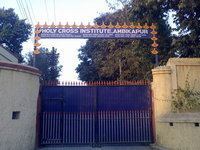
Holy Cross Convent School, DPS, Carmel Convent, Oriental Public School, and Saraswati Vidyalaya are the other schools in Ambikapur.