
District Anuppur PIN 484224 Elevation 505 m Area code +07659 | Time zone IST (UTC+5:30) Telephone code +07659 Population 16,397 (2001) Local time Monday 11:15 AM | |
 | ||
Weather 27°C, Wind N at 6 km/h, 29% Humidity | ||
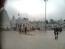
Sky view of energy town chachai anuppur mp
Anuppur is a town in northeastern Madhya Pradesh state of central India. It is the administrative headquarters of Anuppur District. Previously, it was in Shahdol district.
Contents
- Sky view of energy town chachai anuppur mp
- Map of Anuppur Madhya Pradesh 484224
- Geography
- Demographics
- Anuppur district
- Geographical Structure
- Education
- Literacy
- Increase in population
- Climate and Rains
- Forest
- Mines and minerals
- Industries
- Electricity
- Transportation
- Post and telecommunication
- Public health
- Other facilities
- References
Map of Anuppur, Madhya Pradesh 484224
Geography
Anuppur is located at 23.1°N 81.68°E / 23.1; 81.68. It has an average elevation of 505 metres (1656 feet). The Son River and some of its tributaries run through Anuppur. According to 2001 Census, the total population of Anuppur District is 667155, out of which 309624 are Scheduled tribes and 48376 are Scheduled castes. In this manner, Anuppur District is a tribal dominated district.
Demographics
As of 2011 India census, Anuppur district has a population of 749,521. 2001 TO 2011 population growth rate is 12.3%. Males constitute 52% of the population and females 48%.
Anuppur district
Anuppur is a town in southeastern Madhya Pradesh state of central India. It is the administrative headquarters of Anuppur District. Previously, it is Shahdol district.
Geographical Structure
From Geographical point of view, the district consists of a series of mountain ranges and rivers. It can be divided into three geographical divisions. 1. High lands of mountain ranges. 2. The Central plateau . 3. Low lands of rivers :- A number of rivers Including Son, Johila, Narmada, Tipan, Bakan, Chandas and Kewai flow in the district, Maikal mountain range is extended from southern part of the district to the eastern part.
Education
Literacy
Total literacy Percentage of District is 57.75 in which male is 69.55 and for female it is 45.45.
Literacy rate of the District Anuppur :-
Literacy rate (1991) Literacy rate (2001) Male 48.93 69.55
Female 20.23 45.40
Total 35.45 57.76
Increase in population
In year 1991, Total Population of district was 4,97,955 During last decades increase in Population is 667155.
From 1951 to 1961, 1961 to 1971,1971 to 1981 and 1981 to 1991, the increase in Population was 6.96, 11.81, 21.10 and 29.64 respectivily.
Climate and Rains
The climate of the District is temperate. It rains from June to October in the District. The temperature remains the highest in the month of June and the lowest in the Month of January. The maximum and minimum temperature of the District remains 46oC and 2.6oC respectively.
Forest
One third of the District consists of forest area. Sal Amla, Teak, Sarai and Shisham are the main trees found in this District. The flower of Mahua and Guli provide edible oil. Mahua flower is mostly used for making wine by tribal people.
Mines and minerals
District Anuppur is very rich in its mineral resources. Minerals found in district are coal, Bauxite and fire clay. Most of the coalmines are located in Kotma Sub Division. Amarkantak in known for its Bauxite deposits.
Industries
According to the 1998 Survey, there are 106 industries ( Large Scale & Small Scale ) in the whole District. The Orient paper Mill and Soda Factory are situated in Amlai. Small Scale industries of polythene and Baskets of Bamboo are also run in the District. There is a Bidi Factory in Venkatnagar.
Electricity
Amarkantak Thermal Power Plant Chachai
is established for the production of electricity. 94% villages of the District have been electrified. Chachai Power House has total generating capacity of 210 MW.Hindustan Power Jaithari
The thermal arm is developing 2520 MW coal based Thermal Powerproject in Anuppur district, Madhya Pradesh. The project is planned to be executed in two phases as follows :
Phase 1 - : 1200 MW (2X600 MW)
Phase 2 - : 1320 MW (2X660 MW)
Transportation
Road is the main means of Transportation. Matelic Road is about 741.67 km. and Kachhi Road is about 1355.47 km. Railway Facility is available for Katni, Chirimiri and Bilaspur route.
Post and telecommunication
There are one 111 Post Offices and their branches working in the whole District. There are 6 Telegram Offices. The District has 2038 Telephone Connection.
Public health
Besides one District Hospital, there are 5 Community Health Centers, 17 Primary Health Centers, 12 Ayurvedic Dispensaries and 174 Sub-Health Centers Working in the District.
Other facilities
There are 8 Veterinary Hospitals in the District. There are 34 Official inseminations Centre in the District. Besides these there are 9 Police Stations and 1 Police Post.