
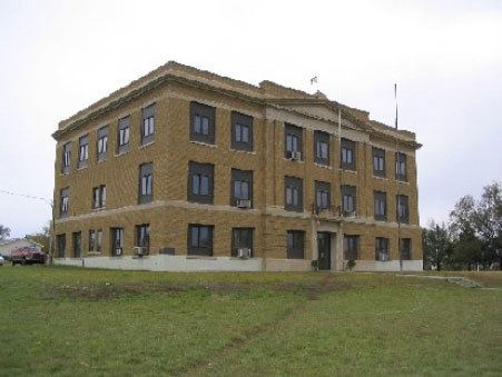
Congressional district At-large Area 5,105 km² Population 2,834 (2013) | Founded 1911 Unemployment rate 5.7% (Apr 2015) Cities Dupree | |
 | ||
Rivers Thunder Butte Creek, Deer Creek, Line Creek, Luis Creek | ||
Ziebach County is a county located in the U.S. state of South Dakota. As of the 2010 census, the population was 2,801. Its county seat is Dupree. It is the last county in the United States alphabetically.
Contents
- Map of Ziebach County SD USA
- History
- Geography
- Buttes
- Major highways
- Adjacent counties
- National protected area
- 2000 census
- 2010 census
- Cities
- Unincorporated communities
- Unorganized territories
- References
Map of Ziebach County, SD, USA
The county's per-capita income makes it the fourth poorest county in the United States. However, another study states that the county is the poorest in the nation.
History
Ziebach County was created in 1911, encompassing parts of the former counties of Schnasse, Armstrong and Sterling, which were the last three extinct counties of South Dakota to cease to exist. It was named for Frank M. Ziebach, a noted political figure in the Dakota Territory during the territorial period from 1861 to 1889. Previously the area had been used by trappers and in 1907 part was briefly a reservation for Ute Indians displaced from Utah and Wyoming. Early in the 20th Century cattle were raised in substantial numbers, but when the railroad bypassed the area this industry declined. Limited homesteading also occurred on the more fertile lands.
Geography
According to the U.S. Census Bureau, the county has a total area of 1,971 square miles (5,100 km2), of which 1,961 square miles (5,080 km2) is land and 9.3 square miles (24 km2) (0.5%) is water. Almost the entire county lies within the Cheyenne River Indian Reservation. The balance of the county, along its extreme northern county line, lies within the Standing Rock Indian Reservation. It is one of five South Dakota counties that lie entirely on Indian reservations.
Buttes
Ziebach County is part of the Great Plains and is characterized by rolling grasslands and numerous buttes. The buttes form the highest points of elevation in Ziebach County and their names, latitude/longitude coordinates, and summit heights are:
Major highways
Adjacent counties
National protected area
2000 census
As of the census of 2000, there were 2,519 people, 741 households, and 594 families residing in the county. The population density was 1.3 people per square mile (0.5/km²). There were 879 housing units at an average density of 0.4 per square mile (0.2/km²). The racial makeup of the county was 72.29% Native American, 26.40% White, 0.08% Asian, 0.12% from other races, and 1.11% from two or more races. 0.99% of the population were Hispanic or Latino of any race.
There were 741 households out of which 47.2% had children under the age of 18 living with them, 47.9% were married couples living together, 23.8% had a female householder with no husband present, and 19.8% were non-families. 17.4% of all households were made up of individuals and 5.1% had someone living alone who was 65 years of age or older. The average household size was 3.40 and the average family size was 3.81.
In the county, the population was spread out with 40.6% under the age of 18, 10.8% from 18 to 24, 24.7% from 25 to 44, 16.5% from 45 to 64, and 7.5% who were 65 years of age or older. The median age was 24 years. For every 100 females there were 97.0 males. For every 100 females age 18 and over, there were 98.1 males.
The median income for a household in the county was $18,063, and the median income for a family was $18,672. Males had a median income of $19,038 versus $21,167 for females. The per capita income for the county was $7,463. About 45.20% of families and 49.90% of the population were below the poverty line, including 61.10% of those under age 18 and 27.20% of those age 65 or over. In 2009, it was one of 17 counties in the United States where half of all children live in poverty.
2010 census
As of the 2010 United States Census, there were 2,801 people, 836 households, and 638 families residing in the county. The population density was 1.4 inhabitants per square mile (0.54/km2). There were 987 housing units at an average density of 0.5 per square mile (0.19/km2). The racial makeup of the county was 74.9% American Indian, 21.8% white, 0.2% black or African American, 0.1% Asian, 0.1% from other races, and 3.0% from two or more races. Those of Hispanic or Latino origin made up 3.1% of the population. In terms of ancestry,
Of the 836 households, 53.7% had children under the age of 18 living with them, 39.0% were married couples living together, 29.3% had a female householder with no husband present, 23.7% were non-families, and 20.9% of all households were made up of individuals. The average household size was 3.35 and the average family size was 3.82. The median age was 25.4 years.
The median income for a household in the county was $27,578 and the median income for a family was $22,857. Males had a median income of $28,954 versus $24,327 for females. The per capita income for the county was $11,069. About 41.9% of families and 46.0% of the population were below the poverty line, including 56.1% of those under age 18 and 22.9% of those age 65 or over.
Cities
Unincorporated communities
Unorganized territories
The county is divided into three areas of unorganized territory: Dupree, North Ziebach, and South Ziebach.