
Named for William P. Dewey Founded 1883 Unemployment rate 11.3% (Apr 2015) | Congressional district At-large Area 6,332 km² Population 5,586 (2013) | |
 | ||
Rivers Missouri River, Little Bear Creek, Sage Creek | ||
Dewey County is a county located in the U.S. state of South Dakota. As of the 2010 census, the population was 5,301. Its county seat is Timber Lake. The county was created in 1883 and organized in 1910. It was named for William P. Dewey, Territorial surveyor-general from 1873 to 1877.
Contents
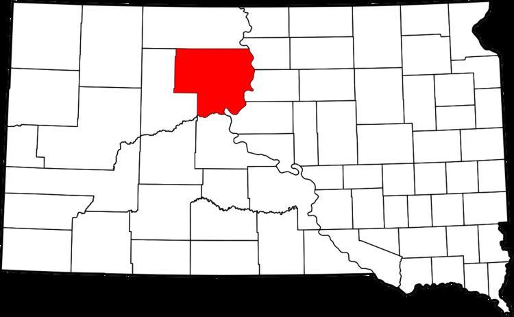
- Map of Dewey County SD USA
- Geography
- Major highways
- Adjacent counties
- 2000 census
- 2010 census
- Cities
- Town
- Census designated places
- Unincorporated communities
- Unorganized territories
- References
Map of Dewey County, SD, USA
Almost the entire county lies in the Cheyenne River Indian Reservation. The balance of the county, along its extreme northern county line, lies in the Standing Rock Indian Reservation. It is one of five South Dakota counties that are contained within Indian reservations.
Geography
According to the U.S. Census Bureau, the county has a total area of 2,445 square miles (6,330 km2), of which 2,302 square miles (5,960 km2) is land and 143 square miles (370 km2) (5.8%) is water.
Major highways
Adjacent counties
2000 census
As of the census of 2000, there were 5,972 people, 1,863 households, and 1,386 families residing in the county. The population density was 3 people per square mile (1/km²). There were 2,133 housing units at an average density of 1 per square mile (0/km²). The racial makeup of the county was 74.16% Native American, 24.15% White, 0.03% Black or African American, 0.12% Asian, 0.05% Pacific Islander, 0.07% from other races, and 1.42% from two or more races. 0.85% of the population were Hispanic or Latino of any race. 14.2% were of German ancestry according to Census 2000. 84.6% spoke English and 14.4% Dakota as their first language.
There were 1,863 households out of which 43.70% had children under the age of 18 living with them, 42.90% were married couples living together, 22.30% had a female householder with no husband present, and 25.60% were non-families. 22.10% of all households were made up of individuals and 8.90% had someone living alone who was 65 years of age or older. The average household size was 3.15 and the average family size was 3.66.
In the county, the population was spread out with 38.90% under the age of 18, 9.00% from 18 to 24, 27.20% from 25 to 44, 16.60% from 45 to 64, and 8.30% who were 65 years of age or older. The median age was 26 years. For every 100 females there were 95.90 males. For every 100 females age 18 and over, there were 95.00 males.
The median income for a household in the county was $23,272, and the median income for a family was $24,917. Males had a median income of $21,522 versus $18,777 for females. The per capita income for the county was $9,251. About 29.80% of families and 33.60% of the population were below the poverty line, including 37.70% of those under age 18 and 28.50% of those age 65 or over. The county's per-capita income makes it one of the poorest counties in the United States.
2010 census
As of the 2010 United States Census, there were 5,301 people, 1,730 households, and 1,239 families residing in the county. The population density was 2.3 inhabitants per square mile (0.89/km2). There were 2,002 housing units at an average density of 0.9 per square mile (0.35/km2). The racial makeup of the county was 74.9% American Indian, 21.0% white, 0.2% Asian, 0.1% black or African American, 0.2% from other races, and 3.6% from two or more races. Those of Hispanic or Latino origin made up 1.8% of the population. In terms of ancestry, 13.2% were German, 6.5% were Irish, and 0.6% were American.
Of the 1,730 households, 45.9% had children under the age of 18 living with them, 37.6% were married couples living together, 24.2% had a female householder with no husband present, 28.4% were non-families, and 24.6% of all households were made up of individuals. The average household size was 3.05 and the average family size was 3.60. The median age was 30.0 years.
The median income for a household in the county was $33,255 and the median income for a family was $40,500. Males had a median income of $33,942 versus $28,594 for females. The per capita income for the county was $15,632. About 20.5% of families and 30.5% of the population were below the poverty line, including 39.5% of those under age 18 and 13.5% of those age 65 or over.
Cities
Town
Census-designated places
Unincorporated communities
Unorganized territories
The county is divided into two areas of unorganized territory: North Dewey and South Dewey.