
- land 0.9 sq mi (2 km) - summer (DST) EDT (UTC-4) Local time Sunday 9:23 AM | - water 0.0 sq mi (0 km), 0% Population 1,799 (2013) Number of airports 1 | |
 | ||
Weather 5°C, Wind E at 8 km/h, 81% Humidity | ||
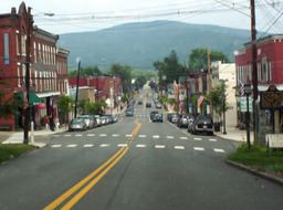
Tunkhannock is a borough in Wyoming County, Pennsylvania, 31 miles (50 km) northwest of Wilkes-Barre. In the past, lumbering was carried on extensively. Today, many residents are employed by the Procter & Gamble plant in nearby Washington Township. As of the 2010 census, the borough population was 1,836. It is the county seat of Wyoming County. Tunkhannock is in the Scranton–Wilkes-Barre–Hazleton, PA Metropolitan Statistical Area.
Contents
- Map of Tunkhannock PA 18657 USA
- General information
- Geography
- Transportation
- Demographics
- Government
- Culture
- Notable people
- References
Map of Tunkhannock, PA 18657, USA
The name Tunkhannock comes from the Minsi-Len'api term Ptuk'hanna'unk, which means "Bend-in-river-place," especially to the town's west, upstream at the radical bend called "The Neck." Modern Tunkhannock, Lackawanna County, The Tunkhannock Historic District, bounded by Tioga, Pine, and Harrison Sts and Wyoming Ave, was added to the National Register of Historic Places in August 2005.
General information
Geography
Tunkhannock is located at 41°32′27″N 75°56′52″W (41.540836, -75.947703).
According to the United States Census Bureau, the borough has a total area of 0.9 square mile (2.3 km²), all of it land.
Transportation
Skyhaven Airport is a public use airport located one nautical mile (1.85 km) south of the central business district of Tunkhannock.
Demographics
As of the census of 2010, there are 1,836 people, 817 households, and 447 families residing in the borough. The population density is 2,040 people per square mile (787.6/km²). There are 871 housing units at an average density of 967.8 per square mile (378/km²). The racial makeup of the borough is 95.9% White, 0.9% African American, 0.2% Native American, 1.1% Asian, 0.1% Pacific Islander, 0.35% from other races, and 1.45% from two or more races. 1.3% of the population are Hispanic or Latino of any race.
There are 817 households out of which 25.3% have children under the age of 18 living with them, 38.7% are married couples living together, 12% have a female householder with no husband present, and 45.3% are non-families. 40.4% of all households are made up of individuals and 20% have someone living alone who is 65 years of age or older. The average household size is 2.15 and the average family size is 2.92.
In the borough the population is spread out with 22.3% under the age of 18, 57% from 18 to 64, and 20.7% who are 65 years of age or older. The median age is 43.5 years.
The median income for a household in the borough is $37,071, and the median income for a family is $56,250. Males have a median income of $43,098 versus $31,313 for females. The per capita income for the borough is $23,110. 2.4% of the population and 6.9% of families are below the poverty line. Out of the total population, none of those under the age of 18 and 8.6% of those 65 and older are living below the poverty line.
Government
The borough is represented by a council-manager government.
Culture
The Wyoming County Historical Society and Genealogical Library offers a major source of research material. The collection includes numerous books on New England ancestry, newspapers dating back to 1797 and census records for Wyoming and surrounding counties from 1790 to 1930. Also on file are records for over 90 area cemeteries and other local history information.
In 1941 artist Ethel Ashton painted on oil on canvas mural, Defenders of the Wyoming Country-1778, for the local post office. It depicted a battle by American settlers and local Native American tribes during the year leading up to Sullivan's March. In 1998, the mural was restored and a documentary was made about it in 2009.
Tunkhannock is the home of the Northern Tier Symphony Orchestra, under the direction of Conductor Robert Helmacy. Tunkhannock is listed as one of the top 10 places to "get away from it all"