
Founded 1824 Largest town Albion Time zone Eastern: UTC-5/-4 Area 2,116 km² Unemployment rate 6.4% (Apr 2015) | Named for House of Orléans Congressional district 27th Website www.orleansny.com Population 42,235 (2013) County seat Albion | |
 | ||
Rivers Sandy Creek, Marsh Creek, Yanty Creek Points of interest Medina Railroad Museum, Oak Orchard Creek, Lake Ontario, Erie Canal, Oak Orchard State Mar Destinations Lake Ontario, Medina, Lakeside Beach State Park, Albion, Holley | ||
Orleans County is a county in the U.S. state of New York. As of the 2010 census, the population was 42,883. The county seat is Albion. The name is in honor of the French Royal House of Orleans.
Contents
- Map of Orleans County NY USA
- History
- Geography
- Adjacent counties
- Major highways
- National protected area
- State protected areas
- Government and politics
- State and federal government
- Demographics
- Education
- Villages
- Hamlets
- References
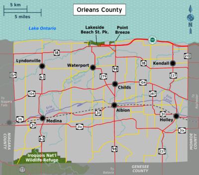
Map of Orleans County, NY, USA
Orleans County is part of the Rochester, NY Metropolitan Statistical Area.
History
When counties were established in New York State in 1683, the present Orleans County was part of Albany County. This was an enormous county, including the northern part of New York State as well as all of the present State of Vermont and, in theory, extending westward to the Pacific Ocean. This county was reduced in size on July 3, 1766 by the creation of Cumberland County, and further on March 16, 1770 by the creation of Gloucester County, both containing territory now in Vermont.
On March 12, 1772, what was left of Albany County was split into three parts, one remaining under the name Albany County. One of the other pieces, Tryon County, contained the western portion (and thus, since no western boundary was specified, theoretically still extended west to the Pacific). The eastern boundary of Tryon County was approximately five miles west of the present city of Schenectady, and the county included the western part of the Adirondack Mountains and the area west of the West Branch of the Delaware River. The area then designated as Tryon County now includes 37 counties of New York State. The county was named for William Tryon, colonial governor of New York.
Before 1776, most of Tryon County's Loyalists fled to Canada. In 1784, following the peace treaty that ended the American Revolutionary War, Tryon County's name was changed to Montgomery County to honor the general, Richard Montgomery, who had captured several places in Canada and died attempting to capture the city of Quebec, replacing the name of the hated British governor.
In 1789, Ontario County was split off from Montgomery.
In 1802, Genesee County was created by a splitting of Ontario County. This was much larger than the present Genesee County, however, containing the present Allegany, Cattaraugus, Chautauqua, Erie, Niagara, Orleans, and Wyoming Counties, and parts of Livingston and Monroe Counties.
In 1806, Genesee County was reduced in size by the splitting off of Allegany County. In 1808, Genesee County was further reduced in size by the splitting off of Cattaraugus, Chautauqua, and Niagara Counties. Niagara County at that time also included the present Erie County.
In 1821, Genesee County was reduced in size by the splitting off of portions which were combined with portions of Ontario County to create Livingston and Monroe Counties. By this time Genesee County had been reduced considerably in size from its original area of 1802, still containing the present Orleans and Wyoming Counties in addition to its present area, however.
In 1824, Orleans County was created from what was left of Genesee County. When the county was formed, a dispute arose about naming it after Andrew Jackson or John Adams; the conflict was ended by choosing the name Orleans.
Geography
According to the U.S. Census Bureau, the county has a total area of 817 square miles (2,120 km2), of which 391 square miles (1,010 km2) is land and 426 square miles (1,100 km2) (52%) is water.
The high proportion of water is due to the extension of Orleans County north into Lake Ontario to the Canada–US border (a line of latitude running through the middle of the lake). The distance from the Orleans shore north to the international border is greater than the distance from the shore south to the Genesee County line, meaning the area of Orleans underwater is actually greater than that above water.
Orleans County is in western New York State, northeast of Buffalo and west of Rochester, on the southern shore of Lake Ontario.
The Erie Canal passes (east–west) through the middle of the county.
Adjacent counties
Major highways
National protected area
State protected areas
Government and politics
Starting in 1824, the county government was run by a board of supervisors consisting of supervisors from each township in Orleans County. In 1980, a seven-member legislature was established to replace the board of supervisors and is headed by a chairman.
State and federal government
Orleans County is part of:
Demographics
As of the census of 2000, there were 44,171 people, 15,363 households, and 10,846 families residing in the county. The population density was 113 people per square mile (44/km²). There were 17,347 housing units at an average density of 44 per square mile (17/km²). The racial makeup of the county was 89.12% White, 7.31% Black or African American, 0.46% Native American, 0.32% Asian, 0.03% Pacific Islander, 1.54% from other races, and 1.21% from two or more races. 3.89% of the population were Hispanic or Latino of any race. 20.3% were of German, 18.3% English, 10.8% Italian, 10.3% Irish, 9.4% American and 7.3% Polish ancestry according to Census 2000. 96.0% spoke English and 3.0% Spanish as their first language.
There were 15,363 households out of which 35.0% had children under the age of 18 living with them, 54.3% were married couples living together, 11.2% had a female householder with no husband present, and 29.4% were non-families. 23.7% of all households were made up of individuals and 10.7% had someone living alone who was 65 years of age or older. The average household size was 2.65 and the average family size was 3.13.
In the county, the population was spread out with 26.2% under the age of 18, 8.2% from 18 to 24, 31.3% from 25 to 44, 21.9% from 45 to 64, and 12.40% who were 65 years of age or older. The median age was 36 years. For every 100 females there were 98.3 males. For every 100 females age 18 and over, there were 95.2 males.
The median income for a household in the county was $37,972, and the median income for a family was $42,830. Males had a median income of $32,450 versus $22,605 for females. The per capita income for the county was $16,457. About 7.7% of families and 10.8% of the population were below the poverty line, including 15.0% of those under age 18 and 5.2% of those age 65 or over.
Education
The county is considered to have five school districts, although the actual district boundaries can extend into neighboring counties, and the same is true for neighboring counties' districts. The five districts, from west to east, are:
The only post-secondary education available in the county are two branches of Genesee Community College located in Albion and Medina.