
Founded April 1, 1820 Area 1,606 km² | Website www.co.wood.oh.us Population 129,264 (2013) | |
 | ||
Colleges and Universities Bowling Green State Uni, Owens Community College, Bowling Green State Uni, The Orion Institute - formerly k Points of interest Fort Meigs, Woodlands Park, Carter Park, W W Knight Nature Preserve, Three Meadows Park | ||
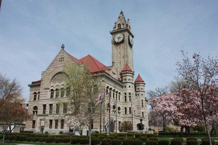
Wood County is a county located in the U.S. state of Ohio. As of the 2010 census, the population was 125,488. Its county seat is Bowling Green. The county was named for Captain Eleazer D. Wood, the engineer for General William Henry Harrison's army, who built Fort Meigs in the War of 1812.
Contents
- Map of Wood County OH USA
- Geography
- Adjacent counties
- 2000 census
- 2010 census
- County officials
- Library
- Cities
- Census designated places
- References
Map of Wood County, OH, USA
Wood County is part of the Toledo, OH Metropolitan Statistical Area. Its diagonnal northwest border is formed by the Maumee River, which has its mouth at Maumee Bay on Lake Erie.
Geography
According to the U.S. Census Bureau, the county has a total area of 620 square miles (1,600 km2), of which 617 square miles (1,600 km2) is land and 3.3 square miles (8.5 km2) (0.5%) is water.
Adjacent counties
2000 census
As of the census of 2000, there were 121,065 people, 45,172 households, and 29,678 families residing in the county. The population density was 196 people per square mile (76/km²). There were 47,468 housing units at an average density of 77 per square mile (30/km²). The racial makeup of the county was 94.83% White, 1.27% Black or African American, 0.23% Native American, 1.03% Asian, 0.01% Pacific Islander, 1.45% from other races, and 1.18% from two or more races. 3.33% of the population were Hispanic or Latino of any race. 36.3% were of German, 9.9% American, 8.2% English, 8.0% Irish and 5.8% Polish ancestry according to Census 2000.
There were 45,172 households out of which 32.00% had children under the age of 18 living with them, 53.90% were married couples living together, 8.50% had a female householder with no husband present, and 34.30% were non-families. 25.80% of all households were made up of individuals and 9.10% had someone living alone who was 65 years of age or older. The average household size was 2.51 and the average family size was 3.04.
In the county, the population was spread out with 23.70% under the age of 18, 17.20% from 18 to 24, 26.80% from 25 to 44, 21.30% from 45 to 64, and 11.00% who were 65 years of age or older. The median age was 33 years. For every 100 females there were 93.80 males. For every 100 females age 18 and over, there were 91.10 males.
The median income for a household in the county was $44,442, and the median income for a family was $56,468. Males had a median income of $40,419 versus $26,640 for females. The per capita income for the county was $21,284. About 4.70% of families and 9.60% of the population were below the poverty line, including 7.40% of those under age 18 and 5.80% of those age 65 or over.
2010 census
As of the 2010 United States Census, there were 125,488 people, 49,043 households, and 30,923 families residing in the county. The population density was 203.3 inhabitants per square mile (78.5/km2). There were 53,376 housing units at an average density of 86.5 per square mile (33.4/km2). The racial makeup of the county was 92.8% white, 2.4% black or African American, 1.5% Asian, 0.2% American Indian, 1.3% from other races, and 1.7% from two or more races. Those of Hispanic or Latino origin made up 4.5% of the population. In terms of ancestry, 40.8% were German, 14.4% were Irish, 10.4% were English, 6.7% were Polish, and 5.2% were American.
Of the 49,043 households, 29.5% had children under the age of 18 living with them, 50.1% were married couples living together, 9.0% had a female householder with no husband present, 36.9% were non-families, and 27.5% of all households were made up of individuals. The average household size was 2.43 and the average family size was 2.98. The median age was 35.3 years.
The median income for a household in the county was $53,298 and the median income for a family was $69,768. Males had a median income of $51,038 versus $35,472 for females. The per capita income for the county was $26,671. About 6.4% of families and 12.2% of the population were below the poverty line, including 10.5% of those under age 18 and 6.3% of those age 65 or over.
County officials
Source:
Library
The Wood County District Public Library serves the county from its administrative offices in Bowling Green and a branch in Walbridge. In 2006, the library loaned 547,422 items and provided 1,121 programs to its patrons. Total holdings in 2006 were nearly 155,000 volumes with over 250 periodical subscriptions.