
Country United States Area code(s) 419, 567 Elevation 238 m Zip code 44830 Number of airports 1 | Time zone Eastern (EST) (UTC-5) FIPS code 39-28014 Local time Wednesday 6:32 AM Population 13,244 (2013) | |
 | ||
Weather -10°C, Wind NW at 24 km/h, 62% Humidity Area 20.12 km² (19.55 km² Land / 57 ha Water) | ||
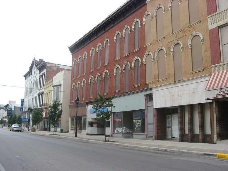
Fostoria is a city located at the convergence of Hancock, Seneca, and Wood counties in the northwestern part of the U.S. state of Ohio. It is approximately 40 miles (64 km) south of Toledo and 90 miles (140 km) north of Columbus.
Contents
- Map of Fostoria OH 44830 USA
- Name and general background
- Geography
- 2010 census
- 2000 census
- Transportation
- Notable people
- References
Map of Fostoria, OH 44830, USA
The city is known for its railroads, as 100 trains pass through the city each day. The city is often visited by railfans, and a railroad viewing park is under construction (2013). Fostoria was also the home for over a dozen glass factories during the end of the 19th century. The glass factories were established in Fostoria because of the discovery of natural gas in the area. As the gas supply became depleted, many of the factories closed or moved—including the Fostoria Glass Company. Fostoria's most famous citizen is Charles Foster (son of the man who helped establish Fostoria), who became governor of Ohio.
The community grew substantially during the end of the 19th century, coinciding with the northwest Ohio gas boom. Typical of Rust Belt cities, Fostoria peaked in size in 1970. The population was 13,441 at the 2010 census.
Name and general background
Fostoria was created in 1854 with the merger of the communities of Rome and Risdon. The combination of the two communities' Methodist churches, on land donated by Charles W. Foster, led to the merger. To show their appreciation for Mr. Foster's generosity, the new community was named Fostoria. Charles W. Foster's son, Charles, became one of Fostoria's most famous citizens—becoming the 35th governor of Ohio and U.S. Secretary of the Treasury under President Benjamin Harrison.
Fostoria is known for its glass heritage and railroads: two CSX main lines and one NS main line intersect in downtown Fostoria, an area called the "Iron Triangle." A natural gas boom in the 1880s, the railroad lines, and recruiting efforts by the community caused Fostoria to become home for numerous glass factories, including the Mambourg Glass Company (the city's first glass factory), the Fostoria Glass Company, the Seneca Glass Company, the Novelty Glass Company, and others.
Although the boom in gas and glass is long over, railroads continue to be important to the community. More than 100 trains passed through Fostoria each day. The Fostoria Railroad Preservation Society, aided by a $815,760 grant from the Ohio Department of Transportation, completed a train viewing park in 2013 to help capitalize on the thousands of railfans who visit yearly.
Geography
Fostoria is located at 41°9′33″N 83°24′55″W (41.159243, -83.415239).
According to the United States Census Bureau, the city has a total area of 7.77 square miles (20.12 km2), of which 7.55 square miles (19.55 km2) is land and 0.22 square miles (0.57 km2) is water.
2010 census
As of the census of 2010, there were 13,441 people, 5,417 households, and 3,432 families residing in the city. The population density was 1,780.3 inhabitants per square mile (687.4/km2). There were 6,225 housing units at an average density of 824.5 per square mile (318.3/km2). The racial makeup of the city was 84.1% White, 6.4% African American, 0.1% Native American, 0.4% Asian, 4.3% from other races, and 4.7% from two or more races. Hispanic or Latino of any race were 11.5% of the population.
There were 5,417 households of which 33.0% had children under the age of 18 living with them, 39.1% were married couples living together, 17.3% had a female householder with no husband present, 7.0% had a male householder with no wife present, and 36.6% were non-families. 31.3% of all households were made up of individuals and 13.7% had someone living alone who was 65 years of age or older. The average household size was 2.42 and the average family size was 2.97.
The median age in the city was 37.9 years. 26% of residents were under the age of 18; 8.3% were between the ages of 18 and 24; 23.9% were from 25 to 44; 25.8% were from 45 to 64; and 16% were 65 years of age or older. The gender makeup of the city was 47.3% male and 52.7% female.
2000 census
As of the census of 2000, there were 13,931 people, 5,565 households, and 3,628 families residing in the city. The population density was 1,917.6 people per square mile (740.9/km²). There were 6,024 housing units at an average density of 829.2 per square mile (320.4/km²). The racial makeup of the city was 87.32% White, 5.75% African American, 0.19% Native American, 0.48% Asian, 3.60% from other races, and 2.66% from two or more races. Hispanic or Latino of any race were 7.92% of the population.
There were 5,565 households out of which 32.0% had children under the age of 18 living with them, 44.9% were married couples living together, 15.1% had a female householder with no husband present, and 34.8% were non-families. 29.6% of all households were made up of individuals and 12.7% had someone living alone who was 65 years of age or older. The average household size was 2.46 and the average family size was 3.03.
In the city the population was spread out with 27.0% under the age of 18, 8.8% from 18 to 24, 27.7% from 25 to 44, 20.8% from 45 to 64, and 15.6% who were 65 years of age or older. The median age was 36 years. For every 100 females there were 90.3 males. For every 100 females age 18 and over, there were 87.0 males.
The median income for a household in the city was $31,166, and the median income for a family was $38,427. Males had a median income of $31,476 versus $22,016 for females. The per capita income for the city was $15,568. About 9.0% of families and 11.2% of the population were below the poverty line, including 14.1% of those under age 18 and 7.0% of those age 65 or over.
Transportation
The city is served by one airport, called Fostoria Metropolitan Airport. Fostoria was served by the Three Rivers Amtrak Service which ran between Chicago and New York City on CSX's B&O line until train service there ended in March 2005.
The city is the site where the Norfolk Southern Railway's ex-Nickel Plate Road mainline crosses the previously mentioned CSX ex-B&O and ex-C&O lines. The three crossings form a triangle, with the site known as the "Iron Triangle." The area is a popular spot for railfans and has a park located in the center between the 3 mainlines.