
Congressional district 3rd Website www.waynecountywv.org Founded 1842 | Area 1,326 km² Population 41,437 (2013) | |
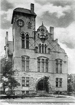 | ||
Cities Wayne, Kenova, Ceredo, Lavalette, Fort Gay, Prichard, West Virginia, Dunlow, Crum, Wilsondale, West Virginia Points of interest Camden Park, Heritage Farm Museum, C‑K Autumnfest - Griffiths G, Virginia Point Park, Z D Ramsdell House | ||
Wayne County is the westernmost county in the U.S. state of West Virginia. As of the 2010 census, the population was 42,481. Its county seat is Wayne. The county was founded in 1842 and named for General "Mad" Anthony Wayne.
Contents
- Map of Wayne County WV USA
- History
- Settlement
- Geography
- Rivers and lakes
- Major highways
- Adjacent counties
- 2000 census
- 2010 census
- Rail
- Air
- Cities
- Towns
- Census designated place
- In popular culture
- References
Map of Wayne County, WV, USA
Wayne County is part of the Huntington–Ashland, WV–KY–OH Metropolitan Statistical Area, which is also included in the Charleston–Huntington–Ashland, WV–OH–KY Combined Statistical Area.
History
Wayne County, West Virginia was originally Wayne County, Virginia, which was created from part of Cabell County in 1842. The county was named for General "Mad" Anthony Wayne.
Settlement
There was no white settlement in the area that became Wayne County until after 1794, due to the constant threat of Indian attack. The area was made safe for white settlement in 1794 through the defeat of the Shawnee at the Battle of Fallen Timbers by General "Mad" Anthony Wayne.
When the first permanent European settlers came to Wayne County around the year 1800, the area was part of Kanawha County. Most of the original pioneer settlers were self-sufficient farmers. They raised their own food, sheep for wool clothing, and made their buildings, furnishings and tools out of the surrounding forest. A few trading posts provided the manufactured goods the pioneers could not make for themselves. Later, grist mills at Wayne, Dickson, south of East Lynn and at Lavalette ground their corn into meal and their wheat into flour.
Geography
According to the U.S. Census Bureau, the county has a total area of 512 square miles (1,330 km2), of which 506 square miles (1,310 km2) is land and 6.1 square miles (16 km2) (1.2%) is water.
Rivers and lakes
Major highways
Adjacent counties
Wayne County is one of two U.S. counties (The other being Apache County, Arizona) to border two counties of the same name, neither of which is in the same state as the county itself (Lawrence County, Ohio and Lawrence County, Kentucky).
2000 census
As of the census of 2000, there were 42,903 people, 17,239 households, and 12,653 families residing in the county. The population density was 85 people per square mile (33/km²). There were 19,107 housing units at an average density of 38 per square mile (15/km²). The racial makeup of the county was 98.79% White, 0.13% Black or African American, 0.23% Native Americans, 0.20% Asian, 0.02% Pacific Islander, 0.08% from other races, and 0.56% from two or more races. 0.47% of the population were Hispanic or Latino of any race.
There were 17,239 households out of which 31.20% had children under the age of 18 living with them, 59.20% were married couples living together, 10.80% had a female householder with no husband present, and 26.60% were non-families. 24.10% of all households were made up of individuals and 11.10% had someone living alone who was 65 years of age or older. The average household size was 2.48 and the average family size was 2.92.
In the county, the population was spread out with 23.40% under the age of 18, 8.70% from 18 to 24, 27.70% from 25 to 44, 25.30% from 45 to 64, and 14.90% who were 65 years of age or older. The median age was 38 years. For every 100 females there were 95.80 males. For every 100 females age 18 and over, there were 91.80 males.
The median income for a household in the county was $27,352, and the median income for a family was $32,458. Males had a median income of $31,554 versus $20,720 for females. The per capita income for the county was $14,906. About 16.20% of families and 19.60% of the population were below the poverty line, including 25.50% of those under age 18 and 15.20% of those age 65 or over.
2010 census
As of the 2010 United States Census, there were 42,481 people, 17,347 households, and 12,128 families residing in the county. The population density was 84.0 inhabitants per square mile (32.4/km2). There were 19,227 housing units at an average density of 38.0 per square mile (14.7/km2). The racial makeup of the county was 98.6% white, 0.3% American Indian, 0.2% black or African American, 0.2% Asian, 0.1% from other races, and 0.8% from two or more races. Those of Hispanic or Latino origin made up 0.5% of the population. In terms of ancestry, 18.1% were Irish, 16.9% were English, 13.0% were American, and 11.8% were German.
Of the 17,347 households, 30.9% had children under the age of 18 living with them, 53.2% were married couples living together, 11.7% had a female householder with no husband present, 30.1% were non-families, and 26.4% of all households were made up of individuals. The average household size was 2.43 and the average family size was 2.92. The median age was 41.3 years.
The median income for a household in the county was $35,079 and the median income for a family was $44,886. Males had a median income of $40,233 versus $25,765 for females. The per capita income for the county was $18,410. About 16.4% of families and 20.2% of the population were below the poverty line, including 23.2% of those under age 18 and 15.0% of those age 65 or over.
Rail
Air
The public Tri-State Airport, the major airport serving the Huntington–Ashland area, is located in Wayne County south of Interstate 64. The airport is accessible from Interstate 64 via Exit 1. Commercial air service is provided by Allegiant Air, Delta Connection, and US Airways Express.
Cities
Towns
Census-designated place
In popular culture
The following books take place in Wayne County: