
Existed: 1956 – present Constructed 1956 | Length 303.8 km | |
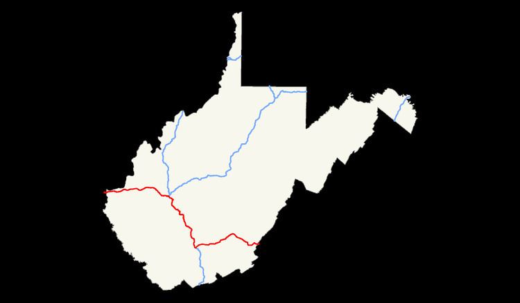 | ||
East end: I‑64 / US 60 at Virginia state line | ||
In the U.S. state of West Virginia, Interstate 64 travels for 184 miles (296 km) passing by the major towns and cities of Huntington, Charleston, Beckley, and Lewisburg. It has only two major junctions within the state: Interstate 77 in Charleston and in Beckley.
Contents
Early beginnings
The first Interstate Highway segment to be let to construction was in Cabell County in 1957. This segment, from US 60 (milepost 15) to Ona (milepost 20) was completed in 1960.
In 1962, a lengthy segment from Exit 28 at Milton to just west of Exit 44 was opened to traffic. This included interchanges 34 and 39. One year later, Interstate 64 was completed to Exit 44, serving originally WV 17, now WV 817 near St. Albans.
In 1964, an 8-mile (13 km) segment of interstate opened from Exit 20 at Ona to Exit 28 at Milton.
1965 saw the completion of a major part of Interstate 64. A lengthy segment opened from the Kentucky state line (milepost 0) to Exit 15 at Barboursville. This consisted of four interchanges: Kenova and Ceredo at milepost 1, the West Huntington Expressway (WV 94, later US 52) at milepost six, US 52 and downtown Huntington (later WV 152/WV 527) at milepost eight, and Hal Greer Blvd. and WV 10 at milepost 10. Two steel-girder bridges were completed over the Big Sandy River connecting Kentucky to West Virginia. That bridge was replaced in 2000 in a reconstruction effort that raised the bridge level and replaced deteriorating bridge girders.
In 1966, the first Kanawha River crossing was completed with new interstate mainlines extending from Exit 44 near St. Albans to Exit 50 at Institute under four contracts. This included three new interchanges: Nitro at milepost 45, Cross Lanes at milepost 47 and Institute at milepost 50. One year later, Interstate 64 was extended eastward to Dunbar at milepost 52.40 with a new interchange constructed at that location. For six years, the interstate would end just outside Charleston's borders.
Charleston's routing troubles
Planning for the routing of Interstate 64, as well as for Interstate 77 and Interstate 79 through Charleston, was embroiled in controversy since the 1950s. Several alignments were considered which included a northern arc around the Charleston metro area, a downtown route and a southern arc south of South Charleston.
The mayor at the time, John Shanklin, mayor for eight years from 1959 to 1967, was originally a strong opponent of any Interstate Highway going through the center of the city. Shanklin reversed his decision soon after, stated that Charleston can adjust to the impact and that it will eventually become a "great thing."
In 1971, the city and many residents were swimming in controversy over the proposed routes of the Interstate Highways. The long planned interstates through West Virginia were either to run directly through the city center or to skirt it.
The plan was to bring Interstate 64 through the Triangle District, just west of the downtown center, an urban blight where many of the city's black population lived. Home to the city's highest crime rates where shootings daily were common; it was referred to as the "Red Light District." Urban renewals in the past had failed. Residents living in the Triangle District formed committees and rebelled. They called the highway routing foolish because it wanted to make Charleston just another exit on an endless ribbon of concrete and that it was racist because the black population would bear the brunt of the relocation.
Federal transportation secretary John Volpe stalled for months at the decision on the routing of Interstate 64 through Charleston. By late 1971, however, the final decision was made to route the interstate through the Triangle District. The Triangle Improvement Council fought the decision for the downtown routing and took its case all the way to the U.S. Supreme Court. They failed however, as they had no basis for their case. Construction began in September 1971, cutting away parts of 14 mountains and demolishing over 1,000 homes on the south banks of the Kanawha River. WV 14 and other roads were relocated. The Fort Hill project, named so because of the mountain that lies near the massive US 119 interchange, became one of the largest earth-moving projects on the North American continent up to that point and one of the biggest changes that Charleston has ever known.
Charleston east to Virginia
The alignment of Interstate 64 was to originally parallel US 60 from Charleston to the Virginia state line. This would go through environmentally sensitive areas such as Hawk's Nest and the New River Gorge area and might have disrupted the natural beauty and the isolation of the area.
In 1969, Governor Arch Moore announced a delay in the construction of Interstate 64 east of Charleston. He concluded that a study needed to be done on whether the highway should run parallel to US 60 east of Charleston. On March 28, 1974, Governor Moore concluded that Interstate 64 would be routed from Sam Black Church almost due west to a junction with the West Virginia Turnpike (I-77) near Beckley, rather than following the U.S. 60 alignment as initially proposed. From that point, I-64 was concurrent with the northern portion of an upgraded West Virginia Turnpike to reach the Charleston area. This section of I-64 is the only portion in West Virginia which is a toll road.
In 1971, Interstate 64 was completed from WV 12 (MP 161.46) to the Virginia state line at MP 184.02. This included six interchanges Exit 161 for WV 12, Exit 169 for US 219 and Lewisburg, Exit 175 for US 60 for White Sulphur Springs, Exit 181 for US 60 (WB only), and for WV 311 (EB only) at Exit 183. It was extended westward to Exit 156 (MP 155.98) at Sam Black Church in 1973.
The final segment of Interstate 64 to be completed was between Sam Black Church and the West Virginia Turnpike near Beckley. This revised interstate alignment traverses through an entirely rural area with extremely rugged terrain. Opened in 1988, this final portion is 38 miles (61 km) long and cost approximately $300 million to construct, making it one of the most expensive segments of Interstate Highway in the United States at $7.8 million per mile. It has some extremely rugged terrain, with one segment boasting a 7% grade downhill eastbound for seven miles (11 km) at Sandstone Mountain. Anticipating loss of braking situations, two emergency truck escape ramps were built to be used by runaway trucks. These emergency ramps were used with such frequency that, in addition to large warning signs alerting truckers to the steep grade, a special truck speed advisory system was installed to automatically weigh each truck and indicate the speed at which it should begin the downhill section.
Even with careful adherence to reduced speeds for truckers, the journey from Charleston to Lewisburg is far quicker and far safer on I-64 than the older routing via U.S. 60, much of which winds through the mountains as the Midland Trail, a two-lane scenic byway, passing through hamlets such as Rainelle and Ansted.
Between milepost 129 and 133, also in Raleigh County, is the Phil G. McDonald Memorial Bridge, also known as the Glade Creek Bridge, a 2,179-foot (664 m) long deck truss bridge towering 700 feet (210 m) above the creek bed.
The New River crossing is at milepost 137 on the Mary Draper Ingles Bridge. The highway also traverses through a wildlife refuge and marsh near milepost 154.
Huntington's inaccessibility
The difficulty of reaching downtown Huntington from Interstate 64 was quite evident since the highway's opening in the early-1960s. When the highway was first proposed in the late-1950s, Interstate 64 was originally to be led into the city of Huntington and cross much of the city on a viaduct similar to Charleston's. When the interstate was completed on the outskirts of the city instead, other means of shuttling people to and from the interstate and downtown were needed. A plan was devised that would radically reshape the city's major roadways. Two new underpasses would be constructed to carry traffic under the CSX railroad tracks that bisect the city—one at 15th Street and the other at 5th Street. The original intent was to pair a new and widened 15th Street with Hal Greer Blvd. (WV 10 - they parallel each other) and its existing underpass, and make each a flow in one direction. The plan also goes on to state that the curves on 5th Street Road would be straightened out and a wider bridge to be constructed at Four Pole Creek at Ritter Park. 5th Street from the bridge to the future underpass would be widened as well.
This never happened in full terms as money was in short supply. It would have been expensive to construct all segments of the plan. NIMBYism was also prevalent, as many residents complained it would destroy the quiet, residential neighborhood appeal.
Part of the plan was completed, however, in the early-1960s along Hal Greer Blvd. (WV 10). Proceeding southbound, Hal Greer Blvd. would use two 90-degree turns and use part of 15th Street as a four-lane one-way road. This would have been the southern end of the new 15th Street that was never fully constructed. Work began on March 19, 2003 to remove the dogleg as it appears the plan to add new underpasses and truly widen 15th Street will never be completed.
Continuing improvements
Continuing improvements and new interchanges were discussed throughout the 1990s and 2000s.
The state's long-term construction forecast, for a six-lane interstate from milepost 6 at West Huntington to Charleston and bridge replacements west of milepost 6 to the Kentucky state line will take 30 years to complete at present funding levels and cost more than $325 million.
Naming
The portion from the Charleston city limits to the Kentucky state line is signed as the "Cecil H. Underwood Freeway". The portion in the city limits of Charleston is signed as the "Nurse Veterans Highway". The portion from the West Virginia Turnpike to the Virginia line is the Hulett Smith Freeway.