
Congressional district 3rd Website www.cabellcounty.org Area 745.9 km² | Founded 1809 Population 97,133 (2013) | |
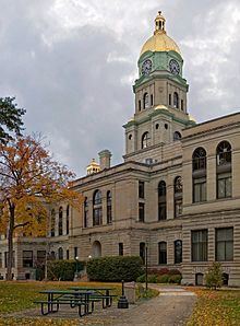 | ||
Colleges and Universities Marshall University, Cabell County Career T, Mountwest Community and Tech, Huntington Junior College, Huntington School of Beauty C | ||
Greater huntington and cabell county west virginia travel destination video
Cabell County is a county in the U.S. state of West Virginia. As of the 2010 census, the population was 96,319, making it West Virginia's fourth-most populous county. Its county seat is Huntington. The county was organized in 1809 and named for William H. Cabell, the Governor of Virginia from 1805 to 1808.
Contents
- Greater huntington and cabell county west virginia travel destination video
- Map of Cabell County WV USA
- Geography
- Adjacent counties
- 2000 census
- 2010 census
- City
- Town
- Village
- Census designated places
- Notable people
- References
Map of Cabell County, WV, USA
Cabell County is part of the Huntington-Ashland, WV-KY-OH Metropolitan Statistical Area, which is also included in the Charleston-Huntington-Ashland, WV-OH-KY Combined Statistical Area.
Geography
According to the U.S. Census Bureau, the county has an area of 288 square miles (750 km2), of which 281 square miles (730 km2) is land and 7.0 square miles (18 km2) (2.4%) is water.
Adjacent counties
2000 census
As of the census of 2000, there were 96,784 people, 41,180 households, and 25,490 families residing in the county. The population density was 344 people per square mile (133/km²). There were 45,615 housing units at an average density of 162 per square mile (63/km²). The racial makeup of the county was 93.37% White, 4.29% Black or African American, 0.18% Native American, 0.77% Asian, 0.04% Pacific Islander, 0.20% from other races, and 1.14% from two or more races. 0.68% of the population were Hispanic or Latino of any race.
There were 41,180 households out of which 25.20% had children under the age of 18 living with them, 47.10% were married couples living together, 11.60% had a female householder with no husband present, and 38.10% were non-families. 31.30% of all households were made up of individuals and 12.50% had someone living alone who was 65 years of age or older. The average household size was 2.27 and the average family size was 2.85.
In the county, the population was spread out with 20.00% under the age of 18, 13.50% from 18 to 24, 26.80% from 25 to 44, 23.60% from 45 to 64, and 16.00% who were 65 years of age or older. The median age was 38 years. For every 100 females there were 91.40 males. For every 100 females age 18 and over, there were 88.50 males.
The median income for a household in the county was $28,479, and the median income for a family was $37,691. Males had a median income of $31,780 versus $22,243 for females. The per capita income for the county was $17,638. About 13.70% of families and 19.20% of the population were below the poverty line, including 24.60% of those under age 18 and 10.80% of those age 65 or over.
2010 census
As of the 2010 United States Census, there were 96,319 people, 41,223 households, and 24,308 families residing in the county. The population density was 342.8 inhabitants per square mile (132.4/km2). There were 46,169 housing units at an average density of 164.3 per square mile (63.4/km2). The racial makeup of the county was 91.6% white, 5.0% black or African American, 1.0% Asian, 0.2% American Indian, 0.3% from other races, and 2.0% from two or more races. Those of Hispanic or Latino origin made up 1.1% of the population. In terms of ancestry, 17.2% were Irish, 16.5% were English, 15.9% were German, and 10.7% were American.
Of the 41,223 households, 26.1% had children under the age of 18 living with them, 42.3% were married couples living together, 12.3% had a female householder with no husband present, 41.0% were non-families, and 33.5% of all households were made up of individuals. The average household size was 2.24 and the average family size was 2.85. The median age was 38.7 years.
The median income for a household in the county was $34,492 and the median income for a family was $48,323. Males had a median income of $39,523 versus $28,952 for females. The per capita income for the county was $21,907. About 15.3% of families and 20.6% of the population were below the poverty line, including 29.0% of those under age 18 and 10.7% of those age 65 or over.