
Country United States Incorporated 1846 Population 393,843 (2013) | State Wisconsin Unemployment rate 3.5% (Apr 2015) | |
 | ||
Area 1,505 km² (1,424 km² Land / 80.29 km² Water) Points of interest Pewaukee Lake, Ten Chimneys, Ice Age National Scenic Tr, Minooka Park, Frame Park Formal Gardens Colleges and Universities | ||
Waukesha County is a county in the U.S. state of Wisconsin. As of the 2010 census, the population was 389,891, making it the third-most populous county in Wisconsin. Its county seat is Waukesha.
Contents
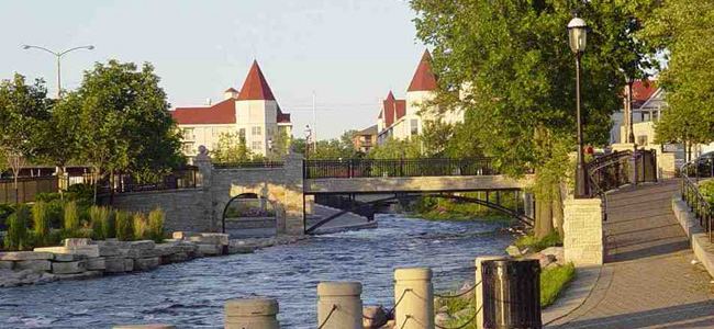
- Map of Waukesha County WI USA
- History
- Geography
- Lake country
- Adjacent counties
- 2010 census
- 2000 census
- Elected officials
- Departments
- Politics
- Census designated place
- Ghost townsNeighborhoods
- References
Map of Waukesha County, WI, USA
Waukesha County is included in the Milwaukee–Waukesha–West Allis, WI Metropolitan Statistical Area.
History
The part of Wisconsin that Waukesha County occupies was a part of Michigan Territory when Milwaukee County was organized in September 1834. On July 4, 1836, the Wisconsin Territory was formed, which included land that is now in the state of Minnesota. In January 1846, part of Milwaukee County was split off into Waukesha County. Curtis Reed was the first county chairman. When a vote decided the county seat, Waukesha defeated Pewaukee by two votes. The name is derived from the Potawatomi word for 'fox' because the streams in the lower part of the county drain into the Fox River.
Waukesha was a New England settlement, and Waukesha's founders were settlers from New England, particularly Connecticut, rural Massachusetts, Vermont, New Hampshire and Maine, as well as from upstate New York who were born to parents who had migrated there from New England shortly after the American Revolution. These people were "Yankees" descended from the English Puritans who settled New England in the 1600s. They were part of a wave of New England farmers who headed west into what was the wilds of the Northwest Territory during the early 1800s. Most arrived as a result of the completion of the Erie Canal as well as the end of the Black Hawk War.
When they arrived in what is now Waukesha County, there was nothing but dense virgin forest and wild prairie. The New Englanders built farms, roads, government buildings and established post routes. They brought many of their Yankee New England values, such as a passion for education that led to the establishment of many schools as well as staunch support for abolitionism. They were mostly members of the Congregationalist Church, though some were Episcopalian. Due to the second Great Awakening some converted to Methodism, and others became Baptists before moving to what is now Waukesha County. Waukesha, like much of Wisconsin, would be culturally very continuous with early New England culture for most of its early history.
Geography
According to the U.S. Census Bureau, the county has a total area of 581 square miles (1,500 km2), of which 550 square miles (1,400 km2) is land and 31 square miles (80 km2) (5.3%) is water.
Lake country
Because of its large number of lakes, the northwestern corner of Waukesha County is referred to as "Lake Country" by local residents. It includes Pewaukee, Delafield, Hartland, Merton, Nashotah, Chenequa, Okauchee Lake, Oconomowoc, Summit, and Lac La Belle.
Adjacent counties
2010 census
As of the census of 2010, there were 389,891 people, 152,663 households, and 108,810 families residing in the county. The population density was 672 people per square mile (260/km²). There were 160,864 housing units at an average density of 277 per square mile (107/km²). The racial makeup of the county was 93.3% White, 1.3% Black or African American, 0.3% Native American, 2.7% Asian, 0.0003% Pacific Islander, 1.0% from other races, and 1.3% from two or more races. 4.1% of the population were Hispanic or Latino of any race.
There were 152,663 households out of which 30.8% had children under the age of 18 living with them, 60.7% were married couples living together, 7.1% had a female householder with no husband present, and 28.7% were non-families. 23.8% of all households were made up of individuals and 10.1% had someone living alone who was 65 years of age or older. The average household size was 2.52 and the average family size was 3.00.
In the county, the population was spread out with 24.1% under the age of 18, 6.8% from 18 to 24, 23.6% from 25 to 44, 31.2% from 45 to 64, and 14.3% who were 65 years of age or older. The median age was 42 years. For every 100 females there were 96.30 males. For every 100 females age 18 and over, there were 93.90 males.
2000 census
As of the census of 2000, there were 360,767 people, 135,229 households, and 100,475 families residing in the county. The population density was 649 people per square mile (251/km²). There were 140,309 housing units at an average density of 252 per square mile (98/km²). The racial makeup of the county was 95.77% White, 0.73% Black or African American, 0.22% Native American, 1.49% Asian, 0.02% Pacific Islander, 0.87% from other races, and 0.90% from two or more races. 2.63% of the population were Hispanic or Latino of any race. 44.5% were of German, 9.2% Polish, 7.5% Italian, and 7.7% Irish ancestry according to Census 2000. 94.3% spoke English, 2.2% Spanish and 1.2% German as their first language.
There were 135,229 households out of which 35.40% had children under the age of 18 living with them, 64.80% were married couples living together, 6.80% had a female householder with no husband present, and 25.70% were non-families. 20.90% of all households were made up of individuals and 8.10% had someone living alone who was 65 years of age or older. The average household size was 2.63 and the average family size was 3.08.
In the county, the population was spread out with 26.30% under the age of 18, 6.80% from 18 to 24, 29.80% from 25 to 44, 25.10% from 45 to 64, and 12.00% who were 65 years of age or older. The median age was 38 years. For every 100 females there were 96.80 males. For every 100 females age 18 and over, there were 94.40 males.
The median income for a household in the county was $62,839, and the median income for a family was $71,773 (these figures had risen to $71,907 and $85,116 respectively as of a 2007 estimate). Males had a median income of $49,232 versus $31,643 for females. The per capita income for the county was $29,164. About 1.7% of families and 2.7% of the population were below the poverty line, including 2.5% of those under age 18 and 4.0% of those age 65 or over.
Elected officials
Departments
There are 12 departments in Waukesha County, with most located in the Administration Center.
The Department of Administration has five divisions that provide administrative services to the county: the finance division, the human resources division, the information technology division, the purchasing and risk management division, and the administrative services division.
The Aging and Disability Resource Center of Waukesha County (ADRC) provides information, assistance, counseling and supportive services regarding adults age 60 and above, adults with physical or developmental disabilities; and adults with mental health or substance abuse concerns. It also provides publicly funded long-term care to county residents.
The Waukesha County Airport serves commercial and private aircraft and is supervised by the Airport Commission.
Waukesha County Federated Library System (WCFLS) works in partnership with 16 public libraries in Waukesha County to cooperatively provide library services. This includes the purchase of shared electronic databases, summer library programming, and circulation services. WCFLS also oversees Internet access for member libraries.
The Medical Examiner investigates suspicious or unexplained deaths or deaths that result from a homicide, suicide, or accident. The office also generates statistics for the county.
The Department of Parks and Land Use (PLU), oversees six divisions that design and maintain county parks. The division also works with state and federal agencies. The planning division administers permits for construction and landscaping activities. The land conservation division works to educate on and regulate soil and water issues. Most programs look to control water runoff and soil erosion. The recycling and solid waste division oversees recycling and disposal programs. It also performs educational outreach on topics such as composting and waste reduction. The official mascot of the recycling division is Recycle Raccoon. The environmental health division oversees animal welfare issues, food safety, and air, water and sewage, and safety issues (such as radon testing, well testing, and septic system monitoring). The land information systems division coordinates databases of information relating to land use and development.
The University of Wisconsin-Extension is a partnership with Waukesha County and brings the research of the UW System to families, businesses, governments, and organizations through educational outreach programs. The UW-Extension office also houses 180° Juvenile Diversion, a non-profit organization that rehabilitates first-time young offenders in Waukesha County.
Politics
Waukesha County has been one of the Republican Party's most solid suburban strongholds for many years. It has not supported a Democrat for president since 1964. While other non-Southern suburban counties have moved towards Democrats since the 1980s, Waukesha and other Milwaukee suburbs have continued to vote solidly Republican. The county is split between 10 state assembly districts and six state senate districts, all held by Republicans.
In 2008, Senator John McCain carried the county by a 25.7% margin over then-Senator Barack Obama, when Obama won Wisconsin by 13.9% over McCain.