
Time zone Central (CST) (UTC-6) Local time Monday 2:12 AM Mayor Dan Devine | State Wisconsin Elevation 728 ft (222 m) Area code(s) 414 Population 60,697 (2013) | |
 | ||
Weather 19°C, Wind S at 19 km/h, 62% Humidity | ||
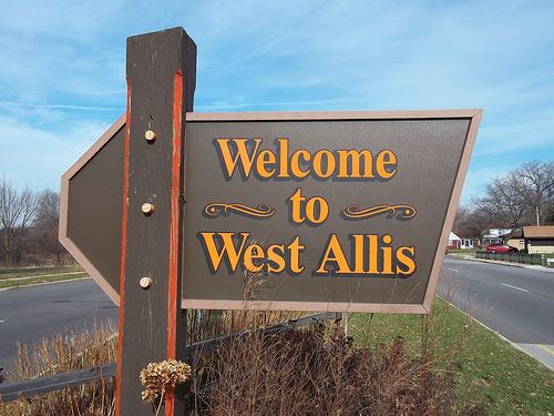
West Allis is a city in Milwaukee County, Wisconsin, United States. A suburb of Milwaukee, it is part of the Milwaukee metropolitan area. The population was 60,411 at the 2010 census.
Contents
- Map of West Allis WI USA
- History
- Geography
- 2010 census
- 2000 census
- Wisconsin State Fair
- Centennial celebration
- Points of Interest
- Sports
- Education
- Government
- Notable businesses
- References
Map of West Allis, WI, USA
History
The name West Allis derives from Edward P. Allis, whose Edward P. Allis Company was a large Milwaukee-area manufacturing firm in the late 19th century. In 1901, the Allis company became Allis-Chalmers, and in 1902 built a large new manufacturing plant west of its existing plant. The locale in which the new plant was constructed was at the time called North Greenfield, and prior to the 1880s had been called Honey Creek. With the building of the western Allis plant, the area was incorporated as the Village of West Allis, and it became the City of West Allis in 1906.
With the presence of Allis-Chalmers, the largest manufacturer in the area, West Allis became the largest suburb of Milwaukee in the early 20th century. After that, West Allis grew quickly. Between 1910 and 1930, its population grew fivefold. After 1965, the Allis-Chalmers company's fortunes had turned. By 1985, Allis-Chalmers's global workforce had shrunk to 13,000 from its peak of 31,000. Since then, West Allis has had some success attracting other employers, such as Quad Graphics.
Geography
West Allis is located at 43°0′29″N 88°1′6″W (43.00, -88.02). The upper courses of the Root and Kinnickinnic Rivers flow through the city. According to the United States Census Bureau, the city has a total area of 11.41 square miles (29.55 km2), of which, 11.39 square miles (29.50 km2) is land and 0.02 square miles (0.05 km2) is water.
2010 census
As of the census of 2010, there were 60,411 people, 27,454 households, and 14,601 families residing in the city. The population density was 5,303.9 inhabitants per square mile (2,047.8/km2). There were 29,353 housing units at an average density of 2,577.1 per square mile (995.0/km2). The racial makeup of the city was 86.7% White, 3.6% African American, 1.1% Native American, 2.0% Asian, 3.6% from other races, and 2.9% from two or more races. Hispanic or Latino of any race were 9.6% of the population.
There were 27,454 households of which 25.8% had children under the age of 18 living with them, 36.3% were married couples living together, 11.9% had a female householder with no husband present, 5.0% had a male householder with no wife present, and 46.8% were non-families. 38.6% of all households were made up of individuals and 13.3% had someone living alone who was 65 years of age or older. The average household size was 2.17 and the average family size was 2.90.
The median age in the city was 37.7 years. 20.5% of residents were under the age of 18; 8.3% were between the ages of 18 and 24; 30.1% were from 25 to 44; 26.5% were from 45 to 64; and 14.6% were 65 years of age or older. The gender makeup of the city was 49.0% male and 51.0% female.
2000 census
As of the census of 2000, there were 61,254 people, 27,604 households, and 15,375 families residing in the city. The population density was 5,397.6 people per square mile (2,083.7/km²). There were 28,708 housing units at an average density of 2,529.7 per square mile (976.6/km²). The racial makeup of the city was 94.03% White, 1.34% African American, 0.70% Native American, 1.33% Asian, 0.02% Pacific Islander, 1.18% from other races, and 1.41% from two or more races. Hispanic or Latino of any race were 3.52% of the population.
There were 27,604 households out of which 25.5% had children under the age of 18 living with them, 41.2% were married couples living together, 10.6% had a female householder with no husband present, and 44.3% were non-families. 37.3% of all households were made up of individuals and 14.0% had someone living alone who was 65 years of age or older. The average household size was 2.19 and the average family size was 2.92.
In the city, the population was spread out with 21.5% under the age of 18, 8.4% from 18 to 24, 32.3% from 25 to 44, 20.5% from 45 to 64, and 17.2% who were 65 years of age or older. The median age was 38 years. For every 100 females there were 93.0 males. For every 100 females age 18 and over, there were 90.0 males.
The median income for a household in the city was $39,394, and the median income for a family was $50,732. Males had a median income of $36,926 versus $26,190 for females. The per capita income for the city was $20,914. About 4.6% of families and 6.5% of the population were below the poverty line, including 9.0% of those under age 18 and 5.6% of those age 65 or over.
Wisconsin State Fair
The Wisconsin State Fair Park, which includes the Milwaukee Mile and is the site of the annual Wisconsin State Fair, is located in West Allis.
Centennial celebration
On June 15, 2006, the city celebrated its 100th anniversary. The celebration included a parade, fireworks and a family festival.
Points of Interest
The West Allis Post Office contains two oil on canvas murals, Wisconsin Wild Flowers – Spring and Wisconsin Wild Flowers – Autumn. painted in 1943 by Frances Foy. Murals were produced from 1934 to 1943 in the United States through the Section of Painting and Sculpture, later called the Section of Fine Arts, of the Treasury Department.
Sports
Pettit National Ice Center is one of only two indoor speed skating rinks in USA.
Education
The schools in the West Allis - West Milwaukee School District:
Government
West Allis is represented by Jim Sensenbrenner (R) in the United States House of Representatives, and by Ron Johnson (R) and Tammy Baldwin (D) in the United States Senate. Tim Carpenter (D) and Leah Vukmir (R) represent West Allis in the Wisconsin State Senate, and Daniel Riemer (D), Rob Hutton (R), and Joe Sanfelippo (R) represent West Allis in the Wisconsin State Assembly.