
Elevation 830 ft (253 m) Postal Code 53005, 53008, 53045 Population 37,920 (2010) | Incorporated August 14, 1954 Area code(s) 262 Local time Saturday 12:42 AM | |
 | ||
Weather -4°C, Wind NW at 2 km/h, 55% Humidity Points of interest Mitchell Park, Mary Knoll Park, Fox Brook Park, Endicott Park, Lilly Heights Park | ||
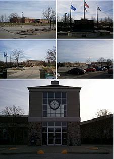
Brookfield is a city located in Waukesha County, Wisconsin, United States. It had a population of 37,920 in the 2010 census. Brookfield is the third largest city in Waukesha County.
Contents
- Map of Brookfield WI USA
- History
- Geography
- 2010 census
- 2000 census
- Economy
- Transportation
- Government
- Common Council
- Education
- Tourism
- Sister cities
- References
Map of Brookfield, WI, USA
History
Brookfield is located west of Milwaukee in Waukesha County in an area originally inhabited by Potawatomi Indians. The first known white settler was Robert Curren who built the first log cabin in 1836. Farms dominated the landscape into the mid-20th century.
The City of Brookfield was incorporated on August 14, 1954 from the Town of Brookfield, a portion of which still survives along the city's western edge.
Geography
According to the United States Census Bureau, the city has a total area of 27.59 square miles (71.46 km2), of which, 27.09 square miles (70.16 km2) is land and 0.50 square miles (1.29 km2) is water. The sub-continental divide passes through Brookfield; on the eastern side of this divide, easily marked by the crest at Calhoun Road and Capitol Drive, water flows to Lake Michigan on its way to the Gulf of Saint Lawrence; on the western side of this divide, water flows to the Fox River of Illinois and Wisconsin on its way to the Mississippi River and the Gulf of Mexico.
There is a heron rookery on a site northwest of Capitol Drive and Brookfield Road.
2010 census
As of the census of 2010, there were 37,920 people, 14,576 households, and 10,999 families residing in the city. The population density was 1,399.8 inhabitants per square mile (540.5/km2). There were 15,317 housing units at an average density of 565.4 per square mile (218.3/km2). The racial makeup of the city was 90.0% White, 1.2% African American, 0.2% Native American, 6.7% Asian, 0.5% from other races, and 1.4% from two or more races. Hispanic or Latino of any race were 2.2% of the population.
There were 14,576 households of which 31.5% had children under the age of 18 living with them, 67.4% were married couples living together, 5.4% had a female householder with no husband present, 2.6% had a male householder with no wife present, and 24.5% were non-families. 21.4% of all households were made up of individuals and 11.9% had someone living alone who was 65 years of age or older. The average household size was 2.57 and the average family size was 3.01.
The median age in the city was 46.7 years. 23.5% of residents were under the age of 18; 5.2% were between the ages of 18 and 24; 18.5% were from 25 to 44; 33% were from 45 to 64; and 19.9% were 65 years of age or older. The gender makeup of the city was 48.5% male and 51.5% female.
2000 census
As of the census of 2000, there were 38,649 people, 13,891 households, and 11,223 families residing in the city. The population density is 1,421.1 people per square mile (548.6/km²). There are 14,208 housing units at an average density of 522.4 per square mile (201.7/km²). The racial makeup of the city is 94.20 percent White, 3.83 percent Asian, 0.83 percent Black or African American, 0.09 percent Native American, 0.02 percent Pacific Islander, 0.23 percent from other races, and 0.81 percent from two or more races. 1.17 percent of the population are Hispanic or Latino of any race.
There are 13,891 households out of which 36.1 percent have children under age 18 living with them, 73.1 percent are married couples living together, 5.5 percent have a female householder with no husband present, and 19.2 percent are non-families. 16.7 percent of all households are made up of individuals and 9.0 percent have someone living alone who is 65 years old or older. The average household size is 2.74 people and the average family size is 3.09 people.
In the city, the population is spread out with 26.8 percent under age 18, 4.6 percent from 18 years old to 24 years old, 23.2 percent from 25 years old to 44 years old, 27.8 percent from 45 years old to 64 years old, and 17.6 percent who are 65 years old or older. The median age is 42 years. For every 100 females there are 93.7 males. For every 100 females age 18 and over, there are 90.8 males.
The median income for a household in the city is $76,225, and the median income for a family is $83,691. Males have a median income of $62,351 versus $37,589 for females. The per capita income for the city is $37,292. 2.2 percent of the population and 1.4 percent of families are below the poverty line. Out of the total population, 2.4 percent of those under age 18 and 3.4 percent of those 65 years old and older are living below the poverty line.
Economy
Fiserv headquarters are in Brookfield.
Transportation
Capitol Airport (02C) serves the city and surrounding communities.
Government
Brookfield has a mayor–council government. The mayor is elected to a four-year term. On April 1, 2014, incumbent mayor Steve Ponto again defeated former two-term Mayor Jeff Speaker by a vote of 4,512 to 2,539.
Brookfield is represented by Jim Sensenbrenner (R) in the United States House of Representatives, and by Ron Johnson (R) and Tammy Baldwin (D) in the United States Senate. Leah Vukmir (R) represents Brookfield in the Wisconsin State Senate, and Rob Hutton (R) and Dale P. Kooyenga (R) in the Wisconsin State Assembly.
Common Council
The Common Council is composed of 14 aldermen, 2 from each of 7 districts. They serve four-year terms, with one member from each district up for election every other year. The aldermen set policy and have extensive financial control, but are not engaged in daily operational management.
Education
The Elmbrook School District, serves residents of Brookfield excluding a small section of southwest Brookfield, which is in the Waukesha School District. Private schools include St. Dominic Catholic School, St. John Vianney Catholic Church, St. Luke Catholic School, St. Joseph's Catholic School, Elm Grove Lutheran School, Brookfield Christian School, and Brookfield Academy. Private high schools located within the Brookfield city limits include Brookfield Christian School and Heritage Christian School, West Suburban Christian Academy.
Tourism
Brookfield offers shopping, fine dining, outdoor golf and parks. Brookfield's concert hall is the Sharon Lynne Wilson Center for the Arts located in Mitchell Park. Brookfield's main beach is located at Fox Brook Park where hiking in natural preserves, sailing, biking and golfing are also available.
Brookfield Square is the main shopping mall for the city and also serves as a commercial anchor to the Blue Mound Road shopping district serving the western suburbs of Milwaukee and Waukesha County. Brookfield has off-road bike paths throughout the city.
Brookfield Days is held annually in June, at Wirth Park supported by the local community. A farmers market runs on weekends in summer months at the Brookfield City Hall.
The Elmbrook Historical Society hosts several events annually celebrating the lives of early Brookfield settlers, including Caroline Ingalls, who was born in the Brookfield area. The city is often visited by fans of her daughter, Laura, author of the Little House on the Prairie book series.
Sister cities
Brookfield has one sister city: