
Existed: 1964 – present Length 18.56 km | Constructed 1964 | |
 | ||
West end: 2nd Street in Ryderwood | ||
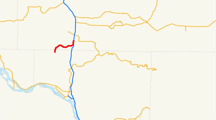
State Route 506 (SR 506) is an 11.53-mile (18.56 km) long state highway in Cowlitz and Lewis counties, part of the U.S. state of Washington, serving the communities of Ryderwood and Vader. SR 506 begins at the intersection of 2nd and Morse Street in Ryderwood, a community in Cowlitz County, traveling north into Lewis County and turning east past Vader to parallel the Cowlitz River and interchange Interstate 5 (I-5) twice west of Toledo. Originating as Secondary State Highway 1P (SSH 1P) in 1937, the highway was designated in its current form in 1964 and it shared its eastern terminus with SR 505. SR 411 terminated at Vader and both SR 411 and SR 505 were moved away from SR 506 in 1991.
Contents
Map of WA-506, Washington, USA
Route description
SR 506 begins as the continuation of Morse Street at the Second Street intersection in Ryderwood, a community located in the Campbell Creek valley in northern Cowlitz County. Traveling north to exit Ryderwood, the highway crosses Campbell Creek and enters Lewis County. The roadway parallels Stillwater Creek in its valley northeast and turns east to cross the creek into Vader. The street is named 7th Street after crossing Olequa Creek; SR 506 crosses a railroad track owned by BNSF Railway and used by two Amtrak services, the Cascades and Coast Starlight, between the Kelso and Centralia stations. Traveling east through Vader, 7th Street intersects the West Side Highway, formerly SR 411 until 1991, and leaves the city heading northeast, paralleling the Cowlitz River, to cross Lacamas Creek, the busiest segment of the highway at a daily average of 1,800 vehicles in 2008. The roadway crosses Bear Creek near its confluence with the Cowlitz River and interchanges Interstate 5 (I-5) southbound exit 59; the route turns north to interchange I-5 again at exit 60 in a full diamond interchange. Exit 60 is also the western terminus of the Toledo-Vader Road, formerly SR 505 until 1991.
History
SR 506 was established in 1964, but was preceded by Secondary State Highway 1P (SSH 1P), established in 1937. Originally, SSH 1P traveled from Ryderwood, paralleling the Longview, Portland and Northern Railway line to Vader and paralleling the Cowlitz River to U.S. Route 99 (US 99) in Toledo. The rail line, established in 1922 by Longview's founder, Robert A. Long, was completed in 1929. In 1953, the rail line was removed, and in 1963, SSH 1P was shortened and moved west to the newer US 99 freeway, later Interstate 5 (I-5). During the 1964 highway renumbering, SR 506 was created, SR 411 ended in Vader and SR 505 ended at the I-5 / SR 506 interchange. In 1991, SR 411 was moved south to end in Castle Rock and SR 505 was moved onto former SR 603 to Winlock.