
Country United States FIPS code 53-71785 Elevation 37 m Zip code 98591 Population 719 (2013) | Time zone Pacific (PST) (UTC-8) GNIS feature ID 1512731 Area 100 ha Local time Sunday 2:17 AM Area code 360 | |
 | ||
Weather 6°C, Wind SW at 5 km/h, 90% Humidity | ||
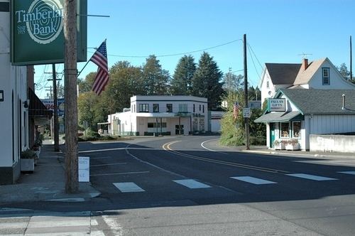
Toledo is a city in Lewis County, Washington, United States. The population was 725 at the 2010 census.
Contents
Map of Toledo, WA 98591, USA
History
Toledo was officially incorporated on October 10, 1892. Toledo was named by Celeste Rochon after a pioneer side wheel paddle steamer operated by Captain Oren Kellogg of the Kellogg Transportation Company. The boat traveled the Cowlitz River. A picture of the riverboat is hanging downtown next to the drugstore. However, it wasn't the first non-Indigenous settlement in Lewis County, as the Pugets Sound Agricultural Company opened and maintained the Cowlitz Farm in 1839, near Toledo.
The first school in Toledo was called the OK School. It was a one-room school house. Most of the kids that lived out of the town limits had to ride a boat across the river to and from school until the bridge was built.
The current Middle School was originally the High School until the new High School was built in the late 70s-early 80s. While the middle school was being remodeled in 1995 the children were relocated for the year to St. Mary's Church and School.
The Cowlitz Indian Tribe made a special Totem Pole for Toledo High School. The town has always used the "Indian" as the School's mascot (of course after receiving permission from the tribe). Recently, a painting was donated to the High School of "Old Ike" who was the last full blooded Cowlitz Indian. His portrait still hangs within the halls of the High School.
Geography
Toledo is located at 46°26′21″N 122°50′53″W (46.439283, -122.848191).
According to the United States Census Bureau, the city has a total area of 0.40 square miles (1.04 km2), all of it land.
Climate
According to the Köppen Climate Classification system, Toledo has a warm-summer Mediterranean climate, abbreviated "Csb" on climate maps.
2010 census
As of the census of 2010, there were 725 people, 274 households, and 199 families residing in the city. The population density was 1,812.5 inhabitants per square mile (699.8/km2). There were 304 housing units at an average density of 760.0 per square mile (293.4/km2). The racial makeup of the city was 91.0% White, 2.6% Native American, 0.8% Asian, 0.3% Pacific Islander, 2.3% from other races, and 2.9% from two or more races. Hispanic or Latino of any race were 7.0% of the population.
There were 274 households of which 42.0% had children under the age of 18 living with them, 45.3% were married couples living together, 20.8% had a female householder with no husband present, 6.6% had a male householder with no wife present, and 27.4% were non-families. 22.6% of all households were made up of individuals and 13.1% had someone living alone who was 65 years of age or older. The average household size was 2.65 and the average family size was 3.04.
The median age in the city was 35.2 years. 28.4% of residents were under the age of 18; 11.4% were between the ages of 18 and 24; 22% were from 25 to 44; 24% were from 45 to 64; and 14.1% were 65 years of age or older. The gender makeup of the city was 46.6% male and 53.4% female.
2000 census
As of the census of 2000, there were 653 people, 265 households, and 182 families residing in the city. The population density was 1,947.3 people per square mile (741.5/km²). There were 283 housing units at an average density of 843.9 per square mile (321.4/km²). The racial makeup of the city was 93.26% White, 0.61% African American, 2.30% Native American, 0.31% Asian, 1.53% from other races, and 1.99% from two or more races. Hispanic or Latino of any race were 4.90% of the population. 18.9% were of American, 13.7% German, 9.9% Irish, 8.0% English and 5.7% Dutch ancestry. 97.5% spoke English and 2.5% Spanish as their first language.
There were 265 households out of which 32.8% had children under the age of 18 living with them, 51.3% were married couples living together, 12.8% had a female householder with no husband present, and 31.3% were non-families. 28.7% of all households were made up of individuals and 16.2% had someone living alone who was 65 years of age or older. The average household size was 2.46 and the average family size was 2.95.
In the city, the population was spread out with 25.7% under the age of 18, 10.7% from 18 to 24, 24.3% from 25 to 44, 22.1% from 45 to 64, and 17.2% who were 65 years of age or older. The median age was 37 years. For every 100 females there were 85.5 males. For every 100 females age 18 and over, there were 83.7 males.
The median income for a household in the city was $29,271, and the median income for a family was $31,833. Males had a median income of $28,750 versus $19,271 for females. The per capita income for the city was $14,483. About 9.3% of families and 14.7% of the population were below the poverty line, including 21.6% of those under age 18 and 3.8% of those age 65 or over.
Politics
Toledo is a fairly Republican area, although less so than most of Lewis County; nearby Vader voted for Democrat John F. Kerry. The results for the 2004 U.S. Presidential Election were as follows: