
Founded December 19, 1845 Area 6,309 km² | Website www.co.lewis.wa.us Population 75,081 (2013) | |
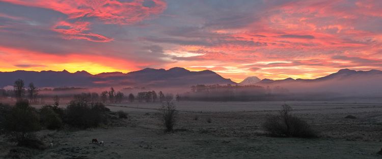 | ||
Points of interest Cascade Range, Riffe Lake, Narada Falls, Grove of the Patriarch, White Pass Destinations | ||
Lewis County is a county located in the U.S. state of Washington. As of the 2010 census, the population was 75,455. The county seat is Chehalis, and its largest city is Centralia. The county was created on December 19, 1845, by the Provisional Government of Oregon, and originally named after George Vancouver. In 1849 the county was renamed after Meriwether Lewis.
Contents
- Map of Lewis County WA USA
- Geography and natural features
- Geographic features
- Major highways
- National protected areas
- 2000 census
- 2010 census
- National level
- Gubernatorial races
- State representation
- County level
- Towns
- Census designated places
- References
Map of Lewis County, WA, USA
Lewis County comprises the Centralia, WA Micropolitan Statistical Area, which is also included in the Seattle-Tacoma, WA Combined Statistical Area.
Geography and natural features
According to the U.S. Census Bureau, the county has a total area of 2,436 square miles (6,310 km2), of which 2,403 square miles (6,220 km2) is land and 33 square miles (85 km2) (1.4%) is water. One of the world's tallest Douglas fir trees ever recorded was in the town of Mineral within Lewis County, attaining a height of 120 metres (390 ft).
Geographic features
Major highways
National protected areas
2000 census
As of the census of 2000, there were 68,600 people, 26,306 households, and 18,572 families residing in the county. The population density was 28 people per square mile (11/km²). There were 29,585 housing units at an average density of 12 per square mile (5/km²). The racial makeup of the county was 92.96% White, 0.38% Black or African American, 1.22% Native American, 0.69% Asian, 0.18% Pacific Islander, 2.55% from other races, and 2.01% from two or more races. 5.37% of the population were Hispanic or Latino of any race. 18.7% were of German, 11.8% United States or American, 11.1% English, 8.7% Irish and 5.7% Norwegian ancestry.
There were 26,306 households out of which 31.60% had children under the age of 18 living with them, 55.90% were married couples living together, 9.90% had a female householder with no husband present, and 29.40% were non-families. 24.00% of all households were made up of individuals and 11.20% had someone living alone who was 65 years of age or older. The average household size was 2.57 and the average family size was 3.02.
In the county, the population was spread out with 26.50% under the age of 18, 8.20% from 18 to 24, 25.20% from 25 to 44, 24.50% from 45 to 64, and 15.50% who were 65 years of age or older. The median age was 38 years. For every 100 females there were 98.30 males. For every 100 females age 18 and over, there were 95.40 males.
The median income for a household in the county was $35,511, and the median income for a family was $41,105. Males had a median income of $35,714 versus $23,453 for females. The per capita income for the county was $17,082. About 10.40% of families and 14.00% of the population were below the poverty line, including 18.60% of those under age 18 and 9.40% of those age 65 or over.
2010 census
As of the 2010 United States Census, there were 75,455 people, 29,743 households, and 20,104 families residing in the county. The population density was 31.4 inhabitants per square mile (12.1/km2). There were 34,050 housing units at an average density of 14.2 per square mile (5.5/km2). The racial makeup of the county was 89.7% white, 1.4% American Indian, 0.9% Asian, 0.5% black or African American, 0.2% Pacific islander, 4.0% from other races, and 3.2% from two or more races. Those of Hispanic or Latino origin made up 8.7% of the population. In terms of ancestry, 24.1% were German, 14.9% were Irish, 12.5% were English, 7.7% were American, and 5.1% were Norwegian.
Of the 29,743 households, 30.2% had children under the age of 18 living with them, 51.2% were married couples living together, 10.9% had a female householder with no husband present, 32.4% were non-families, and 25.7% of all households were made up of individuals. The average household size was 2.51 and the average family size was 2.97. The median age was 41.5 years.
The median income for a household in the county was $43,874 and the median income for a family was $53,358. Males had a median income of $43,695 versus $31,720 for females. The per capita income for the county was $21,695. About 10.3% of families and 13.3% of the population were below the poverty line, including 18.2% of those under age 18 and 8.6% of those age 65 or over.
National level
Lewis County is arguably the most conservative county in western Washington. It is significantly more Republican than the counties it borders, with the possible exception of Yakima County. Unlike much of western Washington, it has a strong tinge of social conservatism. In 2000 George W. Bush received over 60% of the county’s vote. In 2008 John McCain defeated Barack Obama by over eighteen percent — his only victory in a county west of the Cascades. McCain lost all the neighboring counties except Yakima. The Republican candidate has won by over ten percent in every Presidential election since 1992. Since Washington’s statehood in 1889 only two Democratic Presidential candidates have ever carried the county – Franklin Delano Roosevelt three times in 1932, 1936 and 1940, plus Lyndon Johnson in 1964. As part of Washington’s Third Congressional District it is represented by Republican Congresswoman Jaime Herrera Beutler.
Gubernatorial races
In the 1970s Democratic candidates for governor won the county, but this was something of an anomaly. The last Democratic candidate for Governor to win the county was Booth Gardner in 1984.
State representation
The county’s government is the 20th district of the state. It is represented solely by Republicans.
County level
The county’s government is solely Republican.