
Founded December 29, 1824 Area 3,206 km² County seat De Funiak Springs | Website www.co.walton.fl.us Population 59,807 (2013) | |
 | ||
Destinations | ||
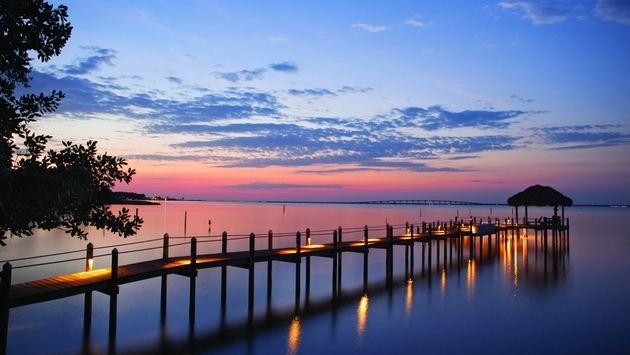
Camping and rv sites in walton county florida
Walton County is a county located in the state of Florida. As of the 2010 census, the population was 55,043. Its county seat is DeFuniak Springs. The county is home to the highest natural point in Florida: Britton Hill, at 345 feet (105 m).
Contents
- Camping and rv sites in walton county florida
- Map of Walton County FL USA
- Coastal dune lakes of south walton county florida
- History
- Geography
- Adjacent counties
- National protected area
- Demographics
- Libraries
- Schools
- Cities
- Town
- Census designated place
- Airports
- Highways
- References
Map of Walton County, FL, USA
Walton County is included in the Crestview-Fort Walton Beach-Destin, FL Metropolitan Statistical Area.
Coastal dune lakes of south walton county florida
History
Walton County was created in 1824. It was named for the son of George Walton the Signer, Colonel George Walton, Jr (born 15 Aug 1786 in Augusta, Richmond Co, Georgia; died 20 Mar 1859 in Petersburg, Virginia) who was Secretary of the Florida territory from 1821 to 1826.
The county was settled in the early 18th Century by Scots who migrated from the Carolinas. The original settlements were in the Euchee (Yuchi) Valley near the landing on the Choctawhatchee River maintained by an Indian named Sam Story. They established one of the first Presbyterian churches in Northwest Florida which is still a functioning parish with an historical cemetery.
Geography
According to the U.S. Census Bureau, the county has a total area of 1,240 square miles (3,200 km2), of which 1,038 square miles (2,690 km2) is land and 202 square miles (520 km2) (16.3%) is water. The County is one of the largest in size in the state, stretching from the Alabama state line to the Emerald Coast.
Adjacent counties
National protected area
Demographics
As of the census of 2000, there were 40,601 people, 16,548 households, and 11,120 families residing in the county. The population density was 38 people per square mile (15/km²). There were 29,083 housing units at an average density of 28 per square mile (11/km²). The racial makeup of the county was 88.41% White, 6.98% Black or African American, 1.28% Native American, 0.45% Asian, 0.04% Pacific Islander, 0.75% from other races, and 2.09% from two or more races. 2.17% of the population were Hispanic or Latino of any race.
There were 16,548 households out of which 26.40% had children under the age of 18 living with them, 53.00% were married couples living together, 10.10% had a female householder with no husband present, and 32.80% were non-families. 27.10% of all households were made up of individuals and 10.10% had someone living alone who was 65 years of age or older. The average household size was 2.35 and the average family size was 2.83.
In the county, the population was spread out with 21.70% under the age of 18, 7.10% from 18 to 24, 28.50% from 25 to 44, 26.90% from 45 to 64, and 15.80% who were 65 years of age or older. The median age was 40 years. For every 100 females there were 105.20 males. For every 100 females age 18 and over, there were 105.00 males.
The median income for a household in the county was $32,407, and the median income for a family was $37,663. Males had a median income of $26,799 versus $21,208 for females. The per capita income for the county was $18,198. About 11.60% of families and 14.40% of the population were below the poverty line, including 21.00% of those under age 18 and 10.90% of those age 65 or over.
Libraries
Walton County has 4 branches, including the historic DeFuniak Springs Library.
Schools
The county is served by the Walton County School District.