
Founded September 7, 1915 Congressional district 1st Website www.co.okaloosa.fl.us Population 193,811 (2013) | Largest community Wright Time zone Central: UTC-6/-5 Area 2,802 km² County seat Crestview | |
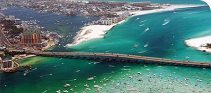 | ||
Colleges and Universities Northwest Florida State College, CHOICE High School and Technical Center Rivers Yellow River, Blackwater River, Shoal River Points of interest Air Force Armament Museum, Fort Walton Mound, Big Kahuna's, Destin History & Fishing M, Henderson Beach State Park Destinations Destin, Fort Walton Beach, Okaloosa Island - Florida, Grayton Beach State Park, Crestview | ||
Okaloosa County is a county located in the northwestern portion of the U.S. state of Florida, extending from the Gulf of Mexico to the Alabama state line. As of the census, 2015 the population was 198,664. Its county seat is Crestview.
Contents
- Map of Okaloosa County FL USA
- History
- Geography
- Adjacent counties
- National protected areas
- State Parks and Forests
- Demographics
- Education
- Libraries
- Airports
- Surface Transportation
- Politics
- Cities
- Towns
- Census designated places
- References
Map of Okaloosa County, FL, USA
Okaloosa County is included in the Crestview-Fort Walton Beach-Destin, FL Metropolitan Statistical Area.
History
Okaloosa County was created by an act passed on September 7, 1915. Okaloosa is a Choctaw word meaning "black water". "Oka" means water, and "lusa" is black in the Choctaw language.
Geography
According to the U.S. Census Bureau, the county has a total area of 1,082 square miles (2,800 km2), of which 930 square miles (2,400 km2) is land and 152 square miles (390 km2) (14.0%) is water. Fort Walton Beach and three United States Air Force bases, (Duke Field in the North and Eglin AFB and Hurlburt Field are in the south).
Adjacent counties
National protected areas
State Parks and Forests
Demographics
As of the census of 2015, there were 198,664 people and 95,494 households. As of the census of 2010,the population density was 194.4 people per square mile (70/km²).
Link to statistics of racial makeup:[1]
As of the 2015 census, there were 95,494 households. Within the 2010 census, 33.10% had children under the age of 18 living with them, 56.20% were married couples living together, 10.20% had a female householder with no husband present, and 29.80% were non-families. 23.50% of all households were made up of individuals and 7.50% had someone living alone who was 65 years of age or older. The average household size was 2.49 and the average family size was 2.94.
According to the 2010 census, the population was spread out with 24.70% under the age of 18, 9.60% from 18 to 24, 31.10% from 25 to 44, 22.40% from 45 to 64, and 12.10% who were 65 years of age or older. The median age was 36 years. For every 100 females there were 102.20 males. For every 100 females age 18 and over, there were 101.50 males.
Within the 2015 census, the median income for a household in the county was $55,880. The per capita income for the county was $28,902. 11.3% of the population were below the poverty line.
Education
The county's public schools come under the Okaloosa County School District.
Libraries
Okaloosa County is served by the Okaloosa County Public Library Cooperative.
Airports
Surface Transportation
Okaloosa County Transit operates bus service in the county.
Politics
Okaloosa County is one of the most conservative counties in Florida. Incumbent George W. Bush won the county in 2004 with 78% of the popular vote and in 2008 the Republican candidate John McCain polled 72%. Mitt Romney won the county in 2012 with 73.86% (69,785) of the popular vote.