
Founded April 24, 1913 Area 2,675 km² County seat Panama City | Website www.co.bay.fl.us Population 174,987 (2013) Unemployment rate 5.2% (Apr 2015) | |
 | ||
Colleges and Universities Gulf Coast State College, Florida State University, Tom P Haney Technical Destinations | ||
Bay County is a county in the U.S. state of Florida. As of the 2010 census, the population was 168,852. Its county seat is Panama City.
Contents
- Map of Bay County FL USA
- History
- Geography
- Adjacent counties
- National protected area
- Demographics
- Board of Commissioners
- Voter Registration
- Education
- Airports
- Public Surface Transportation
- Library
- References
Map of Bay County, FL, USA
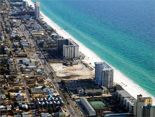
Bay County is included in the Panama City, Florida Metropolitan Statistical Area. The county is best known for its white sand beaches and emerald green water, where large pods of dolphins swim year-round. These beaches attract hundreds of thousands of visitors from all over the world each year.
History
On February 12, 1913, representatives from five towns on St. Andrews Bay met in Panama City to select a name for a proposed new county. The name Bay was selected because it was satisfactory to the majority of the citizens and was descriptive of the territory that would be included. On July 1, 1913, Bay County was created by the Legislature from portions of Washington, Calhoun and Walton counties.
It was the site of Gideon v. Wainwright, which gave all persons accused of a crime the right to an attorney.
Geography
According to the U.S. Census Bureau, the county has a total area of 1,033 square miles (2,680 km2), of which 758 square miles (1,960 km2) is land and 275 square miles (710 km2) (26.6%) is water.
Adjacent counties
National protected area
Demographics
As of the census of 2000, there were 148,217 people, 59,597 households, and 40,466 families residing in the county. The population density was 194 people per square mile (75/km²). There were 78,435 housing units at an average density of 103 per square mile (40/km²). The racial makeup of the county was 84.17% White, 10.64% Black or African American, 0.78% Native American, 1.73% Asian, 0.08% Pacific Islander, 0.66% from other races, and 1.94% from two or more races. 2.42% of the population were Hispanic or Latino of any race.
There were 59,597 households out of which 30.60% had children under the age of 18 living with them, 52.00% were married couples living together, 12.00% had a female householder with no husband present, and 32.10% were non-families. 26.00% of all households were made up of individuals and 8.80% had someone living alone who was 65 years of age or older. The average household size was 2.43 and the average family size was 2.92.
In the county, the population was spread out with 24.00% under the age of 18, 8.70% from 18 to 24, 30.20% from 25 to 44, 23.70% from 45 to 64, and 13.40% who were 65 years of age or older. The median age was 37 years. For every 100 females there were 98.10 males. For every 100 females age 18 and over, there were 95.80 males.
The median income for a household in the county was $36,092, and the median income for a family was $42,729. Males had a median income of $30,116 versus $21,676 for females. The per capita income for the county was $18,700. About 9.80% of families and 13.00% of the population were below the poverty line, including 18.30% of those under age 18 and 11.00% of those age 65 or over.
Board of Commissioners
5 members, elected from districts (zero Democrats, five Republicans)
Voter Registration
According to the Secretary of State's office, Republicans are a majority of the registered voters in Bay County.
Education
Bay District Schools operates public schools serving all portions of the county except for Mexico Beach, which is served by Gulf County Schools.
Airports
Northwest Florida Beaches International Airport
Public Surface Transportation
The county operates the Baytown Trolley, which runs several routes in and around Panama City.
Library
Bay County is part of the Northwest Regional Library System (NWRLS), which serves Gulf and Liberty Counties as well.
Locations: