
Congressional district 2nd Website www.genevacounty.us Founded 26 December 1868 Unemployment rate 5.3% (Apr 2015) | Area 1,500 km² Population 26,727 (2013) | |
 | ||
Rivers Choctawhatchee River, Corner Creek, Big Creek | ||
School bus perspective deteriorating roads in geneva county alabama
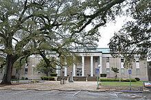
Geneva County is a county of the U.S. state of Alabama. As of the 2010 census, the population was 26,790. Its county seat is Geneva. The county was named after its county seat, which in turn was named after Geneva, New York which was named after Geneva, Switzerland, by Walter H. Yonge, an early town resident and Swiss native. Geneva County is a prohibition or dry county.
Contents
- School bus perspective deteriorating roads in geneva county alabama
- Map of Geneva County AL USA
- History
- Geography
- Major highways
- Adjacent counties
- 2010
- 2000
- Cities
- Towns
- Census designated places
- References
Map of Geneva County, AL, USA
Geneva County is part of the Dothan, AL Metropolitan Statistical Area.
History
Geneva County was established on December 26, 1868.
The county was declared a disaster area in September 1979 due to damage from Hurricane Frederic.
On March 10, 2009, a gunman, identified as Michael McLendon, went on a shooting spree at nine locations in Geneva County from the town of Samson to the city of Geneva, killing ten people and wounding six others. McLendon entered his former place of employment, Reliable Metal Products on the northeastern side of Geneva, where he took his own life.
Geography
According to the U.S. Census Bureau, the county has a total area of 579 square miles (1,500 km2), of which 574 square miles (1,490 km2) is land and 4.5 square miles (12 km2) (0.8%) is water. It is the fifth-smallest county in Alabama by total area.
Major highways
Adjacent counties
2010
Whereas according to the 2010 census Bureau:
2000
As of the census of 2000, there were 25,764 people, 10,477 households, and 7,459 families residing in the county. The population density was 45 people per square mile (17/km2). There were 12,115 housing units at an average density of 21 per square mile (8/km2). The racial makeup of the county was 87.11% White, 10.65% Black or African American, 0.76% Native American, 0.12% Asian, 0.02% Pacific Islander, 0.62% from other races, and 0.72% from two or more races. 1.76% of the population were Hispanic or Latino of any race.
There were 10,477 households out of which 30.60% had children under the age of 18 living with them, 56.40% were married couples living together, 11.00% had a female householder with no husband present, and 28.80% were non-families. 26.30% of all households were made up of individuals and 12.30% had someone living alone who was 65 years of age or older. The average household size was 2.43 and the average family size was 2.92.
In the county, the population was spread out with 24.00% under the age of 18, 7.50% from 18 to 24, 26.80% from 25 to 44, 25.30% from 45 to 64, and 16.30% who were 65 years of age or older. The median age was 39 years. For every 100 females there were 94.70 males. For every 100 females age 18 and over, there were 90.00 males.
The median income for a household in the county was $26,448, and the median income for a family was $32,563. Males had a median income of $26,018 versus $19,341 for females. The per capita income for the county was $14,620. About 15.90% of families and 19.60% of the population were below the poverty line, including 27.20% of those under age 18 and 21.80% of those age 65 or over.