
Area 940.2 km² Population 15,029 (2013) | Website www.unioncountyky.org Founded 1811 Unemployment rate 6.1% (Apr 2015) | |
 | ||
Rivers Ohio River, Tradewater River, Highland Creek | ||
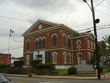
Union County is a county located in the U.S. state of Kentucky. As of the 2010 census, the population was 15,007. Its county seat is Morganfield. The county was formed on January 15, 1811.
Contents
- Map of Union County KY USA
- Geography
- Adjacent counties
- Demographics
- Education
- Transportation
- Cities
- Census designated place
- Other unincorporated place
- References
Map of Union County, KY, USA
Located at the mouth of the Wabash River, Union County, along with neighboring Posey County, Indiana, and Gallatin County, Illinois form the tri-point of the Illinois-Indiana-Kentucky Tri-State Area.
Geography
According to the U.S. Census Bureau, the county has a total area of 363 square miles (940 km2), of which 343 square miles (890 km2) is land and 21 square miles (54 km2) (5.6%) is water. Union County is part of the Western Coal Fields region of Kentucky. The county's northwestern border with Illinois and Indiana is formed by the Ohio River.
Adjacent counties
Demographics
As of the 2010 Census, the population was 15,007. Of this, 85.45% were White, 12.05% were Black or African American, 1.49% were two or more races, 0.44% were some other race, 0.34% were Asian, 0.19% were American Indian or Alaska Native, 0.05% were Native Hawaiian or other Pacific Islander. Hispanic or Latino (of any race) were 1.62% of the population
As of the census of 2000, there were 15,637 people, 5,710 households, and 4,082 families residing in the county. The population density was 45 per square mile (17/km2). There were 6,234 housing units at an average density of 18 per square mile (6.9/km2). The racial makeup of the county was 85.04% White, 12.89% Black or African American, 0.17% Native American, 0.15% Asian, 0.39% from other races, and 1.37% from two or more races. 1.56% of the population were Hispanic or Latino of any race.
There were 5,710 households out of which 32.10% had children under the age of 18 living with them, 56.50% were married couples living together, 11.40% had a female householder with no husband present, and 28.50% were non-families. 26.10% of all households were made up of individuals and 12.40% had someone living alone who was 65 years of age or older. The average household size was 2.50 and the average family size was 2.99.
25.30% of the population was under the age of 18, 13.80% from 18 to 24, 25.50% from 25 to 44, 22.50% from 45 to 64, and 12.90% who were 65 years of age or older. The median age was 34 years. For every 100 females there were 101.80 males. For every 100 females age 18 and over, there were 99.30 males.
The median income for a household in the county was $35,018, and the median income for a family was $43,103. Males had a median income of $30,244 versus $20,817 for females. The per capita income for the county was $17,465. About 9.30% of families and 17.70% of the population were below the poverty line, including 18.30% of those under age 18 and 11.70% of those age 65 or over.
Education
Public schools are managed by Union County Public Schools. The three public elementary schools in the county are located in Morganfield, Sturgis, and Uniontown. The county has one public middle school and one public high school, Union County High School located near Morganfield, Kentucky which is known for its wrestling program. St. Ann School, the only private school in the county, is located in Morganfield—it teaches preschool, elementary, and middle school classes.
Transportation
These are the major highway routes through Union County:
The John T. Myers Locks and Dam once known as Uniontown Locks and Dam is located on the Ohio River 3½ miles downstream from Uniontown and straddles the river between Union County and Posey County Indiana. Construction on the dam was begun in 1965 by the U.S. Army Corps of Engineers and completed in 1977. It was renamed to honor retired Indiana congressman John T. Myers.