
Country United States FIPS code 21-78492 Elevation 111 m Population 968 (2013) Area code 270 | Time zone Central (CST) (UTC-6) GNIS feature ID 0505827 Zip code 42461 Local time Friday 2:50 PM | |
 | ||
Weather 9°C, Wind NW at 23 km/h, 80% Humidity Area 259 ha (233 ha Land / 26 ha Water) | ||
Uniontown is a home rule-class city in Union County, Kentucky, United States. The population was 1,064 at the 2000 census. The name derives from the fact that the city was formed by merging the towns of Francisburg and Locust Port. The John T. Myers Locks and Dam, once known as Uniontown Locks and Dam, is located downriver 3½ miles.
Contents
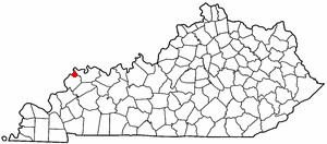
Map of Uniontown, KY 42461, USA
Geography
Uniontown is located at 37°46′20″N 87°55′55″W (37.772281, -87.931890), along the Ohio River.
According to the United States Census Bureau, the city has a total area of 1.0 square mile (2.6 km2), of which 0.9 square miles (2.3 km2) is land and 0.1 square miles (0.26 km2) (7.29%) is water.
Demographics
As of the census of 2000, there were 1,064 people, 445 households, and 300 families residing in the city. The population density was 1,192.9 people per square mile (461.6/km²). There were 482 housing units at an average density of 540.4 per square mile (209.1/km²). The racial makeup of the city was 91.54% White, 7.61% African American, 0.19% Native American, 0.09% Asian, and 0.56% from two or more races. Hispanic or Latino of any race were 0.38% of the population.
There were 445 households out of which 33.7% had children under the age of 18 living with them, 45.8% were married couples living together, 16.0% had a female householder with no husband present, and 32.4% were non-families. 30.6% of all households were made up of individuals and 13.9% had someone living alone who was 65 years of age or older. The average household size was 2.39 and the average family size was 2.95.
In the city, the population was spread out with 26.6% under the age of 18, 9.9% from 18 to 24, 28.9% from 25 to 44, 21.5% from 45 to 64, and 13.1% who were 65 years of age or older. The median age was 35 years. For every 100 females there were 95.2 males. For every 100 females age 18 and over, there were 89.1 males.
The median income for a household in the city was $26,700, and the median income for a family was $31,146. Males had a median income of $24,408 versus $18,235 for females. The per capita income for the city was $13,258. About 15.3% of families and 18.2% of the population were below the poverty line, including 28.0% of those under age 18 and 15.2% of those age 65 or over.
Schools
Uniontown is served by the Union County Public Schools, Kentucky. Elementary students attend Uniontown Elementary. Middle and High School students attend Union County Middle School & Union County High School outside Morganfield.