
Congressional district 15th Area 471.4 km² Population 4,181 (2013) | Founded 1839 | |
 | ||
Points of interest Garden of the Gods Wilderness, Cave‑in‑Rock State Park, Giant City State Park, Pomona Natural Bridge, Bell Smith Springs | ||
Fluorite cave in rocks mine hardin county illinois usa
Hardin County is a county located in the U.S. state of Illinois. According to the 2010 census, it has a population of 4,320, making it the least populous county in Illinois. Its county seat is Elizabethtown. Hardin County is located in the part of the state known as Little Egypt.
Contents
- Fluorite cave in rocks mine hardin county illinois usa
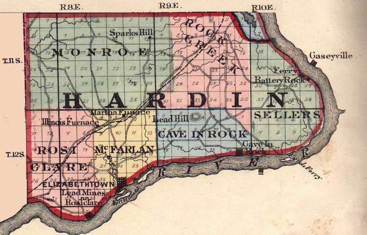
- Map of Hardin County IL USA
- Fluorite from the denton mine hardin county illinois
- History
- Geography
- Climate and weather
- Adjacent counties
- Major highways
- National protected area
- Demographics
- City
- Villages
- Unincorporated communities
- Notable people
- References
Map of Hardin County, IL, USA
Fluorite from the denton mine hardin county illinois
History
Hardin County was formed in 1839 from Pope County. Additional area was later added from Gallatin County. Hardin County was named for Hardin County, Kentucky, which was named in honor of Colonel John Hardin, an officer in the Revolutionary War and the Northwest Indian War. Hardin was murdered by Shawnee Indians while he was on a peace mission in 1792 for President George Washington, in what is now Shelby County, Ohio. In the 1790s and early 1800s, the Hardin County area, especially Cave-In-Rock, was notorious as a stronghold used by outlaws, bandits, river pirates, and counterfeiters.
Geography
According to the U.S. Census Bureau, the county has a total area of 182 square miles (470 km2), of which 178 square miles (460 km2) is land and 4.1 square miles (11 km2) (2.2%) is water. It is the second-smallest county in Illinois by area.
Hicks Dome (37.53139°N 88.36833°W / 37.53139; -88.36833) is an interesting geological feature in Hardin County. Some believe the dome may be related to an ancient meteor or comet impact, part of the 38th parallel structures, which are a string of geological features running west to Kansas. This is thought to be a string of impact craters from a celestial body that broke apart before striking the earth. However, the Hicks Dome is underlain by ultramafic igneous rocks and igneous diatremes or breccia pipes. Most geologists now accept the theory that the older rocks at the center of the uplift are a result of this deep seated igneous activity. This activity may also have provided the fluorine in the fluorspar deposits in the region. Fluorspar, or calcium fluoride, was mined in Hardin County until the early 1990s.
Climate and weather
In recent years, average temperatures in the county seat of Elizabethtown have ranged from a low of 21 °F (−6 °C) in January to a high of 87 °F (31 °C) in July, although a record low of −22 °F (−30 °C) was recorded in January 1994 and a record high of 104 °F (40 °C) was recorded in August 2007. Average monthly precipitation ranged from 3.22 inches (82 mm) in October to 5.02 inches (128 mm) in May.
Adjacent counties
Major highways
National protected area
Demographics
As of the 2010 United States Census, there were 4,320 people, 1,915 households, and 1,234 families residing in the county. The population density was 24.3 inhabitants per square mile (9.4/km2). There were 2,488 housing units at an average density of 14.0 per square mile (5.4/km2). The racial makeup of the county was 97.3% white, 0.6% American Indian, 0.5% Asian, 0.3% black or African American, 0.1% Pacific islander, 0.3% from other races, and 0.8% from two or more races. Those of Hispanic or Latino origin made up 1.3% of the population. In terms of ancestry, 26.5% were Irish, 23.8% were German, 10.4% were English, and 4.3% were American.
Of the 1,915 households, 26.0% had children under the age of 18 living with them, 50.9% were married couples living together, 9.2% had a female householder with no husband present, 35.6% were non-families, and 31.7% of all households were made up of individuals. The average household size was 2.25 and the average family size was 2.78. The median age was 46.3 years.
The median income for a household in the county was $27,578 and the median income for a family was $38,576. Males had a median income of $42,955 versus $26,683 for females. The per capita income for the county was $18,515. About 17.4% of families and 22.3% of the population were below the poverty line, including 37.4% of those under age 18 and 14.6% of those age 65 or over.