
Address Pendleton, OR, USA Established July 1, 1908 | Governing body U.S. Forest Service Area 5,694 km² Number of visitors 703,000 | |
 | ||
Hours Closed now Thursday8AM–4:30PMFriday8AM–4:30PMSaturdayClosedSundayClosedMonday8AM–4:30PMTuesday8AM–4:30PMWednesday8AM–4:30PMSuggest an edit Management United States Forest Service | ||
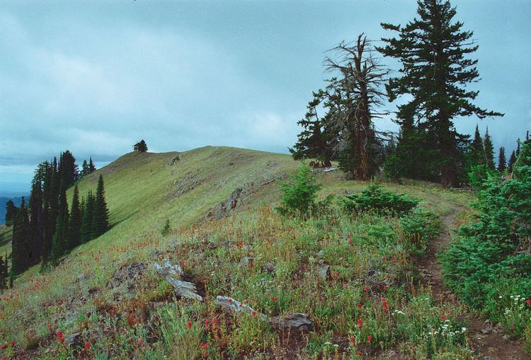
Umatilla national forest july 2016
The Umatilla National Forest, in the Blue Mountains of northeast Oregon and southeast Washington, covers an area of 1.4 million acres (5,700 km2). In descending order of land area the forest is located in parts of Umatilla, Grant, Columbia, Morrow, Wallowa, Union, Garfield, Asotin, Wheeler, and Walla Walla counties. (Columbia, Garfield, Asotin, and Walla Walla counties are in Washington, while the rest are in Oregon.) More than three-quarters of the forest lies in the state of Oregon. Forest headquarters are located in Pendleton, Oregon. There are local ranger district offices in Heppner and Ukiah in Oregon, and in Pomeroy and Walla Walla in Washington.
Contents
- Umatilla national forest july 2016
- Truck camping in the umatilla national forest oregon
- Human history
- Wildlife
- Wilderness
- Vegetation
- Recreation
- References
Truck camping in the umatilla national forest oregon
Human history
The Umatilla National Forest takes its name from the Umatilla Indian word meaning "water rippling over sand." Explorers Lewis and Clark passed through the area in 1805 on the Columbia River, and Marcus and Narcissa Whitman passed through in 1836 to establish a mission at Wailatpu near Walla Walla, Washington. Thousands of emigrants later followed the Oregon Trail west, and many remained in the Blue Mountain region. Discovery of gold in Oregon in 1851 led to the settlement of the North Fork John Day River area. More than $10 million in gold and silver were mined, and remnants of the era are still visible in the National Forest. Some claims are still being mined.
Umatilla was established on July 1, 1908 from part of Blue Mountains National Forest and all of Heppner National Forest. Wenaha National Forest was added on November 5, 1920.
The forest was the site of the School Fire, the largest fire in the contiguous United States of 2005.
Wildlife
Common wildlife in the Umatilla National Forest include moose, elk, bighorn sheep, black bear, mountain goat, mule deer, white-tailed deer, timber wolf, cougar, coyote, badger, Merriam's turkeys, transplanted Rio Grande wild turkeys, blue and ruffed grouse, Franklin's grouse, chinook salmon, coho salmon, steelhead, rainbow trout, brook trout, and lake trout.
Wilderness
More than 20 percent of the Umatilla National Forest is classified as wilderness:
Vegetation
A 1993 Forest Service study estimated that the extent of old growth in the forest was 190,741 acres (77,190 ha).
Recreation
Common recreational activities in the Umatilla National Forest include camping, hiking, fishing, hunting, wildlife watching, skiing, and rafting. Spout Springs Ski Area in Oregon and Bluewood Ski Area in Washington operate under special use permit within the forest. Jubilee Lake has the most popular campground in the forest.