
- location Blue Mountains - location Umatilla, Oregon - average 494 cu ft/s (14.0 m/s) Length 143 km Source Blue Mountains Country United States of America | - elevation 2,332 ft (711 m) - elevation 269 ft (82 m) Discharge 13.99 m³/s Basin area 6,345 km² Mouth Columbia River | |
 | ||
- max 19,800 cu ft/s (560.7 m/s) | ||
The Umatilla River is an 89-mile (143 km) tributary of the Columbia River in the U.S. state of Oregon. Draining a basin of 2,450 square miles (6,300 km2), it enters the Columbia near the city of Umatilla in the northeastern part of the state. In downstream order, beginning at the headwaters, major tributaries of the Umatilla River are the North Fork Umatilla River and the South Fork Umatilla River, then Meacham, McKay, Birch, and Butter creeks.
Contents
Map of Umatilla River, Oregon, USA
The name Umatilla is derived from the Native American name for the river, which was first recorded as Youmalolam in the journals of the Lewis and Clark Expedition and spelled in many other ways in early books about Oregon.
CourseEdit
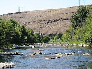
The Umatilla River's headwaters lie in the Blue Mountains at the confluence of its north and south forks in the Umatilla National Forest of northeastern Oregon. Flowing generally west, the river receives Lick Creek and Bear Creek, both from the right before reaching the unincorporated community of Bingham Springs. Further downstream it receives Rock Creek from the right, then Bobsled, Augur, and Ryan creeks from the left before entering the Umatilla Indian Reservation and reaching the unincorporated community of Gibbon. From Gibbon to the river mouth, tracks of the Union Pacific Railroad run parallel to the stream. Between Gibbon and Cayuse, three creeks—Squaw, Buckaroo, and Coonskin—enter the river from the left. Downstream of Cayuse, Moonshine, Cottonwood, and Mission creeks also enter from the left.
The river flows by Mission at about river mile (RM) 61 or river kilometer (RK) 98, leaves the Indian reservation, and reaches the city of Pendleton at about RM 56 (RK 90), passing under Oregon Route 11. Wildhorse Creek enters from the right, then Patawa Creek from the left. The river passes under Interstate 84 (I-84) and receives McKay Creek from the left. Shortly thereafter, Birch Creek enters from the left about 50 miles (80 km) from the mouth. Coombs Creek enters from the left about 3 miles (4.8 km) below that, and then the river, turning north, flows by Echo and under I-84 again. The Umatilla reaches Stanfield about 23 miles (37 km) from the mouth, then passes under Oregon Route 207 and receives Butter Creek from the left. Reaching Hermiston at about RM 9 (RK 14), the river flows by a United States Geological Survey (USGS) stream gauge about 2 miles (3 km) from the mouth, then passes under Interstate 82 and Oregon Route 730 before entering the Columbia River at Umatilla.
The Umatilla River joins the Columbia at what is called Lake Umatilla, a reservoir formed by the John Day Dam on the Columbia. The confluence is 289 miles (465 km) from the Columbia's mouth on the Pacific Ocean at Astoria. McNary Dam, another dam on the Columbia, is slightly upstream at about RM 292 (RK 470).
FishEdit
The Umatilla River supports populations of spring Chinook, fall Chinook, and Coho salmon as well as small trout in its upper reaches. Public access to salmon and steelhead fishing is fairly good downstream of the Oregon Route 11 bridge. Upstream of the bridge, the river runs through the Umatilla Indian Reservation, where fishing is limited to those with a tribal permit.