
Established 1984 | Area 81.52 km² | |
 | ||
Hours Open today · Open 24 hoursFridayOpen 24 hoursSaturdayOpen 24 hoursSundayOpen 24 hoursMondayOpen 24 hoursTuesdayOpen 24 hoursWednesdayOpen 24 hoursThursdayOpen 24 hoursSuggest an edit Management United States Forest Service Similar Bridge Creek Wilderness, Grassy Knob Wilderness, Umpqua State Scenic C, Blue Mountain Forest St, Battle Mountain Forest St | ||
The North Fork Umatilla Wilderness is a wilderness area located inside the Umatilla National Forest, in the Blue Mountains of northeastern Oregon. It is the smallest wilderness in northeast Oregon, encompassing only 20,144 acres (8,152 ha) in Umatilla and Union counties.
Contents
TopographyEdit
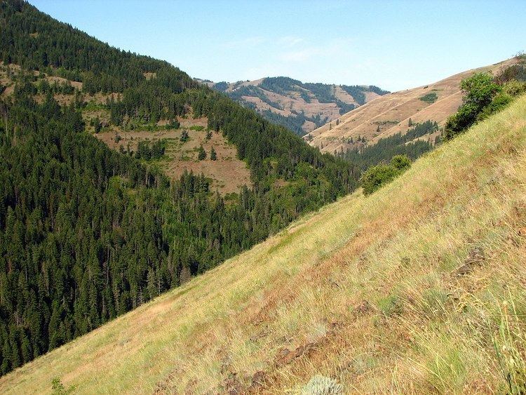
The elevation of the North Fork Umatilla Wilderness ranges from 2,000 to 5,400 feet (610 to 1,650 m), and is characterized by terrain that varies from gentle, sloping hills to extremely steep, timbered canyons below a high plateau. Common vegetation includes juniper, sagebrush, ponderosa pine, fir, spruce, lodgepole pine, and western larch.
WildlifeEdit
The North Fork Umatilla River supports a sizeable population of bull trout, as well as anadromous fish such as steelhead. There are also several streams within the wilderness that contain native trout, and a few streams support spawning steelhead. Big game animals found in the wilderness include Rocky Mountain elk and deer. Other wildlife in the wilderness include blue and ruffed grouse.
RecreationEdit
Primary recreational activities in the North Fork Umatilla Wilderness include hiking, camping, hunting, fishing, and horeseback riding. The North Fork of the Umatilla River is designated catch and release only. There is a 27-mile (43 km) hiking trail system, which opens up early in the season due to the low elevation of the Wilderness.