
Founded November 29, 1881 Website www.co.garfield.wa.us Population 2,256 (2013) | Area 1,860 km² Cities Pomeroy | |
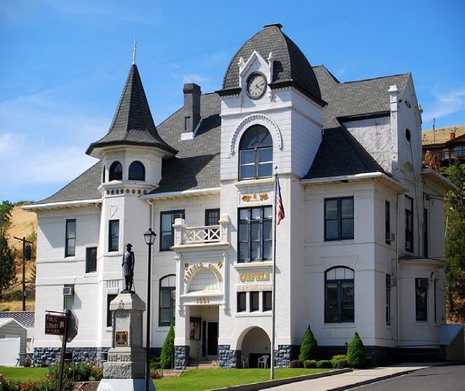 | ||
Points of interest Pataha Flour Mills, Garfield County Museum | ||
Garfield County is a county located in the U.S. state of Washington. As of the 2010 census, the population was 2,266, making it the least populous county in Washington; with about 3.2 inhabitants per square mile (1.2/km2), it is also Washington's least densely populated county. The county seat and only city is Pomeroy.
Contents
- Map of Garfield County WA USA
- History
- Geography
- Geographic features
- Major highway
- Adjacent counties
- National protected area
- 2000 census
- 2010 census
- City
- Unincorporated communities
- In popular culture
- References
Map of Garfield County, WA, USA
History
Garfield County was created out of a large piece of Columbia County on November 29, 1881 Roughly half of the county was split off to form Asotin County in 1883. and was named for the late U.S. President James A. Garfield, who had been assassinated in September, 1881.
Geography
According to the U.S. Census Bureau, the county has a total area of 718 square miles (1,860 km2), of which 711 square miles (1,840 km2) is land and 7.5 square miles (19 km2) (1.0%) is water. It is part of the Palouse, a wide and rolling prairie-like region of the middle Columbia basin.
Geographic features
Major highway
Adjacent counties
National protected area
2000 census
As of the census of 2000, there were 2,397 people, 987 households, and 670 families residing in the county. The population density was 3 people per square mile (1/km²). There were 1,288 housing units at an average density of 2 per square mile (1/km²). The racial makeup of the county was 96.45% White, 0.38% Native American, 0.67% Asian, 0.04% Pacific Islander, 1.38% from other races, and 1.08% from two or more races. 1.96% of the population were Hispanic or Latino of any race. 28.8% were of German, 17.9% United States or American, 10.6% English and 9.5% Irish ancestry. 99.2% spoke English as their first language.
There were 987 households out of which 28.80% had children under the age of 18 living with them, 57.00% were married couples living together, 6.70% had a female householder with no husband present, and 32.10% were non-families. 28.30% of all households were made up of individuals and 14.40% had someone living alone who was 65 years of age or older. The average household size was 2.39 and the average family size was 2.93.
In the county, the population was spread out with 25.90% under the age of 18, 5.40% from 18 to 24, 21.90% from 25 to 44, 25.90% from 45 to 64, and 20.90% who were 65 years of age or older. The median age was 43 years. For every 100 females there were 97.90 males. For every 100 females age 18 and over, there were 93.80 males.
The median income for a household in the county was $33,398, and the median income for a family was $41,645. Males had a median income of $33,313 versus $22,132 for females. The per capita income for the county was $16,992. About 12.00% of families and 14.20% of the population were below the poverty line, including 17.10% of those under age 18 and 10.20% of those age 65 or over.
2010 census
As of the 2010 United States Census, there were 2,266 people, 989 households, and 650 families residing in the county. The population density was 3.2 inhabitants per square mile (1.2/km2). There were 1,233 housing units at an average density of 1.7 per square mile (0.66/km2). The racial makeup of the county was 93.8% white, 1.7% Asian, 0.3% American Indian, 2.3% from other races, and 1.9% from two or more races. Those of Hispanic or Latino origin made up 4.0% of the population. In terms of ancestry, 27.2% were German, 22.4% were English, 19.9% were Irish, 7.9% were Dutch, 5.5% were Swedish, and 3.4% were American.
Of the 989 households, 25.1% had children under the age of 18 living with them, 55.6% were married couples living together, 6.1% had a female householder with no husband present, 34.3% were non-families, and 30.2% of all households were made up of individuals. The average household size was 2.25 and the average family size was 2.79. The median age was 49.0 years.
The median income for a household in the county was $42,469 and the median income for a family was $55,769. Males had a median income of $38,897 versus $30,650 for females. The per capita income for the county was $22,825. About 14.1% of families and 15.7% of the population were below the poverty line, including 22.1% of those under age 18 and 6.6% of those age 65 or over.
City
Unincorporated communities
In popular culture
Part of the 1996 film Black Sheep takes place (but not filmed) in Garfield County.