
Existed: 1926 – present Constructed 1926 | Length 280.2 km | |
 | ||
Counties | ||
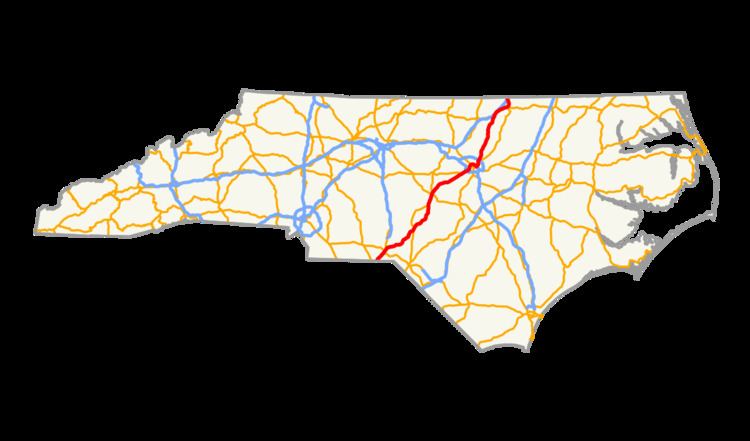
U.S. Route 1 is a north–south United States highway that runs for 174.1 miles (280.2 km) from the South Carolina state line, near Rockingham, to the Virginia state line, near Wise. It serves as a strategic highway, connecting the North Carolina Sandhills and Research Triangle regions.
Contents
Route description
From the South Carolina state line, US 1 passes through downtown Rockingham as a two-lane road with 5-lane boulevard segments before and after downtown. North of Rockingham continues as a two-lane road. Between NC 177 and the Moore County line, begins the multilaned highway where it is mostly a 5 lane rural highway with a continuous center turn lane. Near the Moore County line becomes a 4 lane divided arterial. In southern Moore County, it continues as a 4 lane arterial with 5 lane boulevard segments in Pinebluff, Aberdeen and the southern part of Southern Pines. After the Saunders Boulevard traffic signal, US 1 becomes an Expressway grade bypass in Southern Pines. After North May Street, it becomes a brief 4 lane arterial before it becomes a 4 lane Expressway after Aiken Road. A mile south of the US 15/501` juncture, downgrades as a 4 lane arterial towards Tramway. After Tramway, it becomes a freeway bypassing Sanford and continues to Raleigh as a freeway, sharing briefly with US 64 at Cary and 11 miles (18 km) of the Raleigh Inner-Beltline with I-440. North of Raleigh, US 1 continues as an expressway through Wake Forest and Henderson. Exiting off the connector road before I-85, the highway reverts to a two-lane rural road, paralleling I-85 into Virginia. US 1 through North Carolina generally follows the fall line between the Piedmont and the Atlantic Coastal Plain.
Alternate names
Though the highway is commonly known as "Highway 1" or "U.S. 1" throughout the state, the highway does have other known names it uses locally in areas.
History
The general route of US 1 in North Carolina was first part of the Capital Highway, an auto trail organized in 1909 to encourage counties along the route to improve the road between Washington and Atlanta. It differed from US 1 north of Norlina, where it ran via Emporia and Roanoke Rapids, and between Southern Pines and Rockingham, where a route via Pinehurst - where the association's president lived - was followed. The Quebec-Miami International Highway, organized in 1911 and renamed the Atlantic Highway in 1915, also followed this corridor, overlapping many parts of the Capital Highway. It initially followed even less of US 1 than the Capital Highway, only taking the same route between Raleigh and Cameron and south of Rockingham, but was modified to match the Capital Highway by 1920.
In 1922, the route was designated as North Carolina Highway 50, from the South Carolina state line to Roanoke Rapids. In 1923, the route from Norlina to Roanoke Rapids was renumbered as NC 48; redirecting NC 50 north to Virginia and continuing on to South Hill as VA 122. In 1926, US 1 was established, it was assigned to overlap all of NC 50; it would be in 1934 when NC 50 was dropped from the route.
Since its establishment, US 1 has not changed its route from the South Carolina state line to Pinebluff. The first change along the route happened in 1930 in Raleigh, where minor road changes were done in the downtown area. In 1933, US 1 was moved off Rocky Church Fork Road near Tramway onto new road to the west. Between 1937-1944, US 1 was rerouted in Aberdeen to its current routing and also north of Wise where US 1 moved onto new road east of Mac Powell Road. In 1948, US 1 was removed from most of Wake Forest Road, in Raleigh, and placed onto Louisburg Road; the old route became US 1A. In 1953, US 1 was placed on a bypass west of Wake Forest, leaving the old route to become US 1A.
Around 1956-1957, several changes along US 1 were made: A new bypass build west of Sanford, old route replaced by US 1A (later US 1 Business). In Raleigh, US 1 was redirected onto one-way streets Dawson and McDowell that connected to a new road called Capital Boulevard, which connected US 1 back onto Louisburg Road; Person Street and Wake Forest Road became secondary roads ever since. Finally, a new Super-2 bypass was built east of Henderson; which would later become a full freeway between 1991-1993.
In 1960, US 1 was placed on a Super-2, bypassing Moncure. Around 1963, US 1 was placed onto new freeway between Apex (via NC 55) to North Boulevard (today an extension of Capital Boulevard), in north Raleigh. The old route to Hillsborough Road became what is today Salem Street, Old Apex Road and East Chatham Street (via Cary), while the routing through Raleigh became US 1 Business (1963-1975). Around 1965, the Super-2, from Moncure, extended north into Apex. In 1975, the Super-2, from Moncure, extended south to Sanford, connecting to its bypass. The entire route between Sanford to Apex became a freeway by the mid-1990s.
In June, 2005, a new freeway bypass was built east of Vass and Cameron; the old route became US 1 Business.
Future
The NCDOT, in collaboration with the Department of Commerce and the Department of Environment and Natural Resources, has designated US 1 as a Strategic Highway Corridor from Interstate 85 in Henderson to the South Carolina state line. From I-85 to I-540 in Raleigh, US 1 is recommended to be improved to a freeway. From I-540 to I-440 (the Capital Boulevard section in Raleigh) it is recommended be improved to an expressway (nearby freeway I-540 will maintain mobility). From I-440 to south of I-74 in Richmond County, it is designated as a freeway. South of I-74 to the South Carolina state line, it is designated as an expressway. The Strategic Corridors Initiative is an effort to protect and maximize mobility and connectivity on a core set of highway corridors, while promoting environmental stewardship through maximizing the use of existing facilities to the extent possible, and fostering economic prosperity through the quick and efficient movement of people and goods.
Warren County
US 1 is not designated as Strategic Highway Corridor from the Vance County Line to US 401, as it is a 2 lane highway, with mobility being met by nearby I-85. However, the part of US 1 that is concurrent US 401 near I-85 is designated as a boulevard. (US 401 is designated as a boulevard from US 1 in Wake County to I-85). The small section of US 1 from I-85 to the Virginia State Line is also not designated. The 2010 Warren County Comprehensive Transportation Plan, which addresses transportation needs to the year 2035, concurs with these recommendations. The plan was adopted by all Warren County municipalities and NCDOT in 2007 and 2008.
Vance County
The Comprehensive Transportation Plan for Vance County, which will address transportation needs to the year 2040, is currently under study. US 1 in Vance County from I-85 to the Warren County line not designated as a Strategic Highway Corridor, as mobility is served by nearby I-85.
Franklin County
The Franklin County Comprehensive Transportation Plan, which addresses transportation needs to the year 2035, US 1 is recommended to be improved to a 4 lane freeway throughout the county. The plan was adopted by all Franklin County Municipalities, the Capital Area Metropolitan Planning Organization, and NCDOT in 2011. Recently, a US 1 Corridor Study, managed by the Capital Area Metropolitan Organization, identified improvements between I-540 in Wake County to US 1A in Franklin County.
Wake County
Recently, a US 1 Corridor Study, managed by the Capital Area Metropolitan Organization, identified improvements between I-540 in Wake County to US 1A in Franklin County.
Lee County
Based on the 2011 Lee County Comprehensive Transportation Plan, which addresses transportation needs to the year 2035, US 1 is recommended to be improved to a 6 lane freeway from Chatham County to the US15-501 split. The remainder to the Moore County line is recommended to be improved to a 4 lane freeway. The improvements will increase capacity to address anticipated deficiencies and maintain statewide mobility. The plan was adopted by the County, Sanford, Broadway, and NCDOT in 2008.
Moore County
In 2011, the North Carolina Department of Transportation, Moore County, and the Triangle Rural Planning Organization started work on a Comprehensive Transportation Plan to plan for future (2040) transportation improvements. State Law calls on each municipality to work cooperatively with NCDOT to develop such a plan to serve present and future travel demand. In November, 2011, seven public charrettes were held to document local priorities on five transportation areas within the county, including US 1.
Many in the community fear that a US 1 Bypass project has been planned even though NCDOT has said repeatedly that there is no US 1 Bypass or any other US 1 improvements identified. The strongest opposition of any type of US 1 improvement has come from some area residents, the equestrian community and some business leaders. It is the aspiration of the opposition to lead towards no-build alternatives. However, since the Comprehensive Transportation Plan is based on 2040 travel demand, it is possible that no-build alternatives may not accommodate 2040 traffic, which may necessitate the need to plan for some type of future improvements.
Moore County Commissioners held a meeting on December 15, 2011 and passed a resolution against an US 1 bypass. Furthermore, the Southern Pines town council voted 4-1 against any US 1 improvements. Southern Pines Town Council member Fred Walden was the only dissenter on an US 1 bypass.
At this time, the cooperative effort to develop a Comprehensive Transportation Plan for Moore County is continuing. The plan which includes US 1, must address existing and future traffic and balance local priorities with future transportation needs. In a February, 2012 meeting with the town of Aberdeen, local officials raised concerns over the improvement of US 1. NCDOT officials stated that there are "no lines on maps for any roads at this point". Also, it was conveyed that without a Comprehensive Transportation Plan, money for future projects may be "adversely affected".
Richmond County
As of December 2011, there has been no opposition for a proposed north-south Rockingham bypass. The widening project from the Moore County line to near NC 177 has been recently completed from a two-lane principal highway to mostly a 5 lane road with a small divided section near the Mackall Airfield. US 1 is now four lanes or greater from the US 1/I-85 interchange in Henderson, Vance County. Once US 1 enters South Carolina, there is no intention of widening US 1 to Cheraw and points south to Camden
In December 2012, public hearings have been held in Richmond County for the $260 million bypass. The project would begin at NC 177 and rejoin US 1 south of Rockingham by Sandhill Road, near the South Carolina state line.