
Country United States Elevation 535 ft (163 m) ZIP codes 28387-28388 Local time Tuesday 7:36 AM | Time zone Eastern (EST) (UTC-5) Area code(s) 910 Population 13,005 (2013) | |
 | ||
Weather 17°C, Wind SW at 11 km/h, 89% Humidity Points of interest Reservoir Park, Pool Park, Sandhills Horticultural Gardens, Moore County Historical, Downtown Park | ||
Old pictures of southern pines north carolina
Southern Pines is a town in Moore County, North Carolina, United States. The population was 12,334 as of the 2010 United States Census.
Contents
- Old pictures of southern pines north carolina
- Map of Southern Pines NC USA
- History
- Geography
- Demographics
- Education
- Media
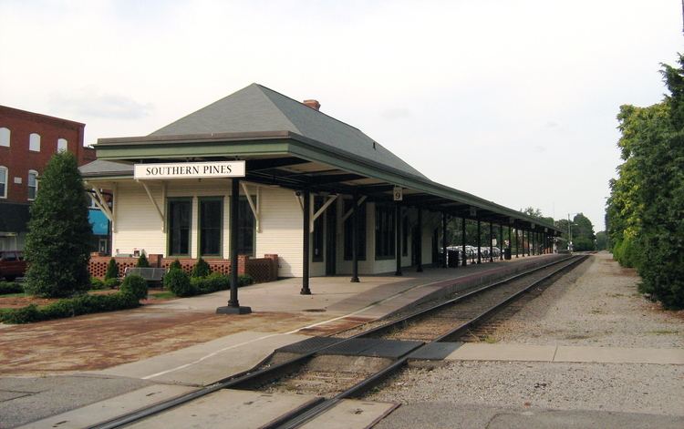
- Transportation
- Notable people
- References
Map of Southern Pines, NC, USA
History
The James Boyd House, Shaw House, Southern Pines Historic District, Firleigh Farms, and Moore County Hunt Lands and Mile-Away Farms are listed on the National Register of Historic Places.
Geography
Southern Pines is located at 35°10′55″N 79°23′54″W (35.181892, −79.398287). According to the United States Census Bureau, the town has a total area of 15.5 square miles (40.2 km²), of which 15.4 square miles (39.8 km²) is land and 0.2 square mile (0.5 km²) (1.16%) is water.
Demographics
As of the 2010 census, there were 12,334 people, 5,866 households, and 3,304 families residing in the town. The population density was 806 people per square mile (311.2/km²). There were 6,859 housing units at an average density of 371 houses/condos per square mile (143.24/km²). The racial makeup of the town was 71.7% White, 24% African American, 0.6% Native American, 0.8% Asian, 0.1% Pacific Islander, 1.3% from other races, and 1.4% from two or more races. Hispanic or Latino of any race were 1.4% of the population.
Of the 5,866 households, 21% had children under the age of 18 living with them, 40.6% were married couples living together, 13% had a female householder with no husband present, 2.7 had a male householder with no female present, and 38.9% were non-families. The average household size was 2.07 and the average family size was 2.75.
In the town, the population was spread out with 21.9% aged 19 and younger, 4.7% from 20 to 24, 20.8% from 25 to 44, 25.2% from 45 to 64, and 27.5% who were 65 years of age or older. The median age was 47. For every 100 females there were 82 males. For every 100 females age 18 and over, there were 78.2 males.
The median income for a household in the town was $41,297 in 2011, and the median income for a family was $60,683. Males had a median income of $29,855 versus $23,920 for females. The per capita income for the town was $30,886. Of families, 9.26% were below the poverty level, along with 12.4% of the population poverty line, including 23.0% of those under age 18 and 9.6% of those age 65 or over.