
NRHP Reference # 78000371 Added to NRHP 30 November 1978 | Area 1,619 m² Nearest city Lee Vining | |
 | ||
Similar | ||
Devils postpile to tuolumne meadows john muir trail 2016
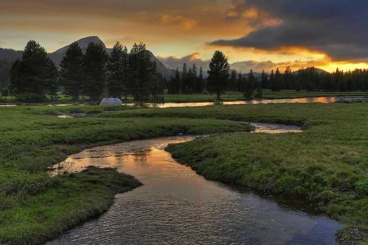
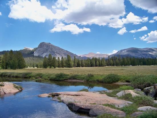
Tuolumne Meadows is a gentle, dome-studded sub-alpine meadowy section of the Tuolumne River, in the eastern section of Yosemite National Park, in the United States. Its approximate location is 37°52.5′N 119°21′W. Its approximate elevation is 8,619 feet (2,627 m). The term Tuolumne Meadows is also often used to describe large portion of Yosemite high country around the meadows, especially in context of rock climbing.
Contents
- Devils postpile to tuolumne meadows john muir trail 2016
- Yosemite national park tuolumne meadows in hd
- Natural history
- Recreation
- Rock climbing
- References
Yosemite national park tuolumne meadows in hd
Natural history
The meadow vegetation is supported by shallow groundwater. The water comes from 1,000 mm (39 inches) of precipitation annually, predominately in the form of snow. Water arises from snowmelt and hill-slope aquifers, and flows through the Tuolumne River, Budd Creek, Delaney Creek, and Unicorn Creek. In spring as soon as the snow melts, it is not uncommon to see large areas of the meadows flooded and practically transformed into a lake.
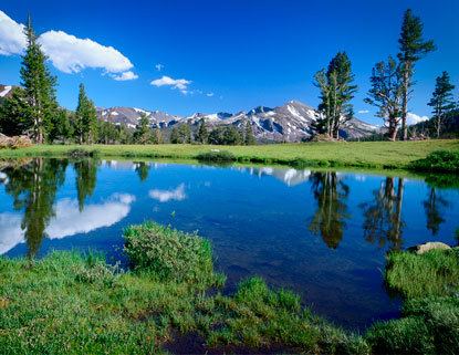
While the mountains of the Sierra near the meadows have had some permanent snowfields: in the summer they are mostly free of snow. Although brief, the late spring and summer wildflower bloom in Tuolumne Meadows is host to a wide variety of California wildflowers, including the relatively rare Purple Webber, a type of lupin.
Plant species composition changes across the meadows with different landforms, landscape positions, and summer water-table depths. Areas with seasonal flooding and deep-standing water support the inflated sedge and Sierra willow. The main herbaceous wet-meadow species include alpine aster, nearly-black sedge, King’s ricegrass, western bistort, Breweri’s reed grass, and dwarf bilberry. Thread-leaved sedge, pussy-toes, Sierra lodgepole pine, and Ross sedge are found in drier uplands within or on the edge of the meadow.
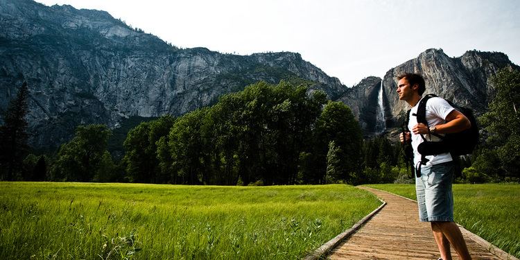
Recreation
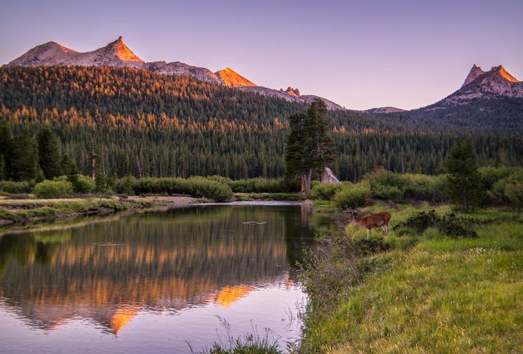
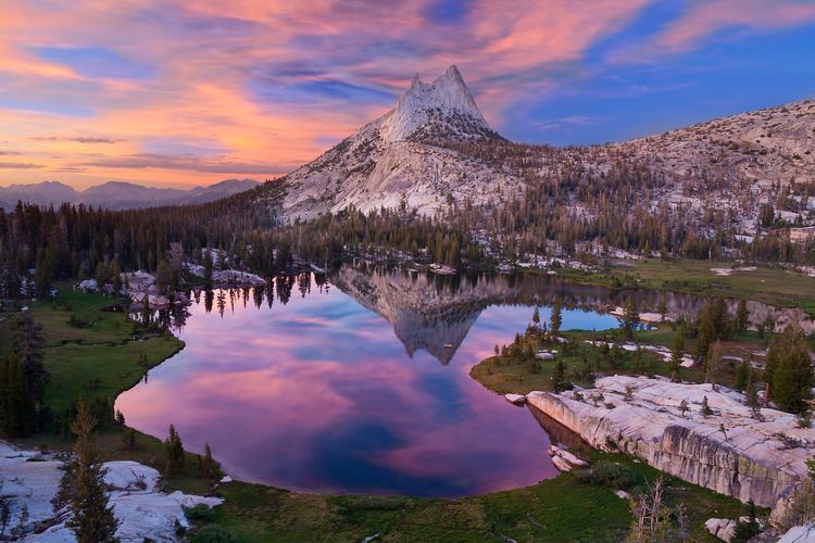
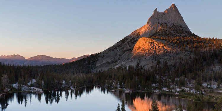
Tuolumne Meadows has a good view of the Cathedral Range and Unicorn Peak (to the south), Lembert Dome and Mount Dana (to the north). Camping is available at the Tuolumne Meadows campground (reservations recommended). Excellent hiking and rock climbing are accessible from Tuolumne Meadows, which tends to be less crowded than Yosemite Valley. The John Muir Trail and the Pacific Crest Trail, long-distance backpacking trails, route through Lyell Canyon into Tuolumne Meadows. Downstream (flowing to the right (western) side of the image), the Tuolumne River cascades over Waterwheel Falls, near Glen Aulin, eventually pooling at Hetch Hetchy Reservoir.
The roads to the meadows are generally free of snow from June through October. Due to the extreme elevation, road access is closed through winter season in the Meadows.
Many back country hiking and backpacking trails start in Tuolumne Meadows including the primary route to summit Mount Lyell, the highest peak in Yosemite National Park.
Rock climbing
In contrast to the big walls of Yosemite Valley, climbing at Tuolumne generally consists of short- to medium-length routes on eleven major domes and a number of minor ones, stretching from the Stately Pleasure Dome above Tenaya Lake to Lembert Dome on the east side of the Meadows. Since the area is all at a high elevation, the climbing season is mainly limited to June through September.
The rock is porphyritic granite, a very strong form of granite. It has a tendency for exfoliation which helps produce and preserve the distinctive dome shapes. The resulting climbing includes both face and crack routes, the former often runout due to limited numbers of bolts, and the latter frequently following very thin cracks. The local ethic is to limit the placement of bolts on new routes and to forbid the addition of bolts to existing routes, resulting in distances of 40 feet (12 m) or more between bolts.
The major domes include:
In addition, the peaks of the nearby Cathedral Range, such as Cathedral Peak, Pywiack Dome, and Medlicott Dome are traditionally considered part of the climbing area.