
Prominence 1,086 ft (331 m) Mountain range Sierra Nevada | Parent range Sierra Nevada Elevation 2,989 m | |
 | ||
Similar Medlicott Dome, Tenaya Peak, Pywiack Dome, Mount Hoffmann, Tresidder Peak | ||
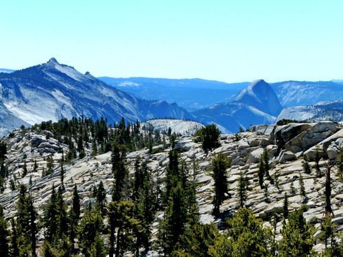
Polly Dome is a prominent granite dome rising 1,640 feet (500 m) above the northwest side of Tenaya Lake and Tioga Road in the Yosemite high country. The dome, more than 3 kilometers (~2 miles) long, is a substantially intact mass of granitic rock that has withstood heavy glaciation and exfoliation. Forest clings to the less-steep parts of its north and west slopes. The southwest end of Polly Dome consists of the Stately Pleasure Dome, 740 feet (230 m) lower than Polly Dome, but rising very steeply 900 feet (270 m) from the shore of the lake. Polly Dome's summit has unobstructed views east to the Cathedral Range, north over Tuolumne Meadows to the Sierra crest, northwest over the Grand Canyon of the Tuolumne and southwest to Half Dome.
Map of Polly Dome, California, USA
References
Polly Dome Wikipedia(Text) CC BY-SA