Puneet Varma (Editor)

Tsamblak Hill

Updated on
Edit
Like
Comment
Share on FacebookTweet on TwitterShare on LinkedInShare on Reddit
Tsamblak Hill

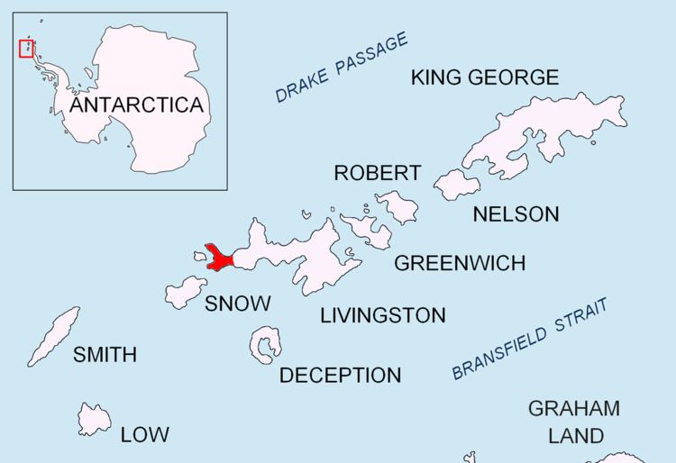
Tsamblak Hill (Bulgarian: хълм Цамблак, ‘Halm Tsamblak’ \'h&lm 'tsam-blak) is a rocky hill trending 900 m in north-south direction, 450 m wide and rising to 113 m in eastern Byers Peninsula on Livingston Island in the South Shetland Islands, Antarctica.

Contents

The hill is named after the Bulgarian scholar and Metropolitan of Kiev, Grigoriy Tsamblak (1365–1420).

Location

Tsamblak Hill is located at 62°38′20.6″S 61°00′12″W which is 1.73 km north of Negro Hill, 1.45 km south of Sparadok Point, and 4.23 km east of Chester Cone (Spanish mapping in 1992 and Bulgarian in 2009).

Maps

  • Península Byers, Isla Livingston. Mapa topográfico a escala 1:25000. Madrid: Servicio Geográfico del Ejército, 1992.
  • L.L. Ivanov et al. Antarctica: Livingston Island and Greenwich Island, South Shetland Islands. Scale 1:100000 topographic map. Sofia: Antarctic Place-names Commission of Bulgaria, 2005.
  • L.L. Ivanov. Antarctica: Livingston Island and Greenwich, Robert, Snow and Smith Islands. Scale 1:120000 topographic map. Troyan: Manfred Wörner Foundation, 2009. ISBN 978-954-92032-6-4 (Second edition 2010, ISBN 978-954-92032-9-5)
  • References

    Tsamblak Hill Wikipedia