
Country United States of America | ||
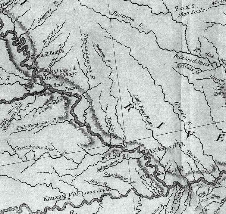 | ||
The Tarkio River (also known as the Big Tarkio River) is a non-navigable river that stretches for approximately 140 miles (225 km) from Cass County, Iowa to its mouth on the Missouri River in Holt County, Missouri.
Contents
Map of Tarkio River, United States
The river basin which drains approximately 508 square miles (1,316 km2) is sandwiched between the Nishnabotna River to the west and the Nodaway River to the east.
The name "Tarkio" is from a Native American word meaning "place where walnuts grow".
The river passes rural areas and figures most prominently in the drainage system nears its mouth in management of Big Lake, Missouri and the Squaw Creek National Wildlife Refuge. Several streams and ditches in the Missouri River bottoms near its mouth contain the Tarkio name.
Course
The river starts as an arroyo in Cass County, Iowa (41.1938794°N 95.0624898°W / 41.1938794; -95.0624898) southeast of Griswold, Iowa and becomes a full stream just south of the county line in Montgomery County, Iowa north of Stanton, Iowa and heads south through Montgomery County into Page County, Iowa passing Coin, Iowa. It enters Missouri in Atchison County, Missouri at Blanchard, Iowa. It passes Tarkio, Missouri and Fairfax, Missouri (which is the main gage for river reporting). It enters Holt County near Corning, Missouri and enters the Missouri River at river mile (RM) 507 or river kilometer (RK) 816 (40.1627768°N 95.4385920°W / 40.1627768; -95.4385920).
Other streams with Tarkio name
There are several streams with the Tarkio name in the Missouri River bottoms near where the Tarkio meets the Missouri. Almost none of the streams actually flows into the Tarkio although some are historically part of the river.
Flooding
The drainage of the river through the flatlands of the Missouri can sometimes lead to spectacular floods when the river cannot drain. In the Great Flood of 1993 flooding caused Interstate 29 to be closed near the mouth. In the 2011 Missouri River floods, the Tarkio River and its other namesakes overwashed an area from Fortescue to the Missouri River totally obliterating Big Lake. On July 7, 2011 the river rose 8 feet (2.4 m) in six hours in one burst at Fairfax.