
Type Rural road Route number(s) State Route 11 | Length 167 km (104 mi) | |
 | ||
Built by Department of Transport and Main Roads | ||
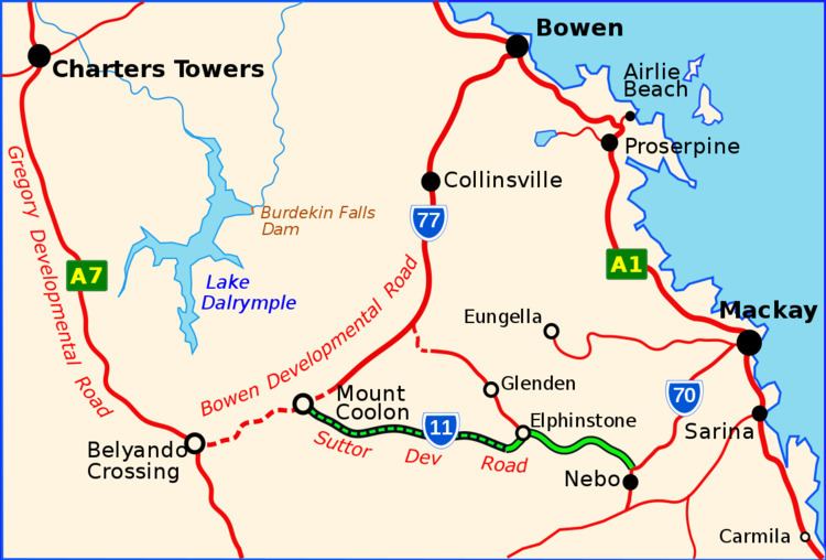
The Suttor Developmental Road is a highway in the east of the Australian state of Queensland. It runs in SE-NW direction and has a length of 167 km. It connects the Peak Downs Highway with the Bowen Developmental Road.
Contents
Map of Suttor Developmental Rd, Queensland, Australia
History
The Suttor Developmental Road branches north of Nebo from the Peak Downs Highway (S70) to the west and south of the Homevale National Park to the locality of Elphinstone.
The paved road ends at Elpinstone after which it hugs the western shore of Lake Elphinstone. Later it crosses the Isaac River. In the locality of Eaglefield it crosses the Suttor River, after which it is named. Finally, it reaches the locality of Mount Coolon at the Bowen Developmental Road (S77).
References
Suttor Developmental Road Wikipedia(Text) CC BY-SA