
Type Rural road | Length 259 km (161 mi) Via Collinsville | |
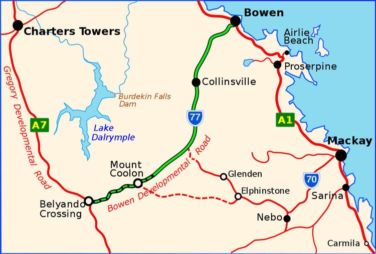 | ||
Bowen Developmental Road is a highway in Queensland, Australia. It is part of State Route 77. It has a length of 259 kilometres (161 mi) and extends in northeast-southwest direction from Bowen on the east coast of Australia to the Gregory Developmental Road in Belyando near Nairana National Park.
Contents
Map of Bowen Developmental Rd, Queensland, Australia
In its course, the road crosses the Clark Range and Leichhardt Range. Until the station Whynot it is paved. The last 70 kilometres (43 mi) are dirt road.
The highest point in the course of the highway is at 394 metres (1,293 ft), the lowest at 8 metres (26 ft).
Route description
State Route 77 departs from the Bruce Highway in a southerly direction, just west of Bowen. From there to Collinsville it is signed as Peter Delamothe Road. From Collinsville onwards the road is signed as Bowen Developmental Road. The road generally follows the route of the railway line to a point south of Collinsville, where the railway continues south to coal mines and the road turns south-west, passing through the locality of Mount Coolon, where the Suttor Developmental Road branches off to the south. From here the road continues south-west until it meets the Gregory Developmental Road in the locality of Belyando.