
Type Highway Length 264 km | Route number(s) State Route 70 | |
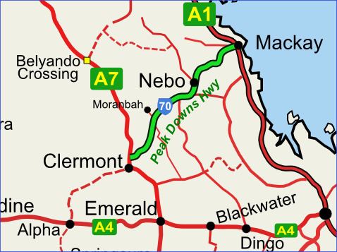 | ||
Major settlements Moranbah, Nebo, Eton, Queensland | ||
Peak downs highway
The Peak Downs Highway links the towns of Mackay and Clermont in the Australian state of Queensland. It represents the main link between Queensland's Whitsunday Coast and the Central West region of the state. The highway runs for a total length of 266 kilometres (165 mi), before joining the Gregory Highway (Highway A7, formerly Highway 55) south to Clermont. Major settlements served by this route include Mackay, Walkerston, Nebo, Moranbah (10 kilometres (6.2 mi) north of the highway, but the largest town along the route) and Clermont.
Contents
Map of Peak Downs Hwy, Queensland, Australia
Highway conditions
The highway is notorious for the extremely dangerous conditions caused by its service as a primary access route for workers, fuel, machinery and other supplies to the coal mines of the Bowen Basin. The narrow two-lane highway is often congested with oversize loads (e.g. mining haul-trucks, dozers and excavators, tyres and buckets) and road trains, which presents a significant hazard and frustration to fatigued long-haul commuters (Drive-in, Drive-out mine workers) on the road.